Download
Preview
Add to list
More
160.7 km
~9 days
3030 m
Multi-Day
“Embark on the Steigerwald Panoramaweg, a scenic Bavarian trek offering history, nature, and vineyard vistas.”
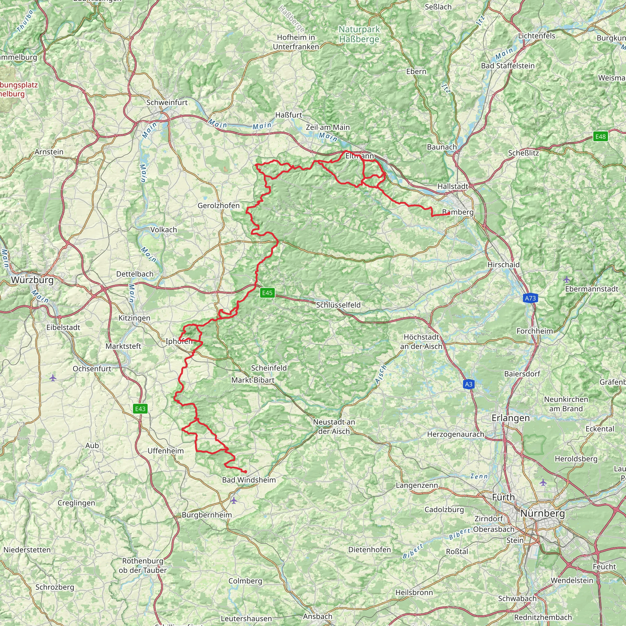
The Steigerwald Panoramaweg is a captivating journey through the diverse landscapes of Bavaria, Germany. Spanning approximately 161 kilometers (100 miles) with an elevation gain of around 3000 meters (nearly 9843 feet), this point-to-point trail offers a medium difficulty rating, making it accessible to hikers with a reasonable level of fitness.
Starting near Neustadt an der Aisch-Bad Windsheim, the trailhead can be reached by public transport or car. For those opting for public transport, the nearest train station is in Neustadt (Aisch) from where you can take a taxi or a local bus to the starting point. If driving, parking is available in the area, allowing you to leave your vehicle for the duration of your hike.
Navigating the Trail
As you embark on the Steigerwald Panoramaweg, it's advisable to use HiiKER to navigate the trail. The app will provide you with detailed maps and waypoints, ensuring you stay on the right path and don't miss any of the significant landmarks along the way.
Landmarks and Natural Beauty
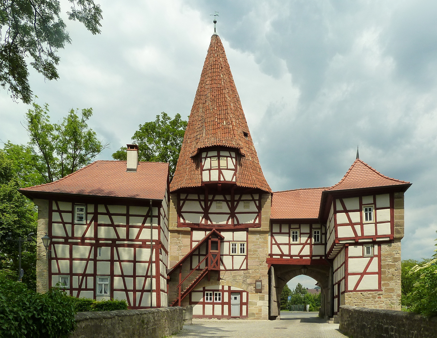
The trail meanders through the picturesque Steigerwald Nature Park, where you'll be treated to a variety of landscapes, including lush forests, rolling hills, and expansive vineyards. The path takes you through charming Franconian villages, where half-timbered houses and historic architecture add to the region's allure.
One of the highlights is the ascent to the Zabelstein Tower, offering panoramic views of the surrounding countryside. Approximately 40 kilometers (25 miles) into the hike, this former watchtower is a perfect spot to rest and take in the scenery.
Wildlife and Flora
The Steigerwald region is rich in biodiversity. Keep an eye out for a variety of bird species, including woodpeckers and birds of prey. The forests are home to deer and wild boar, while the open meadows provide habitats for butterflies and insects. The trail also passes through areas of rare orchids and other protected plant species, particularly in the nature reserves.
Historical Significance
The area is steeped in history, with the trail passing near several historical sites such as the ruins of the 12th-century Castell Castle and the Baroque Schloss Weissenstein. The region's viticulture is also historically significant, with Franconian wine being produced here for centuries. Hikers will have the opportunity to learn about and even taste the local wine culture in the villages along the route.
Preparation and Planning
Given the trail's length and varied terrain, it's important to plan your hike carefully. Consider breaking the journey into manageable sections, with overnight stays in the villages or designated camping areas. Ensure you have appropriate gear for the weather conditions, as the region can experience a range of temperatures and weather patterns.
Water sources are available in the villages, but it's wise to carry enough water and snacks to sustain you between stops. Also, be prepared for sections of the trail with steep inclines, particularly when approaching lookout points.
Access to the Trailhead
To reach the trailhead near Neustadt an der Aisch-Bad Windsheim, you can use the address or significant landmark of the Neustadt (Aisch) train station for navigation. From there, the starting point of the Steigerwald Panoramaweg is just a short journey away, marking the beginning of your adventure through this historically rich and naturally beautiful region of Germany.
Comments and Reviews
User comments, reviews and discussions about the Steigerwald Panoramaweg, Germany.
4.56
average rating out of 5
9 rating(s)

