Download
Preview
Add to list
More
8.5 km
~1 hrs 59 min
175 m
Loop
“Explore a lush, historical 9 km loop trail in Neckar-Odenwald-Kreis, perfect for moderately fit hikers.”
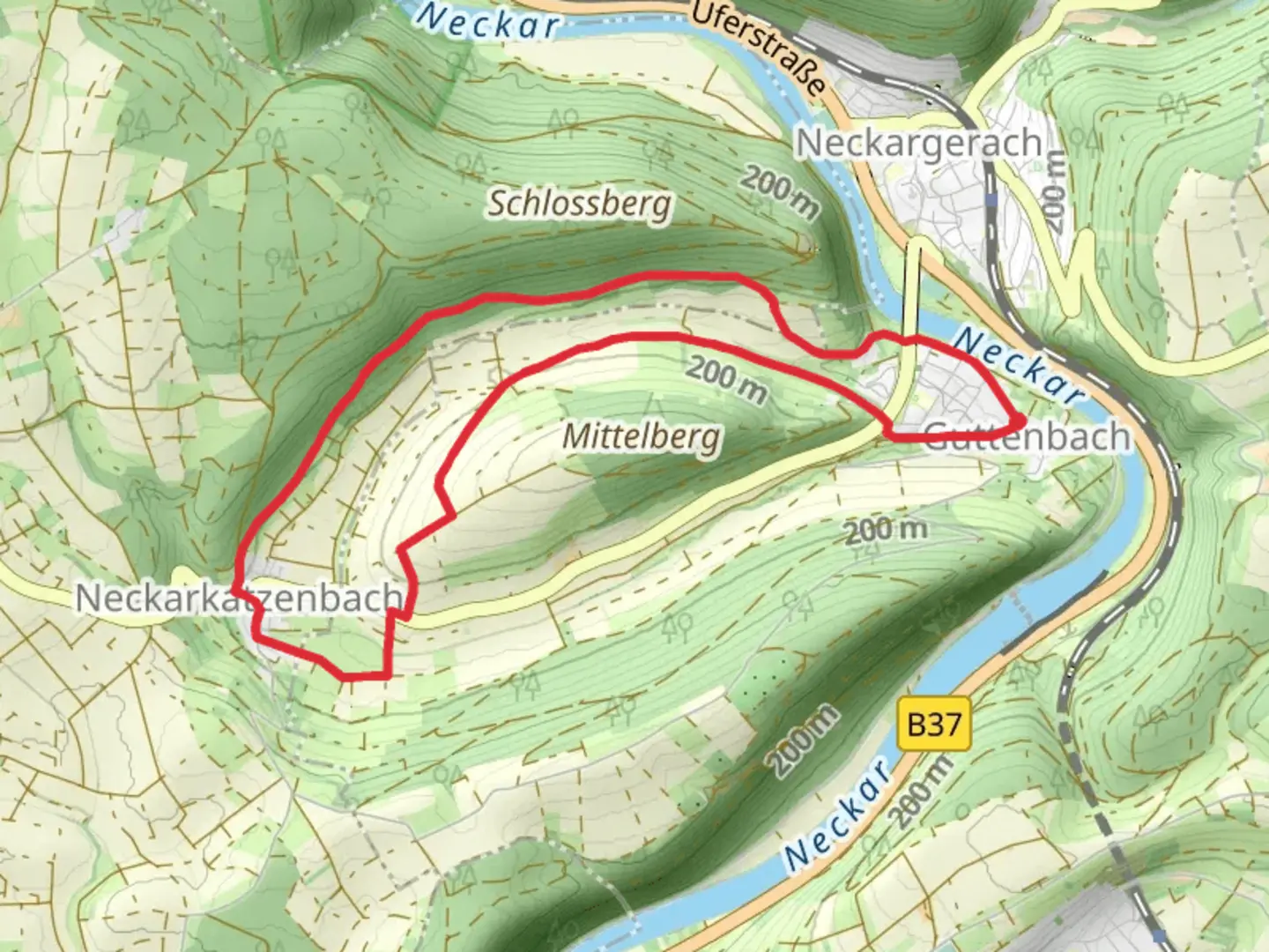
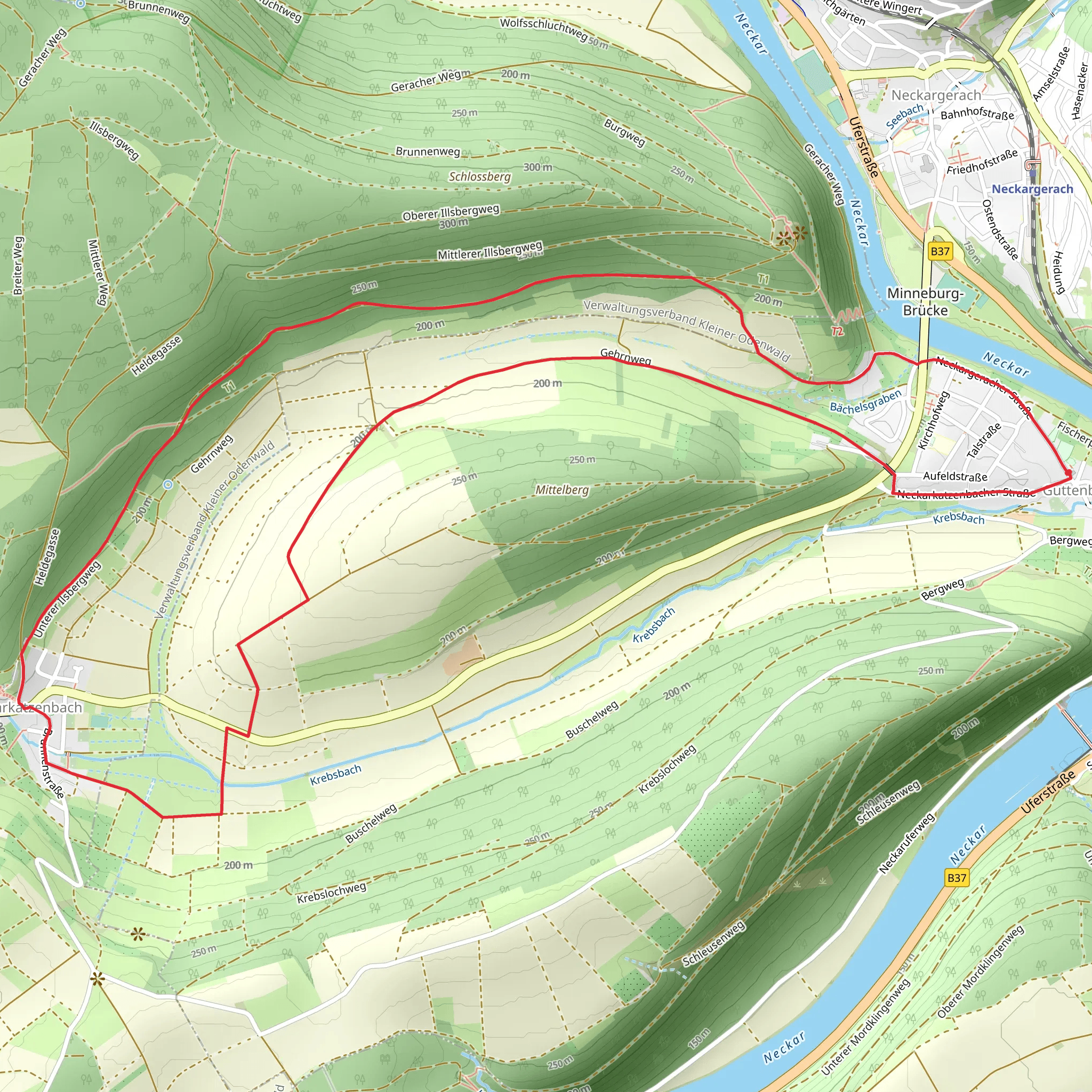
Starting near Neckar-Odenwald-Kreis in Germany, this 9 km (approximately 5.6 miles) loop trail offers a delightful mix of natural beauty and historical intrigue. With an elevation gain of around 100 meters (328 feet), it is rated as a medium difficulty hike, making it accessible for most hikers with a moderate level of fitness.
Getting There To reach the trailhead, you can either drive or use public transport. If driving, set your GPS to Neckar-Odenwald-Kreis, and look for parking options near the starting point. For those using public transport, the nearest significant landmark is the town of Mosbach. From Mosbach, you can take a local bus or taxi to the trailhead.
Trail Navigation For navigation, it is highly recommended to use the HiiKER app, which provides detailed maps and real-time updates to ensure you stay on track.
Trail Highlights As you embark on this loop trail, you will be greeted by a lush forest canopy that provides ample shade, making it a pleasant hike even during warmer months. The trail is well-marked, but always keep an eye on your HiiKER app to avoid any wrong turns.
#### Flora and Fauna The trail is rich in biodiversity. You will encounter a variety of tree species, including oak, beech, and pine. During spring and summer, the forest floor is adorned with wildflowers, adding a splash of color to your hike. Birdwatchers will be delighted by the presence of species such as the European robin, blackbird, and various types of woodpeckers. Small mammals like squirrels and hares are also commonly spotted.
#### Historical Significance The Neckarkatzenbach Weg is steeped in history. The region around Neckar-Odenwald-Kreis has been inhabited since Roman times, and remnants of ancient Roman roads can still be found in the area. Approximately 3 km (1.9 miles) into the hike, you will come across the ruins of a medieval watchtower. This tower once served as a lookout point to protect the local villages from invaders. Take a moment to explore the ruins and imagine the historical events that unfolded here.
Points of Interest - **Neckar River Views:** Around the 5 km (3.1 miles) mark, the trail offers stunning views of the Neckar River. This is an excellent spot for a short break and some photography. - **Wildlife Observation Point:** At approximately 7 km (4.3 miles), there is a designated wildlife observation point. Bring a pair of binoculars to get a closer look at the local fauna. - **Picnic Area:** Near the end of the trail, around the 8 km (5 miles) mark, you will find a well-maintained picnic area. This is a great place to rest and enjoy a packed lunch before completing the loop.
Safety and Preparation Given the moderate difficulty of the trail, it is advisable to wear sturdy hiking boots and bring plenty of water, especially during the summer months. The trail can be muddy after rain, so waterproof gear is recommended. Always check the weather forecast before heading out and inform someone of your hiking plans.
Using the HiiKER app will not only help you navigate but also provide updates on any trail conditions or closures.
Comments and Reviews
User comments, reviews and discussions about the Neckarkatzenbach Weg, Germany.
4.0
average rating out of 5
3 rating(s)
