Download
Preview
Add to list
More
12.6 km
~3 hrs 51 min
801 m
Loop
“The Spitzingsee Loop in Miesbach, Germany, captivates with its stunning alpine views, rich history, and diverse wildlife.”
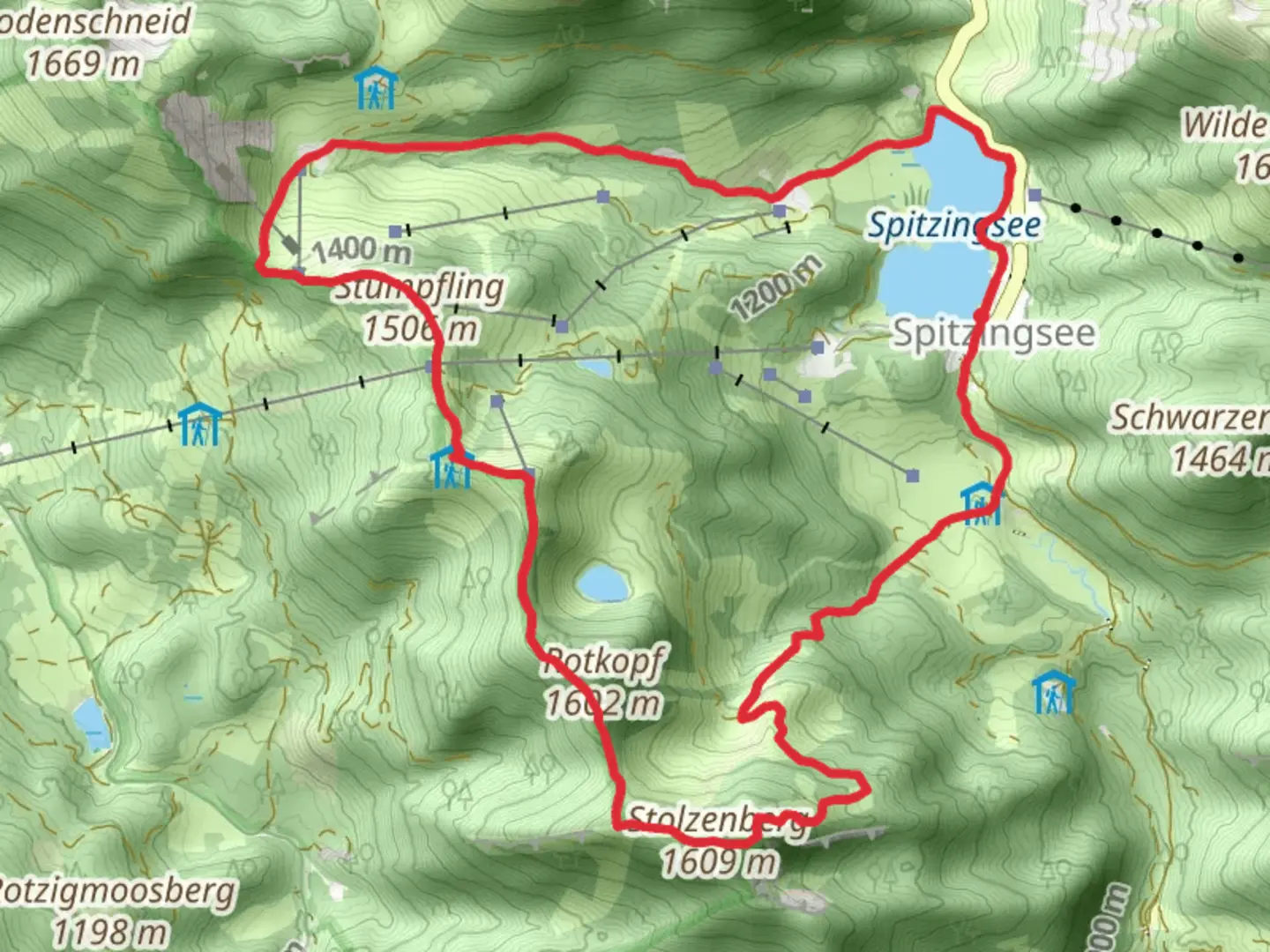
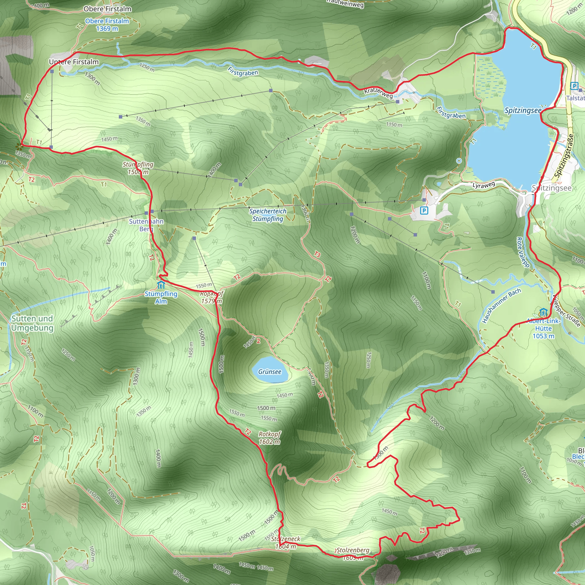
Starting near the picturesque town of Miesbach, Germany, the Spitzingsee, Stolzenberg, Roßkopf, and Suttenstein Loop is a captivating 13 km (8 miles) loop trail with an elevation gain of approximately 800 meters (2,625 feet). This medium-difficulty hike offers a blend of natural beauty, historical significance, and diverse wildlife, making it a must-experience for any avid hiker.### Getting There To reach the trailhead, you can either drive or use public transportation. If driving, head towards Miesbach and follow signs to Spitzingsee. There are several parking areas near the lake where you can leave your car. For those using public transport, take a train to Miesbach station. From there, you can catch a bus to Spitzingsee, which is well-connected and offers frequent services.### Trail Overview The trail begins near Spitzingsee, a serene alpine lake known for its crystal-clear waters and stunning reflections of the surrounding mountains. As you start your hike, you'll be greeted by the tranquil beauty of the lake, making it an ideal spot for a quick photo or a moment of reflection.### Key Sections and Landmarks#### Spitzingsee to Stolzenberg The initial section of the trail takes you from Spitzingsee towards Stolzenberg. This part of the hike is relatively gentle, allowing you to warm up as you traverse through lush forests and meadows. Keep an eye out for local wildlife such as deer and various bird species. After about 3 km (1.9 miles), you'll start to notice a gradual incline as you approach Stolzenberg.#### Stolzenberg Ascent The ascent to Stolzenberg is one of the more challenging parts of the hike, with an elevation gain of around 300 meters (984 feet) over a distance of 2 km (1.2 miles). The trail here is well-marked but can be steep in sections, so take your time and enjoy the panoramic views of the Bavarian Alps. Stolzenberg itself offers a fantastic vantage point, perfect for a rest and some scenic photography.#### Roßkopf Ridge From Stolzenberg, the trail continues along a ridge towards Roßkopf. This section is relatively flat and offers stunning views of the surrounding valleys and peaks. The ridge walk is about 4 km (2.5 miles) and is a great place to spot alpine flora, including edelweiss and gentian flowers. The Roßkopf summit provides another excellent viewpoint, where you can see as far as the Tegernsee Valley on a clear day.#### Suttenstein Descent The final major section of the trail involves descending from Roßkopf towards Suttenstein. This part of the hike is about 4 km (2.5 miles) and features a mix of forested paths and open meadows. The descent is moderate but can be slippery after rain, so good hiking boots are recommended. Suttenstein is known for its unique rock formations and offers a peaceful spot to take a break before completing the loop back to Spitzingsee.### Historical Significance The region around Spitzingsee has a rich history, dating back to medieval times. The area was historically significant for its role in the salt trade, with many old trade routes passing through these mountains. Additionally, the nearby town of Miesbach is known for its traditional Bavarian architecture and cultural heritage, making it worth a visit either before or after your hike.### Navigation and Safety For navigation, it's highly recommended to use the HiiKER app, which provides detailed maps and real-time updates on trail conditions. Always check the weather forecast before heading out, as conditions in the mountains can change rapidly. Carry sufficient water, snacks, and a first-aid kit, and let someone know your hiking plans.This loop trail offers a perfect blend of natural beauty, physical challenge, and historical intrigue, making it an unforgettable experience for any hiker.
What to expect?
Activity types
Comments and Reviews
User comments, reviews and discussions about the Spitzingsee, Stolzenberg, Roßkopf and Suttenstein Loop, Germany.
4.5
average rating out of 5
2 rating(s)
