Download
Preview
Add to list
More
10.8 km
~3 hrs 43 min
940 m
Loop
“Explore a challenging yet rewarding 11-kilometer loop near Miesbach, featuring stunning alpine views and rich history.”
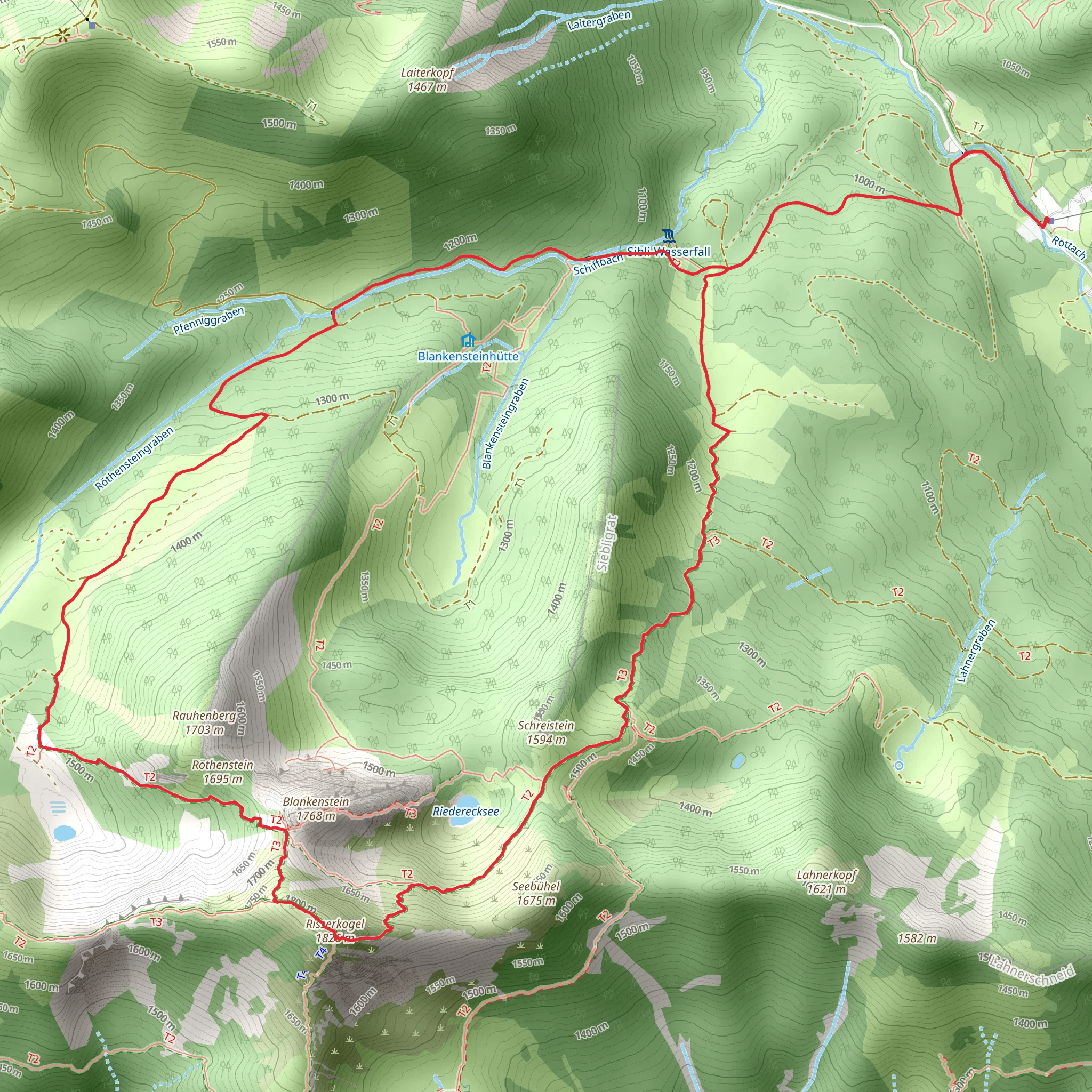
Starting near Miesbach, Germany, this loop trail spans approximately 11 kilometers (around 6.8 miles) with an elevation gain of about 900 meters (approximately 2,950 feet). The trailhead is easily accessible by both public transport and car. If you're taking public transport, you can catch a train to Miesbach and then a local bus or taxi to the trailhead. For those driving, there are parking facilities available near the starting point.### Initial Ascent and TerrainThe trail begins with a moderate ascent through lush forests, offering a serene start to your hike. The initial 2 kilometers (1.2 miles) will see you gaining about 200 meters (656 feet) in elevation. The path is well-marked and maintained, making it suitable for hikers with a medium level of experience. As you climb, the forest canopy provides ample shade, making this section particularly enjoyable during warmer months.### Mid-Trail HighlightsAround the 4-kilometer (2.5-mile) mark, you'll reach a more open area with stunning views of the surrounding Bavarian Alps. This is a great spot to take a break and soak in the scenery. The elevation gain here is more gradual, adding another 300 meters (984 feet) over the next 3 kilometers (1.9 miles). Keep an eye out for local wildlife such as deer and various bird species that are commonly seen in this region.### Risserkogel SummitThe trail then leads you to the Risserkogel summit, which stands at an elevation of approximately 1,826 meters (5,990 feet). The final ascent to the summit is steep and rocky, requiring careful footing. This section is about 1 kilometer (0.6 miles) long and involves an elevation gain of around 400 meters (1,312 feet). Once at the top, you'll be rewarded with panoramic views of the Tegernsee Valley and the surrounding peaks. This is a perfect spot for photography and a well-deserved rest.### Descent and Return LoopThe descent begins with a steep downhill section, so take your time and use trekking poles if you have them. The trail then loops back through alpine meadows and forested areas, gradually descending over the next 4 kilometers (2.5 miles). The terrain here is less challenging, allowing you to enjoy the natural beauty of the region. You'll pass by several small streams and might even spot some wildflowers depending on the season.### Historical SignificanceThe region around Miesbach has a rich history dating back to medieval times. The town itself was first mentioned in historical records in the 11th century. The trail passes through areas that were historically used for logging and grazing, and you might notice remnants of old wooden structures along the way. These serve as a reminder of the region's cultural heritage and its long-standing relationship with the natural environment.### Navigation and SafetyFor navigation, it's highly recommended to use the HiiKER app, which provides detailed maps and real-time updates. The trail is well-marked, but having a reliable navigation tool can enhance your hiking experience and ensure you stay on track.This loop trail offers a balanced mix of challenging ascents, rewarding views, and a descent that allows for a leisurely return. Whether you're a seasoned hiker or someone looking to explore the Bavarian Alps, this trail provides a fulfilling outdoor adventure.
What to expect?
Activity types
Comments and Reviews
User comments, reviews and discussions about the Risserkogel Via Alpina Purple and AV Weg, Germany.
4.8
average rating out of 5
5 rating(s)

