4.7 km
~1 hrs 24 min
284 m
“Explore the scenic Rabenlay trail: a 5km loop of nature, history, and wildlife near Mayen-Koblenz, Germany.”
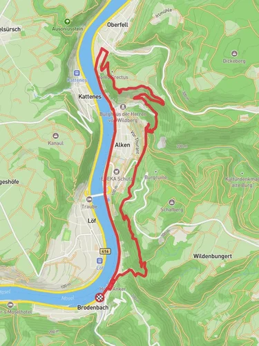
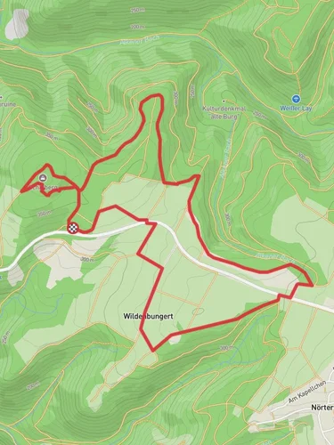
Starting near Mayen-Koblenz, Germany, the Rabenlay via Traumpfaedchen Loefer Rabenlaypfad is a picturesque loop trail that spans approximately 5 kilometers (3.1 miles) with an elevation gain of around 200 meters (656 feet). This medium-difficulty trail offers a delightful mix of natural beauty, historical landmarks, and opportunities for wildlife spotting.### Getting There
To reach the trailhead, you can drive or use public transportation. If driving, set your GPS to the nearest known address: Löf, Germany. For those using public transport, take a train to Löf station, which is well-connected to major cities like Koblenz. From the station, it's a short walk to the trailhead.### Trail Overview
The trail begins with a gentle ascent through lush forests, where you can expect to see a variety of flora and fauna. Keep an eye out for native bird species and small mammals that inhabit the area. The initial part of the trail is well-marked and easy to follow, making it suitable for hikers of all skill levels.### Significant Landmarks
As you progress, you'll come across the Rabenlay viewpoint, approximately 2 kilometers (1.2 miles) into the hike. This vantage point offers stunning panoramic views of the Moselle Valley, making it a perfect spot for a break and some photography. The elevation gain to this point is about 100 meters (328 feet), so take your time and enjoy the scenery.Continuing along the loop, you'll encounter the historic Löfer Rabenlaypfad, a path that has been used for centuries. This section of the trail is steeped in history, with remnants of old stone walls and ancient pathways that tell the story of the region's past. The trail here is a bit more challenging, with a steeper incline and rocky terrain, so sturdy hiking boots are recommended.### Nature and Wildlife
The trail meanders through dense forests and open meadows, offering a diverse range of ecosystems. In the spring and summer months, wildflowers bloom in abundance, adding a splash of color to the landscape. Deer, foxes, and various bird species are commonly spotted, so bring binoculars if you're a wildlife enthusiast.### Navigation and Safety
For navigation, it's advisable to use HiiKER, which provides detailed maps and real-time updates. The trail is generally well-marked, but having a reliable navigation tool can enhance your hiking experience and ensure you stay on track.### Final Stretch
The last leg of the trail descends gradually back towards the starting point, passing through serene woodlands and along the banks of small streams. This section is relatively easy, allowing you to cool down and reflect on the hike. The total elevation gain for the entire loop is around 200 meters (656 feet), making it a manageable yet rewarding hike.Whether you're a seasoned hiker or a casual walker, the Rabenlay via Traumpfaedchen Loefer Rabenlaypfad offers a rich blend of natural beauty, historical intrigue, and opportunities for wildlife observation.
Reviews
User comments, reviews and discussions about the Rabenlay via Traumpfaedchen Loefer Rabenlaypfad, Germany.
4.0
average rating out of 5
4 rating(s)
Loading reviews...


