Download
Preview
Add to list
More
10.0 km
~2 hrs 24 min
239 m
Loop
“The Nettetal Loop via Hochlayer Muhle offers a 10 km journey through lush forests, historical ruins, and scenic overlooks.”
Starting near Mayen-Koblenz, Germany, the Nettetal Loop via Hochlayer Muhle is a captivating 10 km (6.2 miles) loop trail with an elevation gain of approximately 200 meters (656 feet). This medium-difficulty trail offers a blend of natural beauty, historical landmarks, and diverse wildlife, making it a rewarding experience for hikers.### Getting There To reach the trailhead, you can drive or use public transport. If driving, head towards Mayen-Koblenz and look for parking near Hochlayer Muhle. For those using public transport, take a train to Mayen-Koblenz and then a local bus or taxi to the trailhead.### Trail Overview The trail begins near Hochlayer Muhle, a historic mill that dates back several centuries. As you start your hike, you'll be greeted by lush forests and the soothing sounds of the Nette River. The first 2 km (1.2 miles) are relatively flat, making it an excellent warm-up for the more challenging sections ahead.### Key Landmarks and Sections
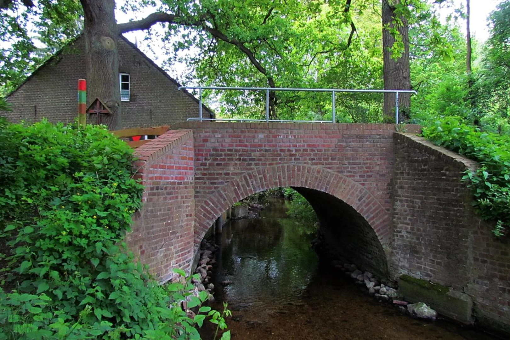
Hochlayer Muhle
At the start, take a moment to explore Hochlayer Muhle. This mill has been a significant part of the local history, providing insight into the region's agricultural past. The mill is well-preserved and offers a picturesque backdrop for photos.#### Forested Pathways Around the 3 km (1.9 miles) mark, the trail begins to ascend gently through dense forests. This section is rich in biodiversity, with various species of birds, deer, and small mammals. Keep an eye out for the European robin and the elusive red fox.#### Scenic Overlook At approximately 5 km (3.1 miles), you'll reach a scenic overlook offering panoramic views of the Nette Valley. This is an ideal spot for a break and some photography. The elevation gain to this point is about 100 meters (328 feet), providing a moderate challenge.#### Historical Ruins Continuing on, you'll encounter the ruins of an old castle around the 7 km (4.3 miles) mark. These ruins are a testament to the region's medieval history and offer a fascinating glimpse into the past. The trail here is a bit steeper, adding another 50 meters (164 feet) of elevation gain.### Final Stretch The last 3 km (1.9 miles) of the trail loop back towards Hochlayer Muhle, descending gradually through open meadows and farmland. This section is less strenuous, allowing you to enjoy the serene landscape and perhaps spot some local farmers at work.### Navigation and Safety For navigation, it's highly recommended to use HiiKER, which provides detailed maps and real-time updates. The trail is well-marked, but having a reliable navigation tool ensures you stay on track.### Wildlife and Flora The Nettetal Loop is home to a variety of flora and fauna. In spring and summer, the trail is adorned with wildflowers like bluebells and daisies. The forests are predominantly oak and beech, providing ample shade and a cool environment even in warmer months.### Historical Significance The region around Mayen-Koblenz has a rich history dating back to Roman times. The presence of ancient mills, castle ruins, and old pathways adds a layer of historical intrigue to your hike. Each landmark tells a story, making the trail not just a physical journey but a historical one as well.Prepare adequately with water, snacks, and appropriate footwear, and you'll find the Nettetal Loop via Hochlayer Muhle to be a fulfilling and enriching hiking experience.

What to expect?
Activity types
Comments and Reviews
User comments, reviews and discussions about the Nettetal Loop via Hochlayer Muhle, Germany.
4.75
average rating out of 5
4 rating(s)