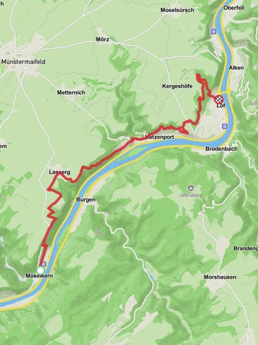
Druidenstein Kreuz and Schinderhanneshöhle Loop - Burgen
10.1 km
~2 hrs 53 min
514 m
“Explore the captivating 10 km Druidenstein Kreuz and Schinderhanneshöhle Loop, rich in history and scenic beauty.”
Starting near Mayen-Koblenz, Germany, the Druidenstein Kreuz and Schinderhanneshöhle Loop is a captivating 10 km (6.2 miles) loop trail with an elevation gain of approximately 500 meters (1,640 feet). This trail is rated as medium difficulty, making it suitable for moderately experienced hikers.
### Getting There To reach the trailhead, you can drive or use public transport. If driving, set your GPS to the nearest known address in Mayen-Koblenz. For those using public transport, take a train to Mayen West station and then a local bus or taxi to the trailhead.
### Trail Highlights #### Druidenstein One of the first significant landmarks you'll encounter is the Druidenstein, a striking rock formation that has historical and cultural significance. The Druidenstein is believed to have been a site for ancient Celtic rituals. The rock formation offers panoramic views of the surrounding landscape, making it a perfect spot for a short break and some photography.
#### Kreuz As you continue, you'll come across the Kreuz, a large cross that stands as a testament to the region's Christian heritage. This area is often used for local religious ceremonies and offers another excellent viewpoint.
#### Schinderhanneshöhle The trail then leads you to the Schinderhanneshöhle, a cave named after the infamous German outlaw, Schinderhannes. Legend has it that Schinderhannes used this cave as a hideout. The cave is accessible and provides a cool, shaded area to explore. Make sure to bring a flashlight if you plan to venture inside.
### Nature and Wildlife The trail meanders through dense forests and open meadows, offering a diverse range of flora and fauna. Keep an eye out for deer, foxes, and a variety of bird species. The forested sections are particularly beautiful in the autumn when the leaves change color.
### Navigation For navigation, it is highly recommended to use HiiKER. The app provides detailed maps and real-time updates, ensuring you stay on the right path. The trail is well-marked, but having a reliable navigation tool can enhance your hiking experience.
### Elevation and Terrain The trail features a mix of ascents and descents, with the most significant elevation gain occurring in the first half of the hike. The terrain varies from rocky paths to soft forest floors, so wearing sturdy hiking boots is advisable. The total elevation gain is around 500 meters (1,640 feet), which is spread out over the 10 km (6.2 miles) distance, making it manageable for most hikers.
### Historical Significance The region around Mayen-Koblenz is rich in history. The trail itself passes through areas that have been inhabited since ancient times. The Druidenstein and Schinderhanneshöhle are just two examples of the historical landmarks you'll encounter. The area was also significant during the Roman era, and you may come across remnants of Roman roads and settlements.
### Final Tips - Bring plenty of water and snacks, as there are no facilities along the trail. - Check the weather forecast before heading out, as conditions can change rapidly. - Wear layers, as the temperature can vary significantly between the forested and open sections of the trail. - Always follow Leave No Trace principles to keep the trail beautiful for future hikers.
This trail offers a perfect blend of natural beauty, historical intrigue, and moderate physical challenge, making it a rewarding experience for those who undertake it.
Reviews
User comments, reviews and discussions about the Druidenstein Kreuz and Schinderhanneshöhle Loop - Burgen, Germany.
0.0
average rating out of 5
0 rating(s)


