Download
Preview
Add to list
More
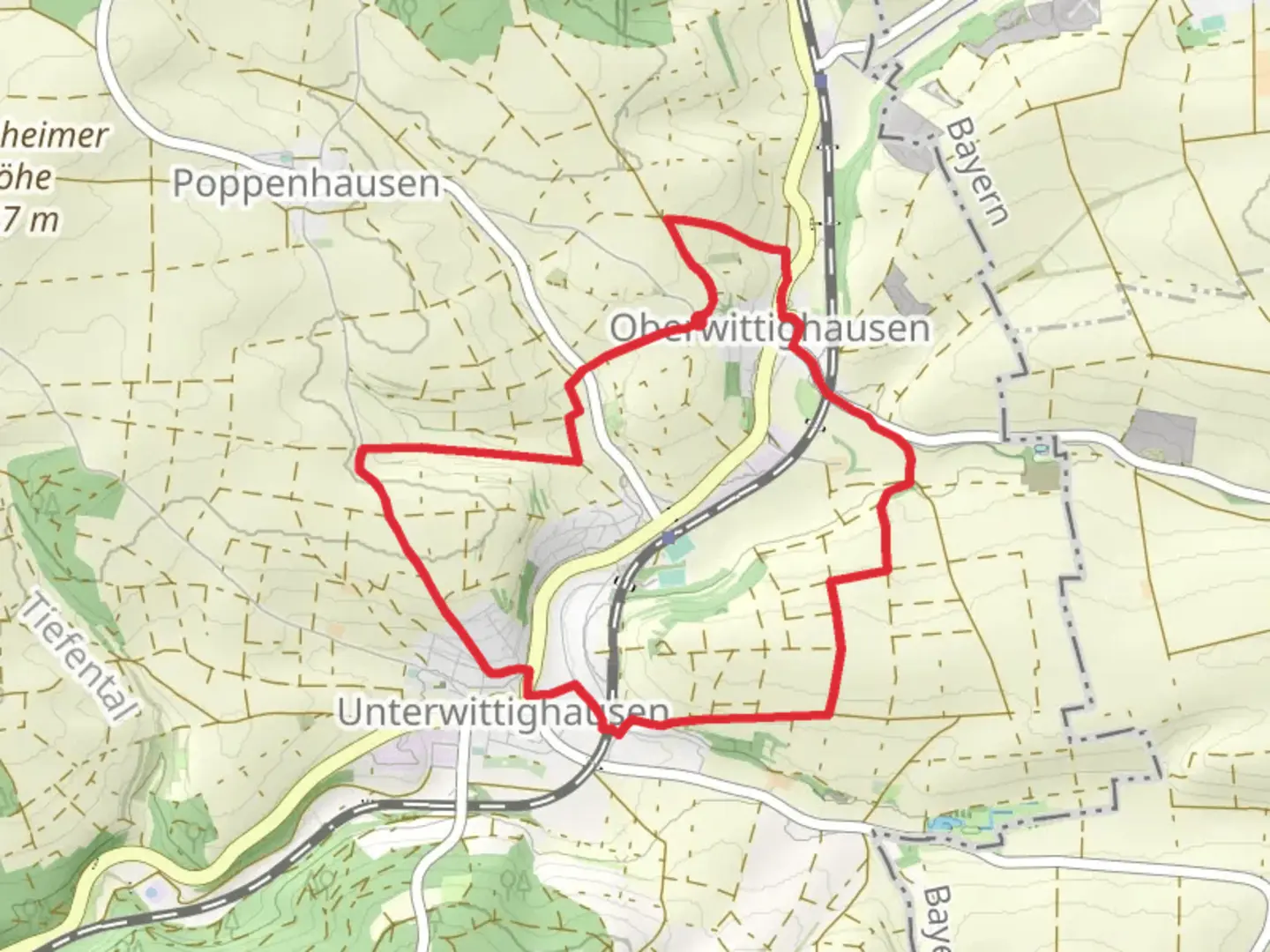
7.9 km
~1 hrs 48 min
137 m
Loop
“Explore serene landscapes, historic monuments, and diverse wildlife on the rewarding 8 km Bildstockweg Wittighausen loop.”
Starting near Main-Tauber-Kreis, Germany, the Bildstockweg Wittighausen is an 8 km (approximately 5 miles) loop trail with an elevation gain of around 100 meters (328 feet). This trail is rated as medium difficulty, making it suitable for moderately experienced hikers.### Getting There To reach the trailhead, you can either drive or use public transport. If driving, set your GPS to Wittighausen, a small town in the Main-Tauber-Kreis district. For those using public transport, Wittighausen is accessible via regional trains from larger cities like Würzburg. The nearest train station is Wittighausen Bahnhof, from which the trailhead is a short walk away.### Trail Overview The trail begins near the town center of Wittighausen, where you can find ample parking and basic amenities. As you start your hike, you'll immediately notice the serene rural landscape, characterized by rolling hills and agricultural fields.### Key Landmarks and Points of Interest - Bildstock Monuments: The trail is named after the numerous "Bildstock" or wayside shrines that dot the route. These religious monuments date back several centuries and offer a glimpse into the region's spiritual and cultural history. The first of these shrines appears about 1 km (0.6 miles) into the hike.
- Wittighausen Church: Approximately 2 km (1.2 miles) into the trail, you'll pass by the historic Wittighausen Church. This church, with its classic architecture, is a great spot for a brief rest and some photos.- Forest Section: Around the 4 km (2.5 miles) mark, the trail enters a dense forest area. This section provides a welcome change of scenery and a bit of shade. Keep an eye out for local wildlife such as deer and various bird species.### Elevation and Terrain The trail features a gradual elevation gain of about 100 meters (328 feet), making it manageable for most hikers. The terrain is a mix of dirt paths, gravel roads, and some paved sections. Good hiking boots are recommended, especially after rain when the paths can become muddy.### Navigation To ensure you stay on track, consider using the HiiKER app, which provides detailed maps and real-time navigation. The trail is well-marked, but having a digital guide can be very helpful, especially in the forested sections.### Historical Significance The Main-Tauber-Kreis region has a rich history dating back to the medieval period. The Bildstock monuments you'll encounter are a testament to the area's long-standing religious traditions. Additionally, the agricultural fields you pass through have been cultivated for centuries, contributing to the local economy and way of life.### Wildlife and Flora The trail offers a diverse range of flora and fauna. In the open fields, you'll find wildflowers and various crops, while the forested sections are home to oak, beech, and pine trees. Wildlife sightings may include deer, foxes, and a variety of bird species, making it a rewarding experience for nature enthusiasts.### Final Stretch As you near the end of the loop, the trail brings you back to the outskirts of Wittighausen. This final section is relatively flat and easy, allowing you to cool down and reflect on the journey. The trail concludes back at the starting point, where you can find local cafes and restaurants to relax and enjoy a meal.This 8 km loop offers a balanced mix of cultural landmarks, natural beauty, and manageable terrain, making it a rewarding hike for those looking to explore the Main-Tauber-Kreis region.

Comments and Reviews
User comments, reviews and discussions about the Bildstockweg Wittighausen, Germany.
average rating out of 5
0 rating(s)