Download
Preview
Add to list
More
15.0 km
~3 hrs 51 min
515 m
Loop
“Explore lush forests, historical landmarks, and diverse wildlife on this moderately challenging 15 km loop trail.”
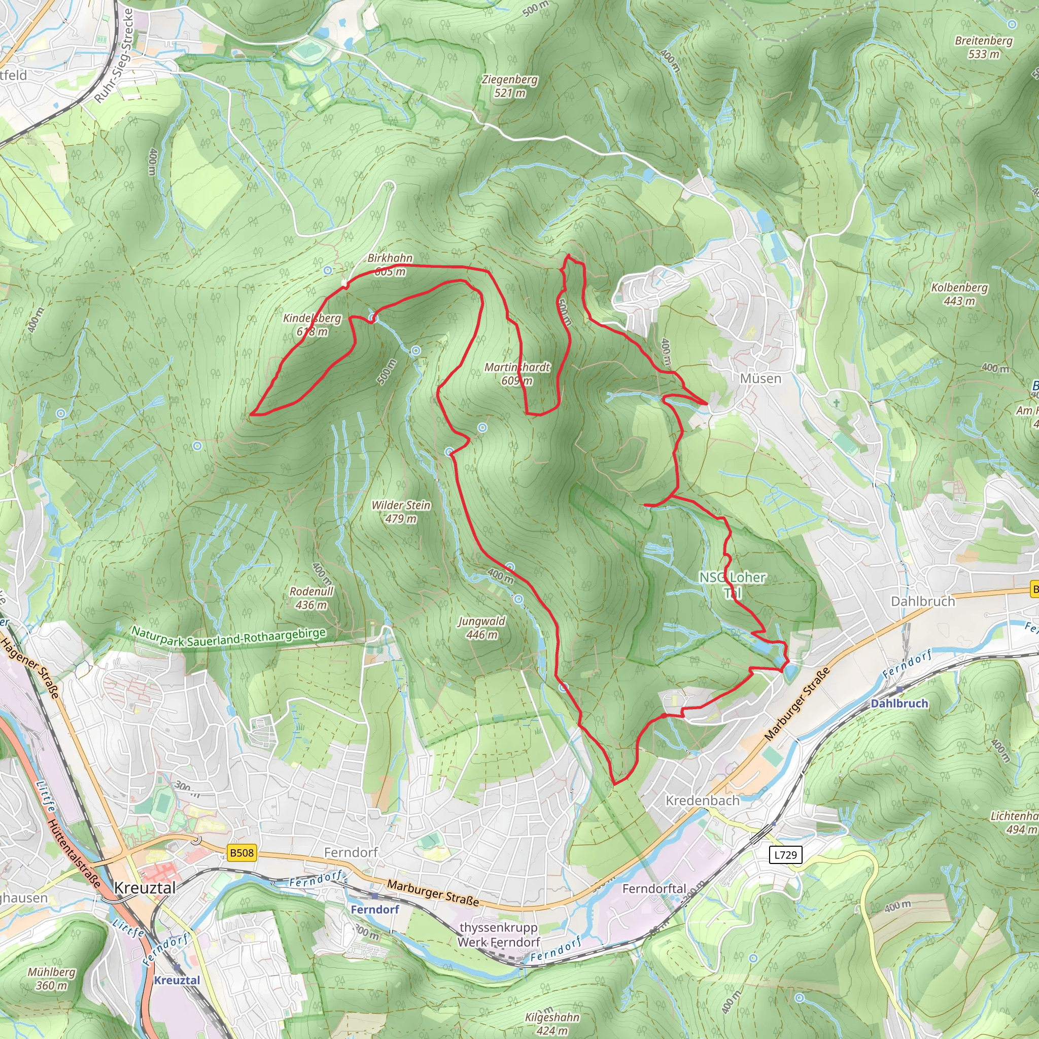
Starting near Kreis Siegen-Wittgenstein, Germany, this 15 km (approximately 9.3 miles) loop trail offers a moderately challenging hike with an elevation gain of around 500 meters (about 1,640 feet). The trailhead is conveniently accessible by both car and public transport. If you're driving, you can park near the town of Kreuztal, which is the closest significant landmark. For those using public transport, take a train to Kreuztal station and then a local bus to the trailhead.
Trail Overview
The trail begins with a gentle ascent through lush forests, providing a serene start to your journey. As you progress, the path becomes steeper, leading you to the first significant landmark, the Martinshardt. This section of the trail is about 5 km (3.1 miles) in and offers panoramic views of the surrounding countryside. The elevation gain here is gradual, making it a perfect spot to catch your breath and take in the scenery.
Historical Significance
The region around Kreis Siegen-Wittgenstein is steeped in history, particularly from the medieval period. The Kindelsberg Tower, located roughly halfway through the trail, is a notable historical landmark. Built in the early 20th century, this observation tower stands on the Kindelsberg hill and offers stunning views of the Siegerland region. The area was historically significant for its iron ore mining, and remnants of this industrial past can still be seen along the trail.
Flora and Fauna
As you continue your hike, you'll traverse through diverse ecosystems. The lower sections of the trail are dominated by deciduous forests, home to a variety of bird species and small mammals. As you ascend, the vegetation changes to coniferous forests, where you might spot deer and other wildlife. Keep an eye out for the vibrant wildflowers that bloom in the spring and summer months, adding a splash of color to the landscape.
Navigation and Safety
The trail is well-marked, but it's always a good idea to have a reliable navigation tool. HiiKER is an excellent app for this purpose, providing detailed maps and real-time updates. The trail can be slippery after rain, so sturdy hiking boots with good grip are recommended. There are a few steep sections, particularly as you approach the Kindelsberg Tower, so trekking poles can be helpful.
Points of Interest
- Martinshardt: Approximately 5 km (3.1 miles) from the start, offering panoramic views. - Kindelsberg Tower: Around 7.5 km (4.7 miles) into the hike, this historical tower provides a great spot for a break and some photos. - Wildlife Viewing: Various points along the trail offer opportunities to see local wildlife, especially in the early morning or late afternoon.
Final Stretch
The descent from Kindelsberg is more gradual, winding through picturesque meadows and forests. This section is about 7.5 km (4.7 miles) and brings you back to the trailhead near Kreuztal. The loop nature of the trail makes it convenient to complete without backtracking, and the varied terrain ensures that the hike remains interesting throughout.
Whether you're a seasoned hiker or someone looking to explore the natural beauty and historical richness of the Siegerland region, this trail offers a rewarding experience.
What to expect?
Activity types
Comments and Reviews
User comments, reviews and discussions about the Martinshardt and Kindelsberg via Kindelsbergpfad, Germany.
5.0
average rating out of 5
4 rating(s)

