Farrenkopf, Multhaupter Hammer and Waldbahn Almetal Loop via Grenzstein Weg
7.1 km
~1 hrs 44 min
187 m
“Explore Kreis Paderborn's natural beauty and history on this scenic 7 km loop with diverse landmarks.”
Starting your hike near Kreis Paderborn, Germany, the Farrenkopf, Multhaupter Hammer and Waldbahn Almetal Loop via Grenzstein Weg offers a delightful 7 km (approximately 4.3 miles) loop with an elevation gain of around 100 meters (328 feet). This medium-difficulty trail is perfect for those looking to explore the natural beauty and historical significance of the region.
### Getting There To reach the trailhead, you can either drive or use public transport. If driving, set your GPS to the nearest known address: Bahnhofstraße 1, 33154 Salzkotten, Germany. From there, it's a short drive to the starting point. For those using public transport, take a train to Salzkotten station and then a local bus or taxi to the trailhead.
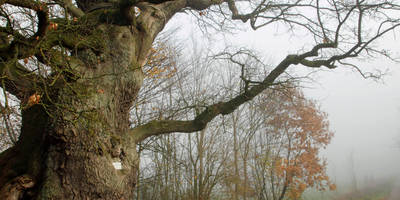
### Trail Overview The trail begins with a gentle ascent, allowing you to ease into the hike. As you progress, you'll encounter a mix of forested areas and open landscapes, providing a variety of scenery. The initial 2 km (1.2 miles) will take you through dense woodlands, where you might spot local wildlife such as deer and various bird species.
### Historical Significance One of the highlights of this trail is its historical significance. The Grenzstein Weg, or Boundary Stone Path, features several ancient boundary stones that date back to the medieval period. These stones were used to demarcate territories and are a fascinating glimpse into the region's history. Keep an eye out for these markers around the 3 km (1.9 miles) mark.
### Key Landmarks - Farrenkopf: Around the 4 km (2.5 miles) point, you'll reach Farrenkopf, a small hill offering panoramic views of the surrounding countryside. This is a great spot to take a break and enjoy the scenery. - Multhaupter Hammer: Continuing on, you'll come across the Multhaupter Hammer, an old hammer mill that has been preserved as a historical site. This landmark is located approximately 5 km (3.1 miles) into the hike and provides an interesting look into the region's industrial past. - Waldbahn Almetal: Near the end of the loop, you'll follow a section of the Waldbahn Almetal, an old forest railway line that has been converted into a hiking path. This part of the trail is relatively flat and easy, making for a pleasant end to your hike.
### Navigation and Safety For navigation, it's highly recommended to use the HiiKER app, which provides detailed maps and real-time updates. The trail is well-marked, but having a reliable navigation tool will ensure you stay on track.
### Flora and Fauna The trail is rich in biodiversity. In the spring and summer months, you'll find a variety of wildflowers, including bluebells and daisies. The forested sections are home to oak, beech, and pine trees. Wildlife enthusiasts might spot red squirrels, foxes, and a variety of bird species, including woodpeckers and owls.
### Final Stretch The last 2 km (1.2 miles) of the trail are relatively flat, making for an easy and enjoyable finish. You'll loop back to your starting point, completing a rewarding hike that combines natural beauty, historical landmarks, and a touch of local wildlife.
This trail offers a well-rounded hiking experience, perfect for those looking to explore the natural and historical richness of the Kreis Paderborn region.
Reviews
User comments, reviews and discussions about the Farrenkopf, Multhaupter Hammer and Waldbahn Almetal Loop via Grenzstein Weg, Germany.
0.0
average rating out of 5
0 rating(s)


