Download
Preview
Add to list
More
7.0 km
~1 hrs 46 min
216 m
Loop
“Experience a scenic 7 km hike blending lush forests, historical landmarks, and vibrant wildlife near Kreis Olpe.”
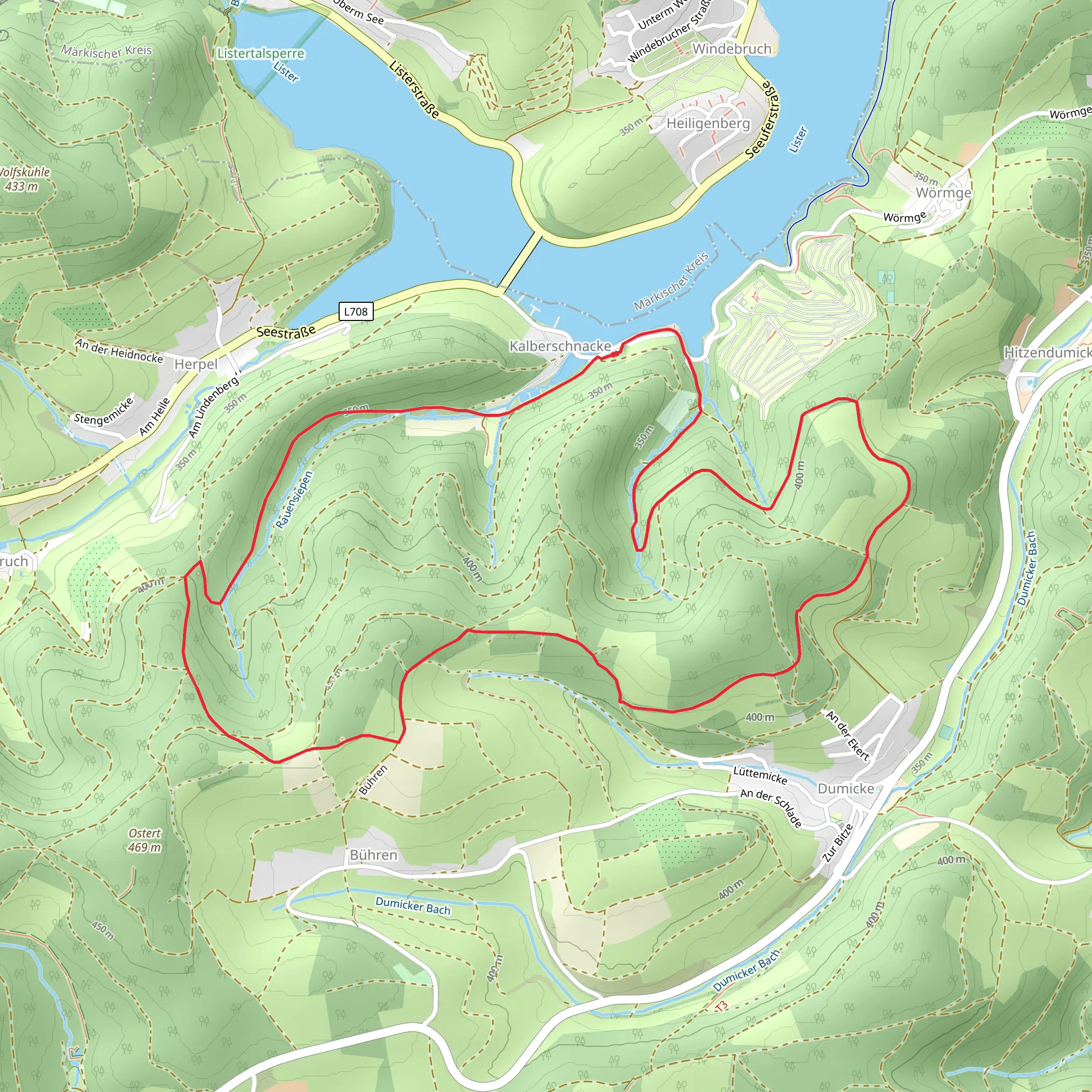
Starting near Kreis Olpe, Germany, the Kalberschnacke and Dumicker Gnick Loop via Drolshagen Rundweg is a picturesque 7 km (4.35 miles) loop trail with an elevation gain of approximately 200 meters (656 feet). This medium-difficulty trail offers a delightful mix of natural beauty, historical landmarks, and opportunities for wildlife observation.
Getting There To reach the trailhead, you can drive or use public transport. If driving, set your GPS to Kreis Olpe, Germany, and look for parking near the trailhead. For those using public transport, the nearest significant landmark is the town of Drolshagen. From Drolshagen, you can take a local bus or taxi to the trailhead.
Trail Overview The trail begins with a gentle ascent through lush forests, offering a serene start to your hike. As you progress, you'll encounter a mix of deciduous and coniferous trees, providing ample shade and a cool environment, especially during the warmer months.
Key Landmarks and Points of Interest - **Kalberschnacke**: Approximately 2 km (1.24 miles) into the hike, you'll reach Kalberschnacke, a small hill offering panoramic views of the surrounding countryside. This is a great spot for a short break and some photography. - **Dumicker Gnick**: Around the 4 km (2.48 miles) mark, you'll come across Dumicker Gnick, another elevated area that provides stunning vistas. The elevation gain here is gradual, making it accessible for most hikers. - **Historical Significance**: The region around Kreis Olpe has a rich history dating back to medieval times. Keep an eye out for old stone markers and remnants of ancient pathways that were once used by traders and pilgrims.
Flora and Fauna The trail is home to a variety of wildlife, including deer, foxes, and numerous bird species. In the spring and summer, the forest floor is carpeted with wildflowers, adding a splash of color to your hike. Be sure to carry a pair of binoculars if you're interested in birdwatching.
Navigation and Safety While the trail is well-marked, it's always a good idea to have a reliable navigation tool. The HiiKER app is highly recommended for this trail, providing detailed maps and real-time updates. Make sure to wear sturdy hiking boots, as some sections can be rocky and uneven.
Final Stretch The last 2 km (1.24 miles) of the trail take you through open meadows and past small streams, offering a peaceful end to your hike. The descent is gradual, making it easy on the knees and a pleasant way to conclude your journey.
This trail offers a balanced mix of natural beauty, historical intrigue, and moderate physical challenge, making it a rewarding experience for hikers of all levels.
What to expect?
Activity types
Comments and Reviews
User comments, reviews and discussions about the Kalberschnacke and Dumicker Gnick Loop via Drolshagen Rundweg, Germany.
4.75
average rating out of 5
4 rating(s)
