Teufelsley, Mestrenger Mühle and Kalltal und Nebentaler Loop via Kall Trail
Download
Preview
Add to list
More
11.4 km
~2 hrs 43 min
274 m
Loop
“Explore the scenic 11 km Teufelsley Loop near Kreis Düren, blending nature, history, and diverse wildlife.”
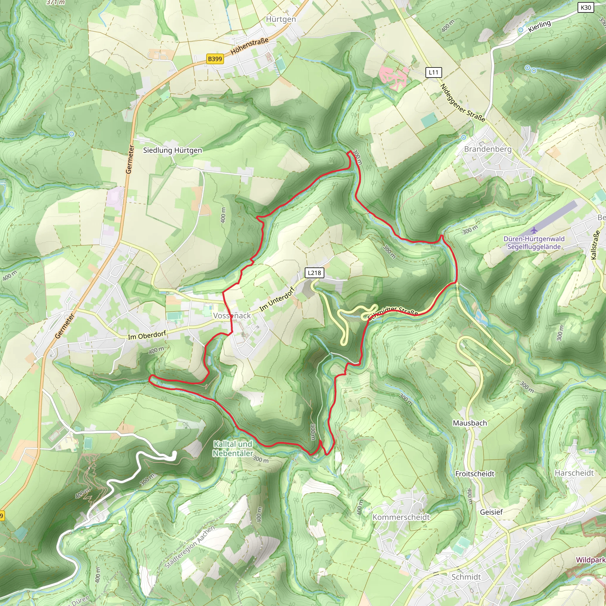
Starting near Kreis Düren, Germany, the Teufelsley, Mestrenger Mühle and Kalltal und Nebentaler Loop via Kall Trail is an 11 km (approximately 6.8 miles) loop with an elevation gain of around 200 meters (656 feet). This medium-difficulty trail offers a blend of natural beauty, historical landmarks, and diverse wildlife, making it a rewarding experience for hikers.
Getting There To reach the trailhead, you can drive or use public transport. If driving, set your GPS to Kreis Düren, Germany, and look for parking options near the trailhead. For public transport, take a train to Düren station and then a local bus towards the trailhead area. The nearest significant landmark is the town of Heimbach, which is well-connected by public transport.
Trail Highlights
#### Teufelsley The trail begins with a gentle ascent towards Teufelsley, a rocky outcrop offering panoramic views of the surrounding Eifel region. This section is about 3 km (1.86 miles) into the hike and involves an elevation gain of approximately 100 meters (328 feet). The name "Teufelsley" translates to "Devil's Rock," and local legends often speak of mysterious occurrences in this area.
#### Mestrenger Mühle Continuing on, you'll reach Mestrenger Mühle, an old mill that has been converted into a charming guesthouse and restaurant. This is a great spot to take a break, roughly 5 km (3.1 miles) into the hike. The mill is situated along the Kall River, providing a picturesque setting for a rest stop. The area around the mill is rich in history, dating back to medieval times when mills were essential for local agriculture.
#### Kalltal und Nebentaler Loop The trail then loops through the Kalltal and Nebentaler valleys, offering a mix of dense forests and open meadows. This section is particularly rich in wildlife; keep an eye out for deer, foxes, and a variety of bird species. The loop is about 3 km (1.86 miles) long and relatively flat, making it a relaxing part of the hike.
Navigation and Safety For navigation, it's highly recommended to use the HiiKER app, which provides detailed maps and real-time GPS tracking. The trail is well-marked, but having a reliable navigation tool will ensure you stay on the right path.
Historical Significance The region around Kreis Düren has a rich history, particularly from the medieval period. The old mills and ancient pathways you encounter along the trail were once vital to the local economy. Additionally, the area played a significant role during World War II, with many remnants of that era still visible.
Flora and Fauna The trail traverses through diverse ecosystems, from rocky outcrops to lush valleys. You'll encounter a variety of plant species, including oak, beech, and pine trees. The Kall River adds to the biodiversity, supporting aquatic life and providing a habitat for numerous bird species.
Final Stretch The final stretch of the trail brings you back to the starting point near Kreis Düren. This section is a gentle descent, allowing you to cool down and reflect on the diverse landscapes and historical landmarks you've encountered.
This 11 km loop offers a well-rounded hiking experience, combining natural beauty, historical significance, and a moderate challenge suitable for most hikers.
What to expect?
Activity types
Comments and Reviews
User comments, reviews and discussions about the Teufelsley, Mestrenger Mühle and Kalltal und Nebentaler Loop via Kall Trail, Germany.
4.5
average rating out of 5
4 rating(s)
