Download
Preview
Add to list
More
7.5 km
~2 hrs 12 min
429 m
Loop
“Explore the diverse natural beauty and rich history of Kreis Düren on this captivating 7 km trail.”
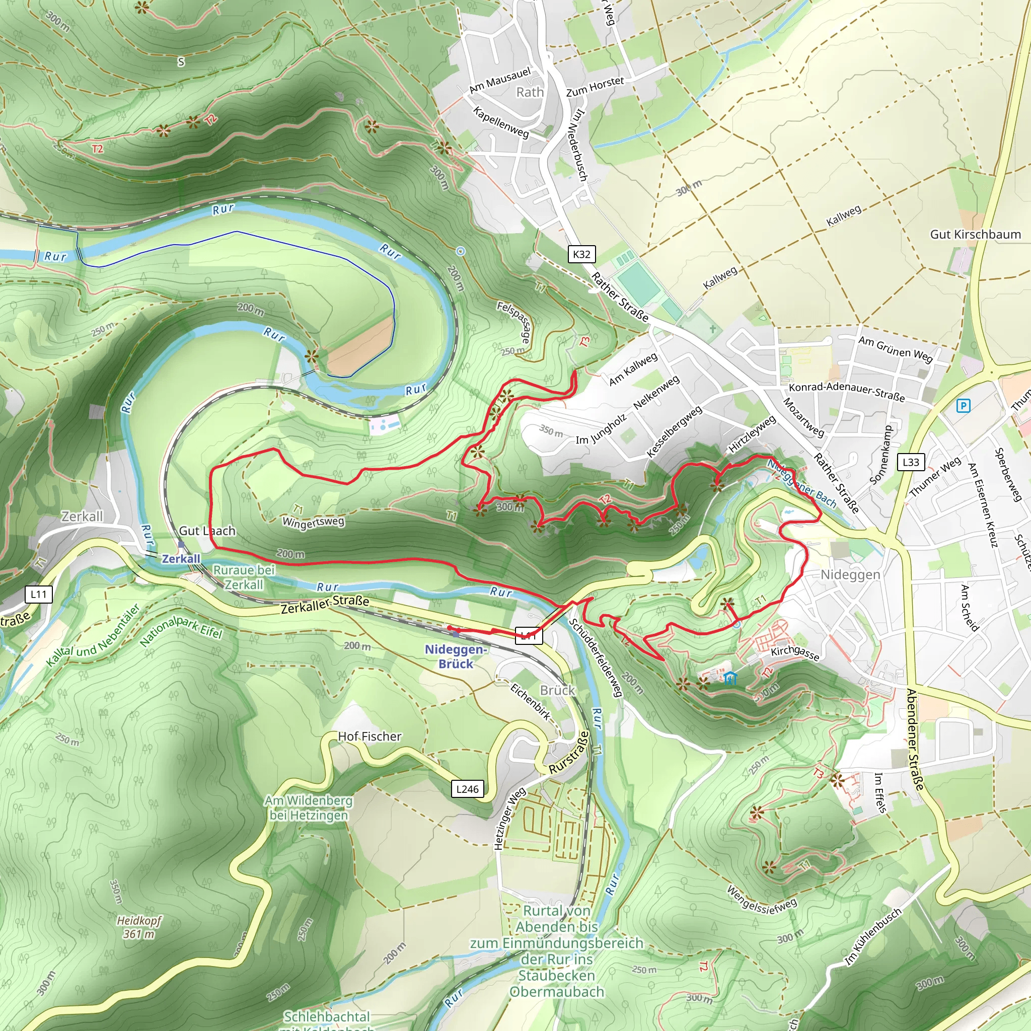
Starting near Kreis Düren, Germany, the Rundweg Sonne and Buntsandsteinroute Loop is a captivating 7 km (approximately 4.3 miles) trail with an elevation gain of around 400 meters (about 1,312 feet). This loop trail is rated as medium difficulty, making it suitable for moderately experienced hikers.### Getting There To reach the trailhead, you can drive or use public transport. If driving, set your GPS to Kreis Düren, Germany, and look for parking options near the trailhead. For public transport, take a train to Düren Station. From there, local buses or taxis can take you closer to the starting point.### Trail Overview The trail begins with a gentle ascent through a mixed forest, where you'll be greeted by the serene sounds of nature. As you progress, the path becomes steeper, offering a moderate challenge. The initial 2 km (1.2 miles) will see you gaining about 150 meters (492 feet) in elevation, providing a good warm-up for the rest of the hike.### Significant Landmarks Around the 3 km (1.9 miles) mark, you'll encounter the first significant landmark: the Buntsandstein rock formations. These striking red sandstone formations are a geological marvel, dating back to the Triassic period. Take a moment to appreciate the unique textures and colors of the rocks, which have been shaped by millions of years of natural forces.### Flora and Fauna The trail is rich in biodiversity. As you hike, keep an eye out for native wildlife such as deer, foxes, and a variety of bird species. The forest is predominantly composed of beech and oak trees, providing ample shade and a cool environment, especially during the summer months. In spring and early summer, the forest floor is often carpeted with wildflowers, adding a splash of color to your hike.### Historical Significance The region around Kreis Düren has a rich history. During the hike, you'll come across several old stone markers and remnants of ancient settlements. These markers are a testament to the area's long-standing human habitation, dating back to Roman times. The Buntsandstein formations themselves have historical significance, having been used as a resource for building materials in the past.### Navigation To ensure you stay on track, use the HiiKER app for accurate navigation. The trail is well-marked, but having a reliable navigation tool can help you explore with confidence.### Final Stretch The last 2 km (1.2 miles) of the trail offer a gentle descent back to the starting point. This section provides stunning views of the surrounding landscape, including distant hills and valleys. The descent is a great opportunity to cool down and reflect on the natural beauty and historical richness of the area.Prepare adequately with water, snacks, and appropriate hiking gear. The Rundweg Sonne and Buntsandsteinroute Loop offers a rewarding experience for those looking to explore the natural and historical wonders of Kreis Düren.
What to expect?
Activity types
Comments and Reviews
User comments, reviews and discussions about the Rundweg Sonne and Buntsandsteinroute Loop, Germany.
4.6
average rating out of 5
5 rating(s)

