Download
Preview
Add to list
More
9.8 km
~2 hrs 47 min
499 m
Loop
“Embark on the Rather Felsen, Stausee Obermaubach, and Eugenienstein Loop for panoramic views and natural beauty.”
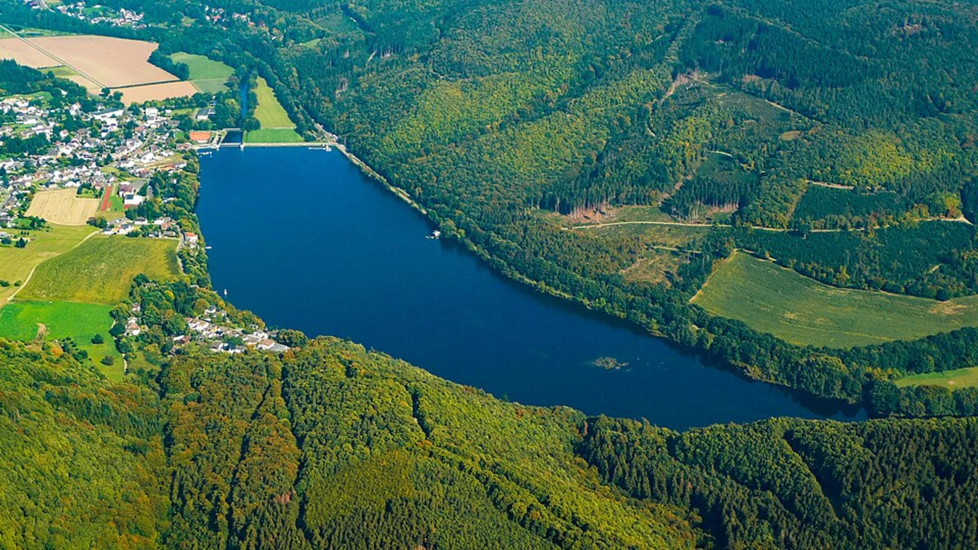
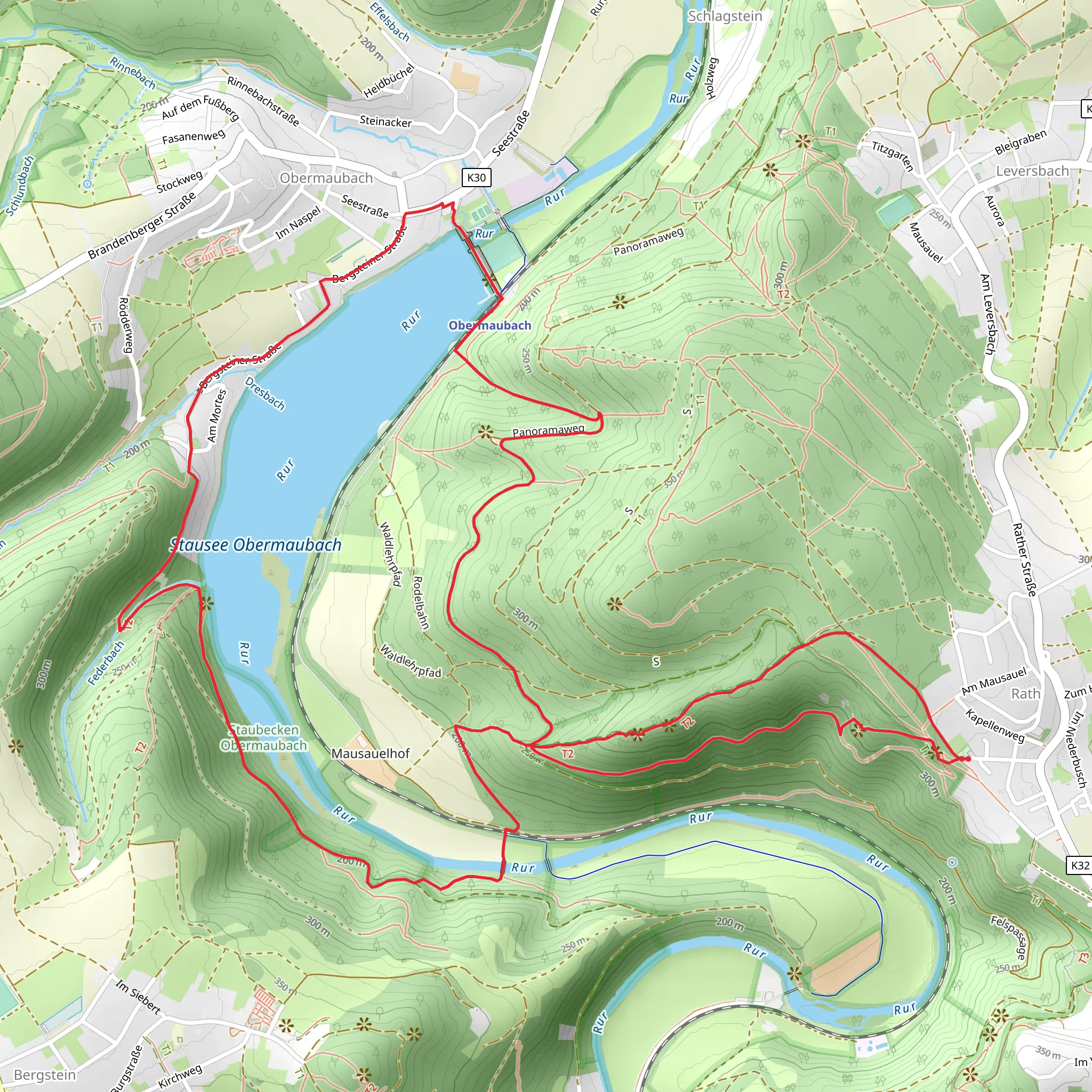
Starting near Kreis Düren, Germany, the Rather Felsen, Stausee Obermaubach, and Eugenienstein Loop is a captivating 10 km (6.2 miles) trail with an elevation gain of approximately 500 meters (1,640 feet). This loop trail is rated as medium difficulty, making it suitable for moderately experienced hikers.### Getting There To reach the trailhead, you can either drive or use public transport. If driving, set your GPS to Kreis Düren, Germany. For those using public transport, take a train to Düren Station and then a local bus to the nearest stop at Obermaubach. From there, it's a short walk to the trailhead.### Trail Overview The trail begins near the picturesque village of Obermaubach, which is easily accessible and offers ample parking. As you start your hike, you'll be greeted by the serene beauty of the Stausee Obermaubach reservoir. This man-made lake is a popular spot for fishing and boating, and its calm waters provide a tranquil backdrop as you begin your journey.### Significant Landmarks and Nature
Rather Felsen
Approximately 3 km (1.9 miles) into the hike, you'll encounter Rather Felsen, a striking rock formation that offers panoramic views of the surrounding landscape. The climb to Rather Felsen involves a moderate ascent, but the effort is well worth it for the breathtaking vistas. This area is also rich in flora, with a variety of wildflowers and native plants that add a splash of color to the rocky terrain.#### Stausee Obermaubach Continuing along the trail, you'll loop around the Stausee Obermaubach. The reservoir is not only a scenic highlight but also a habitat for various bird species. Keep an eye out for kingfishers and herons, which are commonly spotted here. The trail around the lake is relatively flat, providing a gentle respite before the next ascent.#### Eugenienstein Around the 7 km (4.3 miles) mark, you'll reach Eugenienstein, another notable viewpoint. The climb to Eugenienstein is steeper, with an elevation gain of about 200 meters (656 feet) over a short distance. This vantage point offers sweeping views of the Eifel region, characterized by rolling hills and dense forests. It's an ideal spot for a rest and some photography.### Historical Significance The region around Kreis Düren has a rich history dating back to Roman times. The trail itself passes through areas that were once part of ancient trade routes. The village of Obermaubach has historical significance as well, with remnants of medieval architecture and old mills that tell the story of its past.### Navigation and Safety For navigation, it's highly recommended to use the HiiKER app, which provides detailed maps and real-time updates. The trail is well-marked, but having a reliable navigation tool ensures you stay on track. Be prepared for varying terrain, including rocky paths and forested areas. Proper hiking boots and trekking poles are advisable, especially for the steeper sections.### Wildlife and Flora The trail is home to diverse wildlife, including deer, foxes, and a variety of bird species. The forested sections are lush with oak, beech, and pine trees, creating a rich tapestry of green. In spring and summer, the trail is adorned with wildflowers, adding vibrant hues to the landscape.### Final Stretch As you complete the loop and head back towards Obermaubach, the trail descends gently, allowing you to cool down and reflect on the natural beauty you've experienced. The final stretch offers more views of the reservoir and the surrounding hills, making for a peaceful end to a rewarding hike.
What to expect?
Activity types
Comments and Reviews
User comments, reviews and discussions about the Rather Felsen, Stausee Obermaubach and Eugenienstein Loop, Germany.
4.0
average rating out of 5
4 rating(s)

