Download
Preview
Add to list
More
7.5 km
~1 hrs 41 min
114 m
Loop
“Discover history and nature on an 8 km moderately challenging loop trail near Kreis Düren, Germany.”
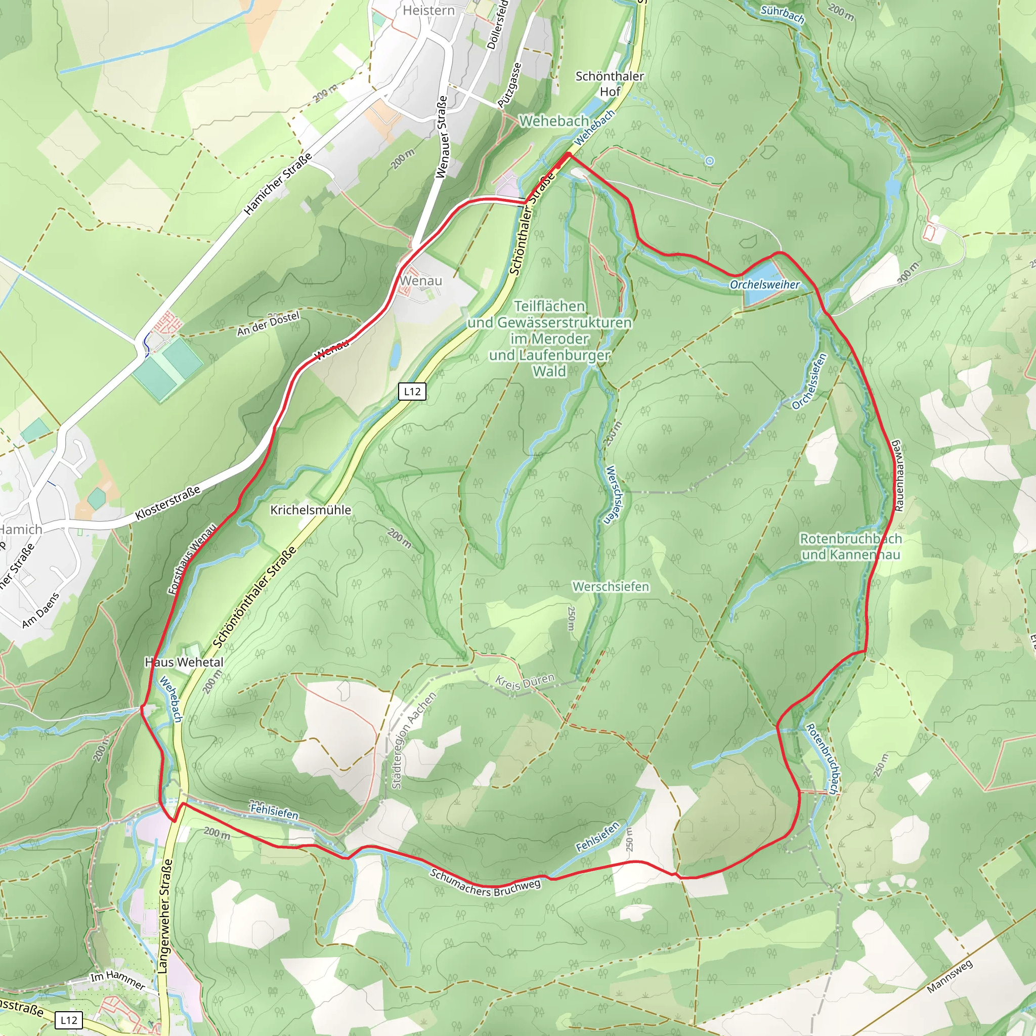
Starting near Kreis Düren, Germany, the Jakobs-Pilgerweg Koeln - Achen and Wald-Wasser-Wildnis-Weg Loop is an 8 km (approximately 5 miles) loop trail with an elevation gain of around 100 meters (328 feet). This trail offers a medium difficulty rating, making it suitable for moderately experienced hikers.### Getting There To reach the trailhead, you can drive or use public transport. If driving, set your GPS to Kreis Düren, Germany. For public transport, take a train to Düren Station and then a local bus towards the trailhead area. The nearest significant landmark is the Düren Town Hall, which is well-connected by local transit options.### Trail Overview The trail begins with a gentle ascent through a dense forest, offering a serene start to your hike. As you progress, the path meanders through a mix of deciduous and coniferous trees, providing ample shade and a cool environment even during warmer months. The first kilometer (0.6 miles) is relatively easy, with a gradual elevation gain of about 20 meters (65 feet).### Historical Significance This region is steeped in history, particularly related to the Jakobs-Pilgerweg, a part of the larger network of pilgrimage routes leading to Santiago de Compostela in Spain. Historically, this path has been trodden by countless pilgrims seeking spiritual fulfillment. Along the way, you may encounter historical markers and plaques that provide insights into the lives of these early travelers.### Key Landmarks and Nature Around the 2 km (1.2 miles) mark, you will come across a picturesque clearing with a small pond, a perfect spot for a short break. This area is rich in wildlife; keep an eye out for deer, foxes, and a variety of bird species. The trail then continues through a section known as the "Wald-Wasser-Wildnis" or "Forest-Water-Wilderness," characterized by its lush vegetation and small streams.### Midpoint and Elevation At approximately 4 km (2.5 miles), you will reach the highest point of the trail, with an elevation gain of about 50 meters (164 feet) from the start. Here, you can enjoy panoramic views of the surrounding forest and distant hills. This is an excellent spot for photography and taking in the natural beauty of the region.### Navigation and Safety The trail is well-marked, but it's always a good idea to have a reliable navigation tool. HiiKER is highly recommended for this purpose, as it provides detailed maps and real-time tracking to ensure you stay on course. Be mindful of the weather, as the trail can become slippery after rain, particularly in the forested sections.### Final Stretch The descent begins after the midpoint, leading you back through a different section of the forest. This part of the trail is slightly steeper, so take your time and watch your footing. As you approach the final kilometer (0.6 miles), the path levels out, guiding you back to the trailhead near Kreis Düren.This loop trail offers a perfect blend of natural beauty, historical significance, and moderate physical challenge, making it a rewarding experience for any hiker.
What to expect?
Activity types
Comments and Reviews
User comments, reviews and discussions about the Jakobs-Pilgerweg Koeln - Achen and Wald-Wasser-Wildnis-Weg Loop, Germany.
5.0
average rating out of 5
1 rating(s)

