Download
Preview
Add to list
More
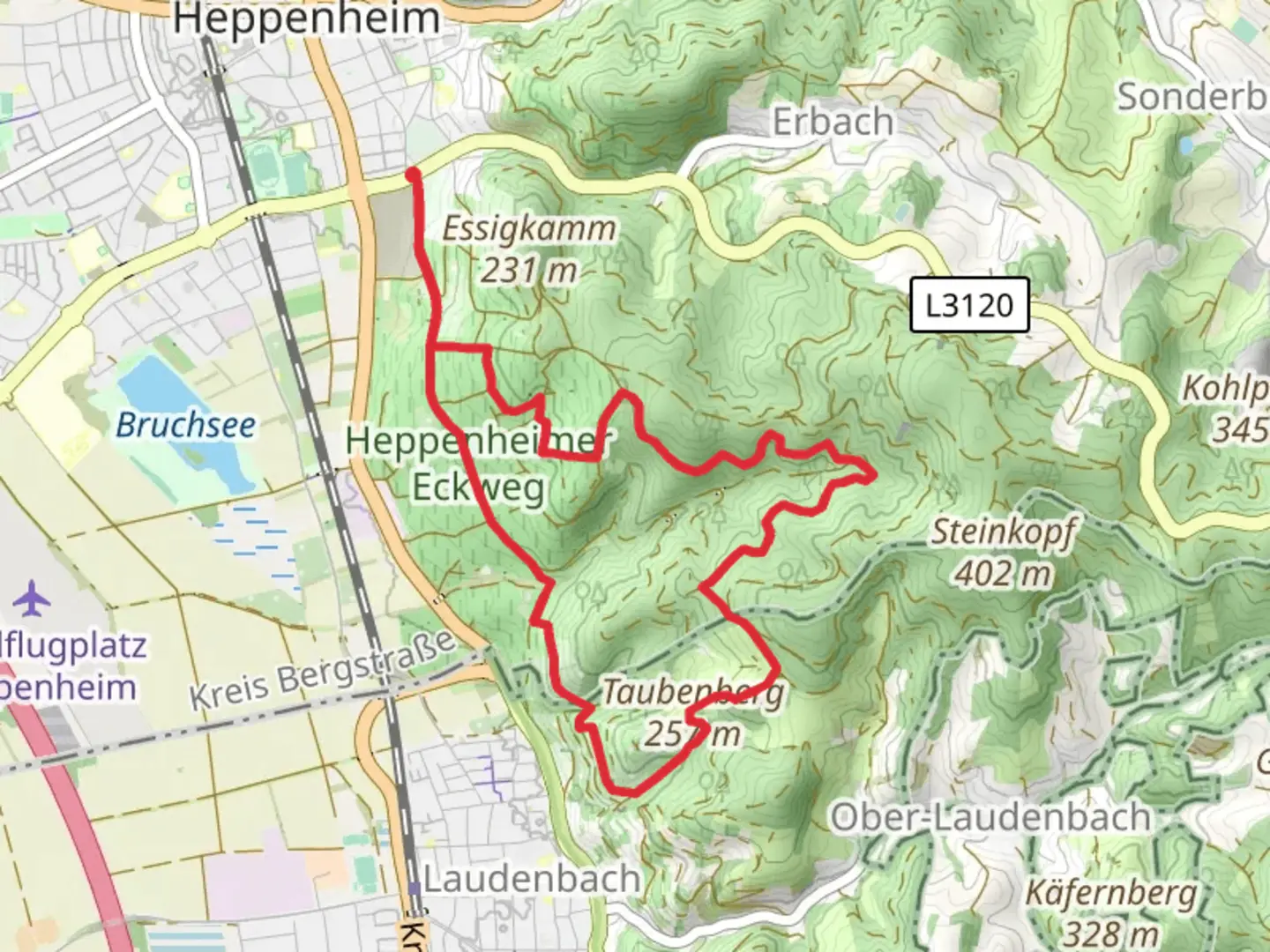
8.9 km
~2 hrs 27 min
408 m
Loop
“Experience breathtaking views and rich history on the challenging Taubenberg Loop's rewarding hike.”
Nestled in the picturesque region of Kreis Bergstraße, Germany, the Taubenberg Loop via Burgensteig Bergstrasse offers a challenging yet rewarding hiking experience. This 9 km (approximately 5.6 miles) loop trail boasts an elevation gain of around 400 meters (about 1,312 feet), making it a demanding trek suitable for experienced hikers.### Getting ThereTo reach the trailhead, you can drive to Kreis Bergstraße, where parking is available near the starting point. For those relying on public transport, the nearest major town is Bensheim. From Bensheim, you can take a local bus or taxi to the trailhead, ensuring a convenient start to your adventure.### Trail OverviewThe trail begins with a steady ascent through dense forests, where the air is filled with the scent of pine and the sounds of chirping birds. As you climb, the path becomes steeper, demanding careful footing on rocky terrain. The initial 2 km (1.2 miles) will test your endurance, but the effort is rewarded with stunning views of the surrounding landscape.### Historical SignificanceThe Burgensteig Bergstrasse is steeped in history, with the trail passing near several ancient castles and ruins. These remnants of the past offer a glimpse into the region's rich medieval history. Keep an eye out for the ruins of Starkenburg Castle, a significant landmark that dates back to the 11th century. This castle once served as a strategic fortification and now stands as a testament to the area's historical importance.### Nature and WildlifeAs you continue along the loop, the trail meanders through lush meadows and open fields, providing opportunities to spot local wildlife. Deer and foxes are common sightings, and birdwatchers will delight in the variety of species that inhabit the area. The diverse flora includes wildflowers that bloom in vibrant colors during the spring and summer months.### Navigation and SafetyNavigating the Taubenberg Loop requires a reliable map or navigation tool. HiiKER is recommended for its detailed maps and real-time tracking features, ensuring you stay on course. The trail is well-marked, but it's essential to remain vigilant, especially in areas where the path narrows or becomes overgrown.### Final StretchThe final section of the loop descends gradually, offering a more relaxed pace as you make your way back to the trailhead. This part of the hike provides panoramic views of the valley below, a perfect opportunity to pause and reflect on the journey. As you complete the loop, you'll return to the starting point, enriched by the natural beauty and historical depth of the Taubenberg Loop via Burgensteig Bergstrasse.

What to expect?
Activity types
Comments and Reviews
User comments, reviews and discussions about the Taubenberg Loop via Burgensteig Bergstrasse, Germany.
average rating out of 5
0 rating(s)