Download
Preview
Add to list
More
12.5 km
~3 hrs 27 min
578 m
Point-to-Point
“Embark on the Hirschhorn to Eberbach Walk for scenic forests, historic landmarks, and wildlife encounters.”
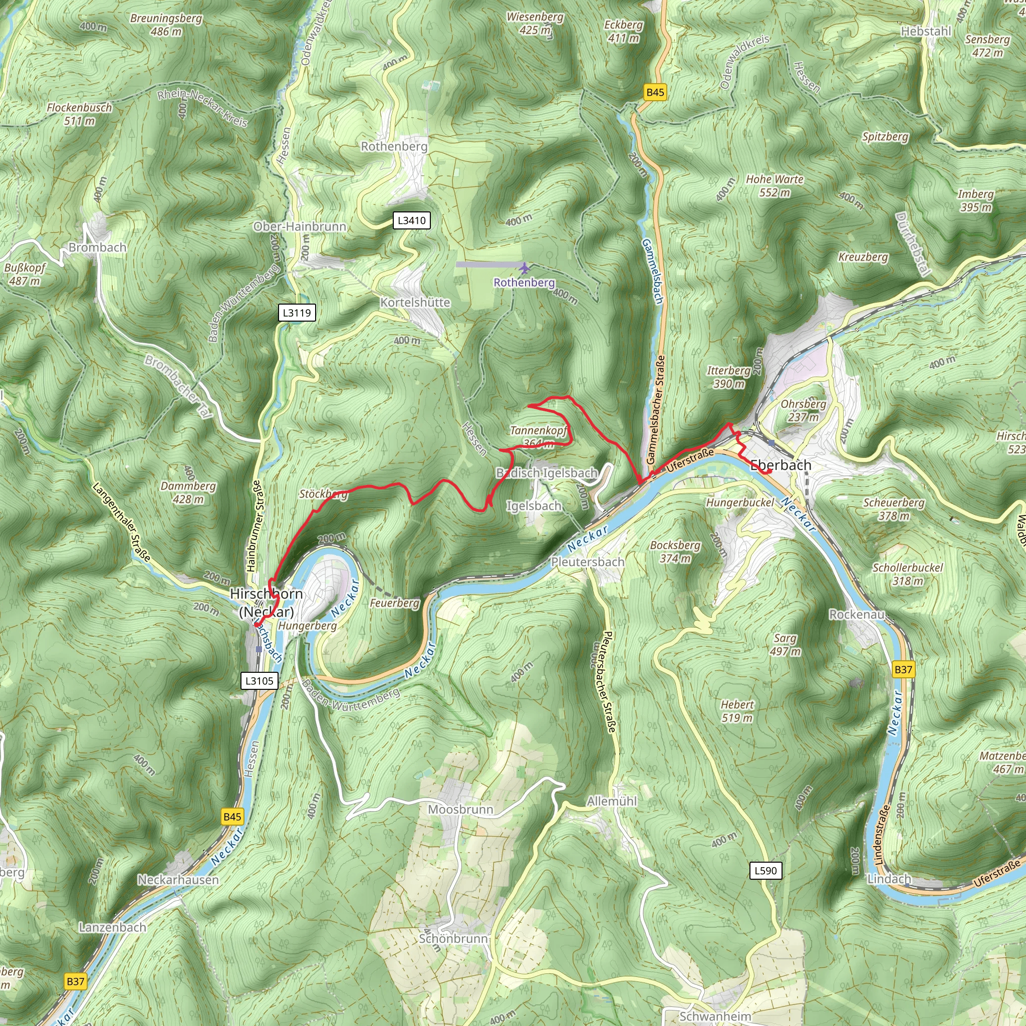
Starting near Kreis Bergstraße in Germany, the Hirschhorn to Eberbach Walk via Tannenkopf is a captivating point-to-point trail that spans approximately 12 kilometers (7.5 miles) with an elevation gain of around 500 meters (1,640 feet). This medium-difficulty hike offers a blend of natural beauty, historical landmarks, and opportunities for wildlife spotting.
Getting There To reach the trailhead, you can either drive or use public transport. If driving, set your GPS to Hirschhorn, a charming town located in the Odenwald region. For those opting for public transport, take a train to Hirschhorn (Neckar) station, which is well-connected to major cities like Heidelberg and Frankfurt. From the station, the trailhead is just a short walk away.
Trail Overview The trail begins in the picturesque town of Hirschhorn, known for its medieval castle and well-preserved old town. As you start your hike, you'll immediately notice the lush greenery and the serene ambiance of the Odenwald forest. The initial part of the trail is relatively gentle, allowing you to ease into the hike.
Key Landmarks and Elevation - **Hirschhorn Castle (Burg Hirschhorn)**: Approximately 1 kilometer (0.6 miles) into the hike, you'll pass by the Hirschhorn Castle. This 12th-century fortress offers panoramic views of the Neckar River and the surrounding valley. It's worth taking a short detour to explore the castle grounds. - **Tannenkopf**: As you continue, the trail gradually ascends towards Tannenkopf, the highest point of the hike. This section covers about 5 kilometers (3.1 miles) and involves an elevation gain of around 300 meters (984 feet). The climb is steady but manageable, with well-marked paths and occasional benches for rest. - **Forest and Wildlife**: The dense forest around Tannenkopf is home to a variety of wildlife, including deer, foxes, and numerous bird species. Keep your eyes peeled and your camera ready for potential sightings.
Midpoint and Descent After reaching Tannenkopf, the trail begins to descend towards Eberbach. The descent is gradual, covering the remaining 6 kilometers (3.7 miles) with an elevation loss of about 200 meters (656 feet). This section of the trail offers stunning views of the Neckar Valley and the town of Eberbach in the distance.
Historical Significance The region is steeped in history, with Eberbach itself being a former imperial city with roots dating back to the 13th century. As you approach Eberbach, you'll pass by several historical landmarks, including old mills and remnants of ancient fortifications.
Navigation and Safety For navigation, it's highly recommended to use the HiiKER app, which provides detailed maps and real-time updates. The trail is well-marked, but having a reliable navigation tool ensures you stay on track.
Arrival in Eberbach The trail concludes in the town of Eberbach, where you can explore the historic old town, visit the Eberbach Abbey, or relax by the Neckar River. Eberbach is well-connected by train, making it easy to return to your starting point or continue your journey.
This hike offers a perfect blend of natural beauty, historical intrigue, and moderate physical challenge, making it an excellent choice for hikers looking to explore the Odenwald region.
What to expect?
Activity types
Comments and Reviews
User comments, reviews and discussions about the Hirschhorn to Eberbach Walk via Tannenkopf, Germany.
4.5
average rating out of 5
2 rating(s)

