Download
Preview
Add to list
More
15.0 km
~3 hrs 33 min
338 m
Loop
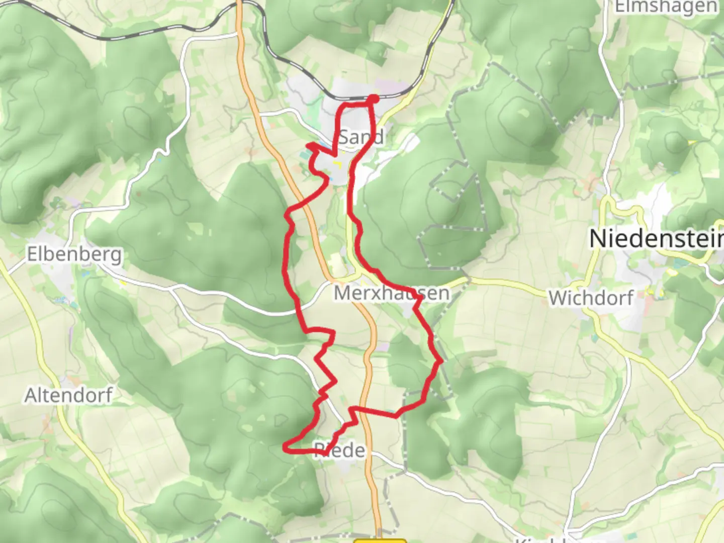
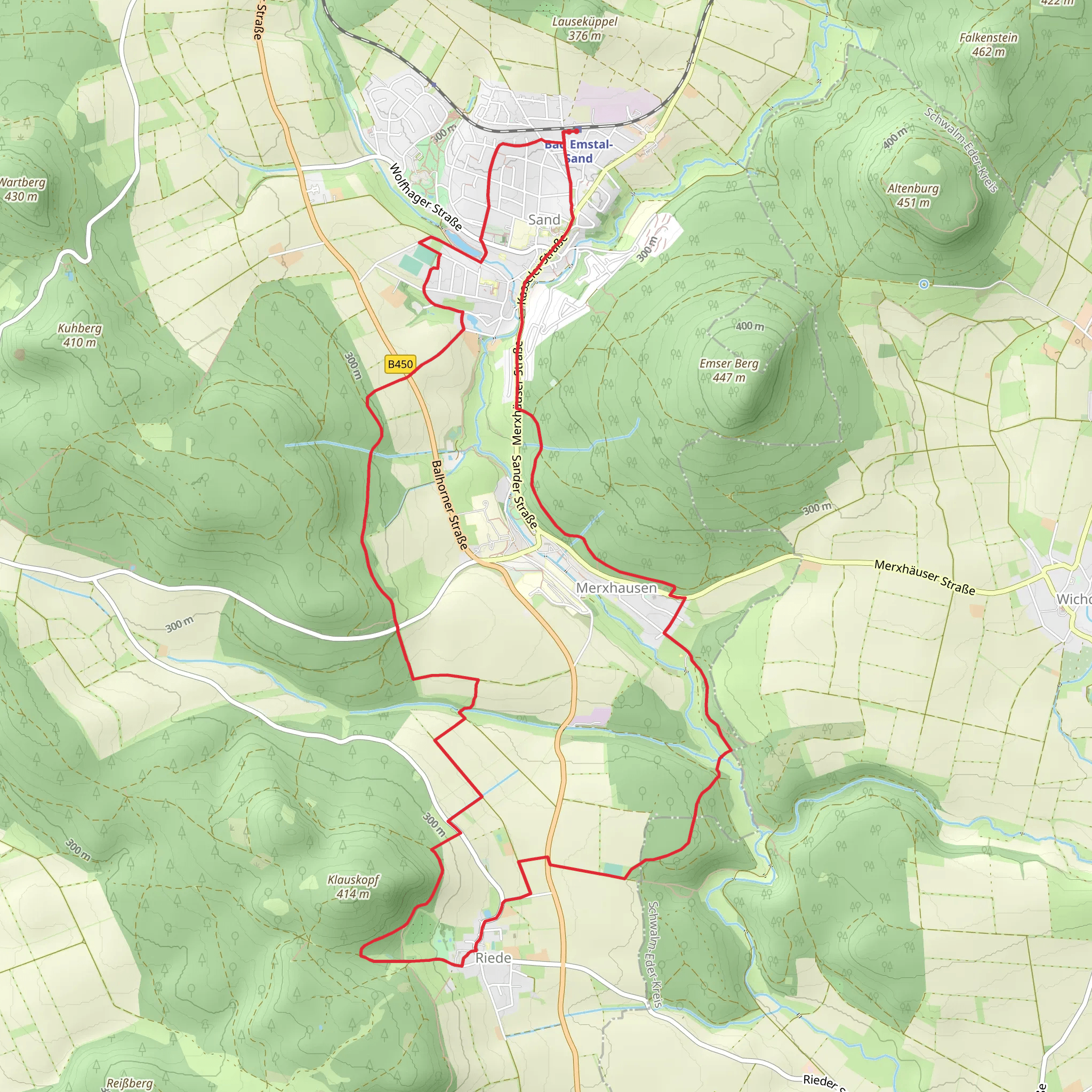
“Explore a lush, historic 15 km loop near Bad Emstal, featuring spa gardens, castle ruins, and diverse wildlife.”
Starting near Kassel, Germany, this 15 km (approximately 9.3 miles) loop trail offers a moderate challenge with an elevation gain of around 300 meters (984 feet). The trailhead is conveniently accessible by both public transport and car. If you're driving, you can park near the town center of Bad Emstal. For those using public transport, take a train to Kassel-Wilhelmshöhe station and then a bus to Bad Emstal.
Trail Overview
The trail begins in the charming town of Bad Emstal, known for its therapeutic spas and scenic beauty. As you set off, you'll quickly find yourself immersed in lush forests and rolling hills. The initial part of the trail is relatively flat, making it a good warm-up for the more challenging sections ahead.
Key Landmarks and Points of Interest
#### Bad Emstal Spa Gardens Approximately 2 km (1.2 miles) into the hike, you'll come across the Bad Emstal Spa Gardens. This area is perfect for a short break, offering beautifully manicured gardens and a serene atmosphere. The spa gardens are a historical landmark, dating back to the early 20th century when the town became a popular health resort.
#### Falkenstein Castle Ruins Around the 5 km (3.1 miles) mark, you'll encounter the ruins of Falkenstein Castle. This medieval fortress, perched on a hill, offers panoramic views of the surrounding countryside. The castle dates back to the 12th century and played a significant role in the region's history. It's a great spot for a picnic and some exploration.
Flora and Fauna
The trail is rich in biodiversity. As you hike through the dense forests, keep an eye out for native wildlife such as deer, foxes, and various bird species. The flora is equally impressive, with a mix of deciduous and coniferous trees, wildflowers, and ferns. Spring and autumn are particularly beautiful times to hike this trail, as the changing seasons bring vibrant colors to the landscape.
Elevation and Terrain
The trail's elevation gain of 300 meters (984 feet) is spread out over several sections, making it manageable for most hikers. The steepest part of the trail occurs between the 7 km (4.3 miles) and 10 km (6.2 miles) marks, where you'll ascend through a series of switchbacks. This section can be challenging, but the views from the top are well worth the effort.
Navigation
To ensure you stay on track, it's advisable to use the HiiKER app, which provides detailed maps and real-time navigation. The trail is well-marked, but having a reliable navigation tool can enhance your hiking experience and provide peace of mind.
Historical Significance
The region around Bad Emstal has a rich history, with evidence of human settlement dating back to the Bronze Age. The trail itself passes through areas that were once important trade routes in medieval times. The Falkenstein Castle ruins are a testament to the area's strategic importance during the Middle Ages.
Getting There
If you're driving, set your GPS to Bad Emstal town center, where you'll find ample parking options. For public transport users, take a train to Kassel-Wilhelmshöhe station and then catch a bus to Bad Emstal. The bus ride offers scenic views of the German countryside and takes about 30 minutes.
This trail offers a perfect blend of natural beauty, historical landmarks, and moderate physical challenge, making it an ideal choice for a day hike.
Comments and Reviews
User comments, reviews and discussions about the Bad Emstal and Alternative, Germany.
average rating out of 5
0 rating(s)
