Schuessel, Teufelstisch and Arnsteinfels via Fraenkischer Gebirgsweg Teil and Zell Grosser Waldstein
Download
Preview
Add to list
More
7.2 km
~1 hrs 50 min
233 m
Loop
“This 7 km loop near Hof, Germany, blends natural beauty, historical intrigue, and moderate hiking challenges.”
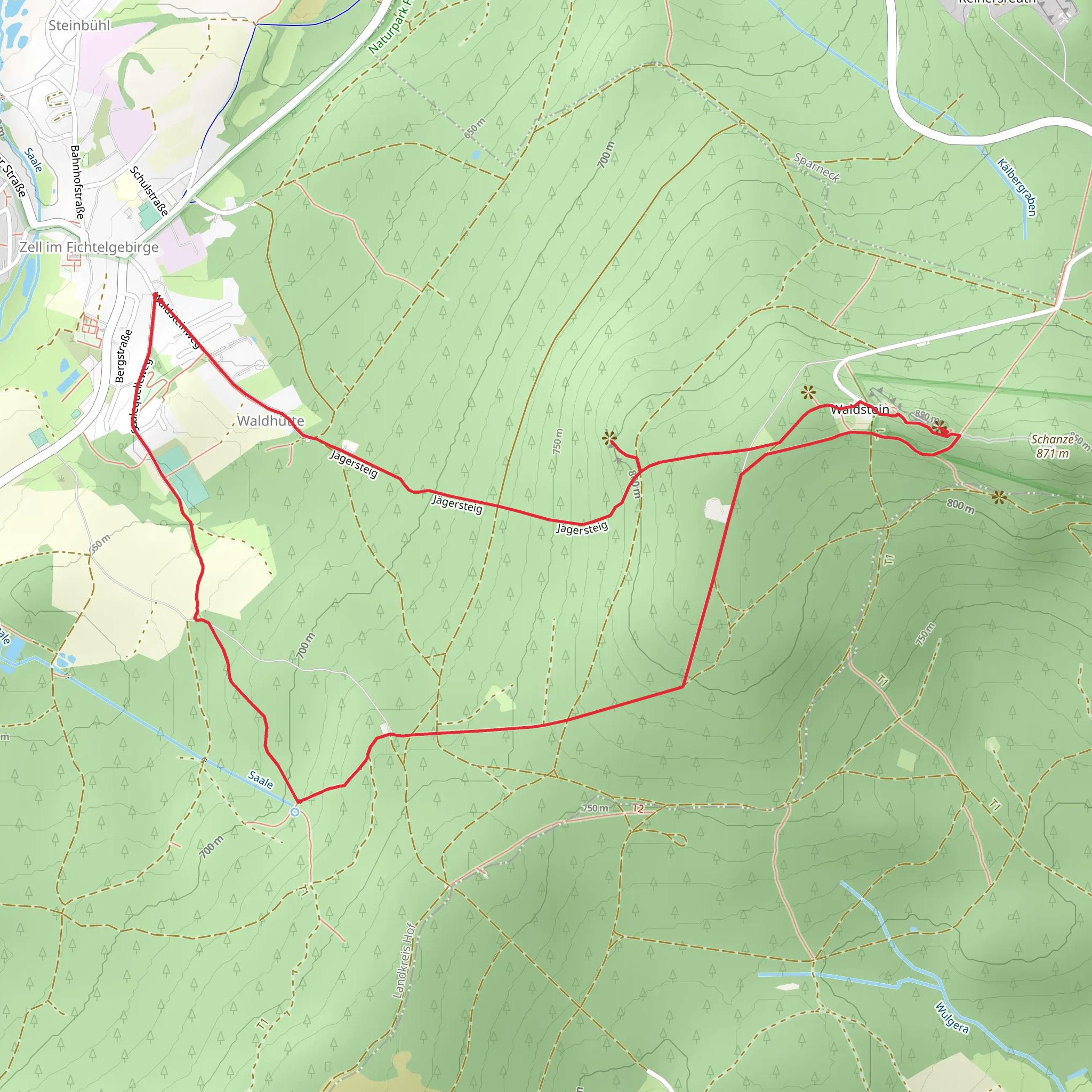
Starting near the charming town of Hof in Germany, this 7 km (4.35 miles) loop trail offers a delightful mix of natural beauty, historical landmarks, and moderate physical challenge. With an elevation gain of around 200 meters (656 feet), the trail is rated as medium difficulty, making it suitable for hikers with some experience.
Getting There To reach the trailhead, you can either drive or use public transport. If driving, set your GPS to Zell Grosser Waldstein, a well-known landmark near Hof. For those using public transport, take a train to Hof Hauptbahnhof and then a local bus to Zell Grosser Waldstein. The trailhead is conveniently located near this area.
Trail Highlights
#### Schuessel The first significant landmark you'll encounter is Schuessel, a natural rock formation that resembles a bowl. This unique geological feature is a great spot for a short break and some photos. The area around Schuessel is rich in flora, with various types of moss and ferns adding to the enchanting atmosphere.
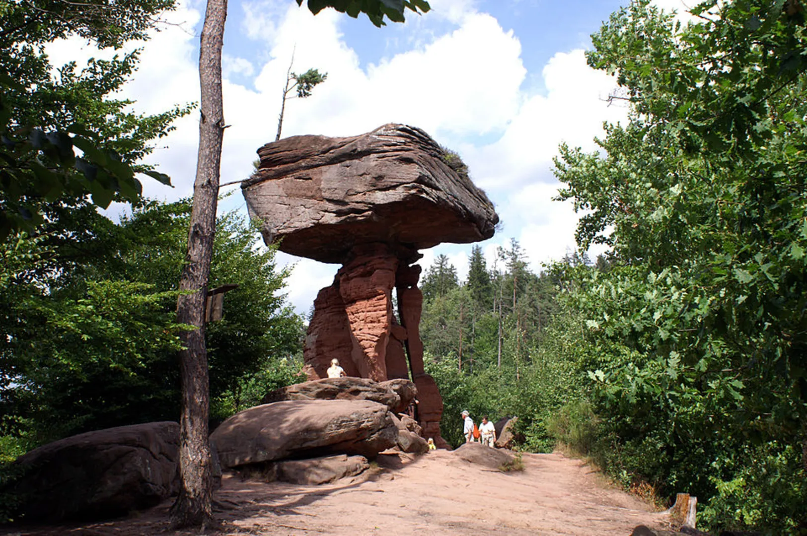
#### Teufelstisch Continuing along the trail, you'll come across Teufelstisch, or "Devil's Table." This striking rock formation has a flat top and stands out against the surrounding forest. According to local folklore, the Devil himself used this rock as a table, adding a layer of mystique to your hike. The area is also home to various bird species, so keep an eye out for woodpeckers and songbirds.
#### Arnsteinfels Next, you'll reach Arnsteinfels, a viewpoint offering panoramic views of the Franconian landscape. This is one of the highest points on the trail, and the climb to get here will reward you with breathtaking vistas. The elevation gain to this point is approximately 100 meters (328 feet) from the trailhead. The viewpoint is an excellent place to rest and take in the scenery before heading back down.
Historical Significance The region around Hof has a rich history, dating back to medieval times. The trail itself is part of the Fraenkischer Gebirgsweg, a historic route that has been used for centuries. Along the way, you may notice remnants of old stone walls and pathways, hinting at the area's past.
Navigation and Safety For navigation, it's highly recommended to use the HiiKER app, which provides detailed maps and real-time updates. The trail is well-marked, but having a reliable navigation tool will ensure you stay on track.
Flora and Fauna The trail passes through diverse ecosystems, including dense forests and open meadows. In spring and summer, the meadows are filled with wildflowers, attracting butterflies and bees. The forested sections are home to deer, foxes, and various bird species.
Final Stretch As you loop back towards the trailhead, the path becomes less steep, allowing for a more relaxed descent. The final stretch takes you through a serene forest, where the sounds of rustling leaves and chirping birds provide a peaceful end to your hike.
This 7 km loop offers a perfect blend of natural beauty, historical intrigue, and moderate physical challenge, making it a rewarding experience for any hiker.
What to expect?
Activity types
Comments and Reviews
User comments, reviews and discussions about the Schuessel, Teufelstisch and Arnsteinfels via Fraenkischer Gebirgsweg Teil and Zell Grosser Waldstein, Germany.
4.67
average rating out of 5
3 rating(s)
