Download
Preview
Add to list
More
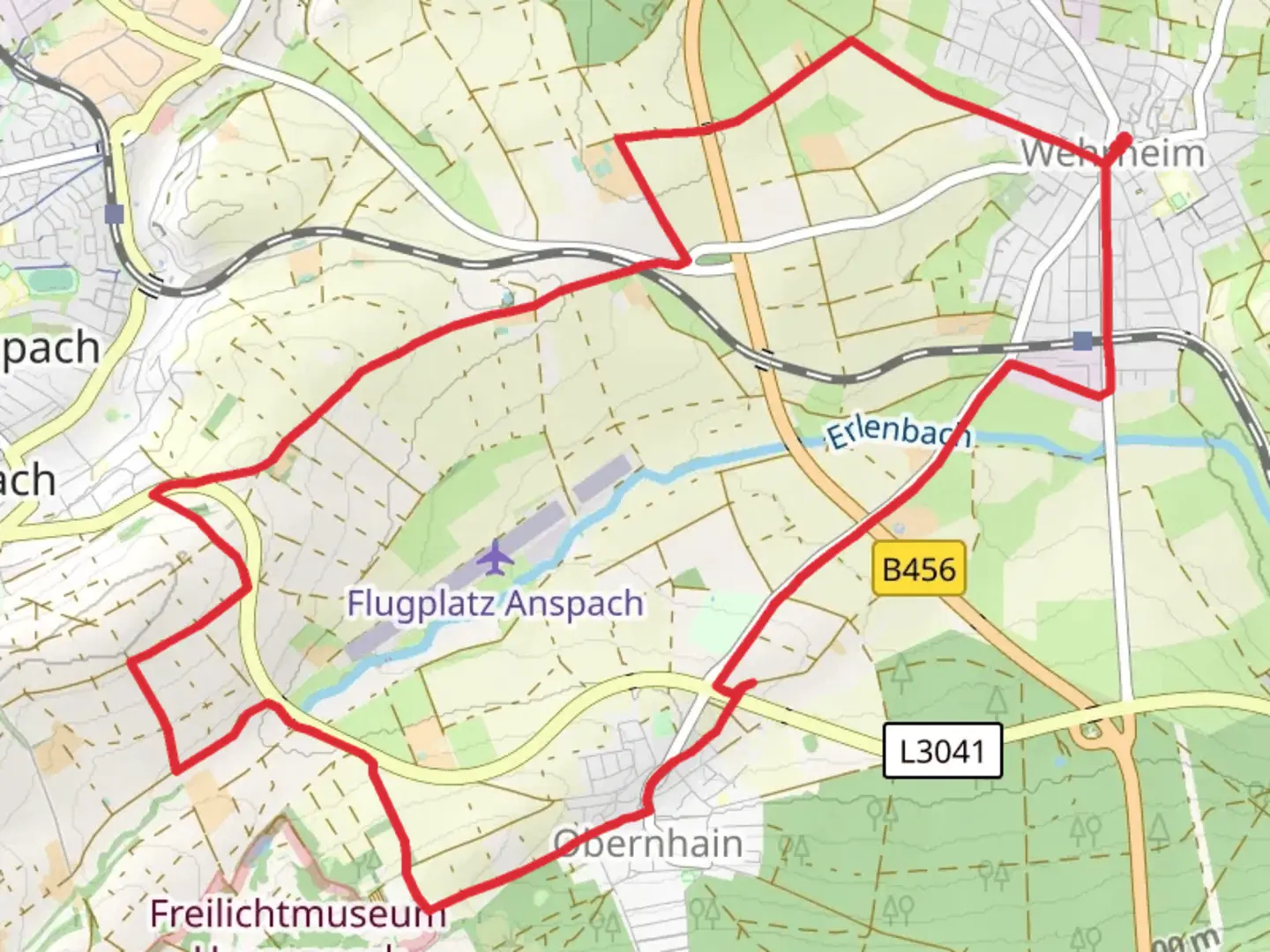
13.1 km
~2 hrs 52 min
152 m
Loop
“Explore scenic forests and historical landmarks on this enchanting Taunus trail for medium-level hikers.”
Nestled in the scenic landscapes of Hochtaunuskreis, Germany, the Taunusklub Route and Ziegeleiweg offers a delightful loop trail that spans approximately 13 kilometers (about 8 miles) with an elevation gain of around 100 meters (328 feet). This trail is a perfect blend of natural beauty and historical intrigue, making it a rewarding experience for hikers of medium skill level.### Getting ThereTo reach the trailhead, you can drive to Hochtaunuskreis, where ample parking is available near the starting point. For those preferring public transport, the area is well-served by regional trains and buses. The nearest major station is Bad Homburg, from where local buses can take you closer to the trailhead.### Trail HighlightsAs you embark on this loop, you'll traverse through the lush forests and rolling hills characteristic of the Taunus region. The trail is well-marked, but it's advisable to use the HiiKER app for precise navigation and to ensure you stay on track.#### Nature and WildlifeThe trail meanders through dense woodlands, offering a serene escape into nature. Keep an eye out for the diverse flora, including oak and beech trees, which provide a vibrant canopy overhead. Wildlife enthusiasts might spot deer, foxes, and a variety of bird species that call this region home. The gentle elevation gain allows for a leisurely pace, giving you ample opportunity to appreciate the natural surroundings.#### Historical SignificanceThe Taunus region is steeped in history, and this trail offers glimpses into its past. One of the notable landmarks along the route is the remnants of ancient Roman structures, a testament to the area's historical significance as a frontier of the Roman Empire. The trail also passes by traditional German villages, where you can observe half-timbered houses and other architectural features that have stood the test of time.### Trail ExperienceThe loop is designed to provide a balanced hiking experience, with sections of gentle ascents and descents. The terrain is varied, ranging from forest paths to open fields, offering a dynamic landscape that keeps the hike engaging. The trail is accessible year-round, but it's particularly enchanting in the spring and autumn when the foliage is at its most vibrant.### Practical TipsEnsure you wear sturdy hiking boots, as some sections can be uneven or muddy, especially after rain. Carry sufficient water and snacks, as there are limited facilities along the trail. While the trail is generally well-maintained, it's always wise to check weather conditions before setting out and to inform someone of your plans if hiking alone.The Taunusklub Route and Ziegeleiweg is a captivating journey through nature and history, offering a peaceful retreat into the heart of Germany's picturesque landscapes.

Comments and Reviews
User comments, reviews and discussions about the Taunusklub Route and Ziegeleiweg, Germany.
5.0
average rating out of 5
1 rating(s)