Download
Preview
Add to list
More
6.6 km
~1 hrs 48 min
291 m
Loop
“The Schmelzhuettenweg offers a 7 km loop of natural beauty and historical intrigue in Hochsauerlandkreis.”
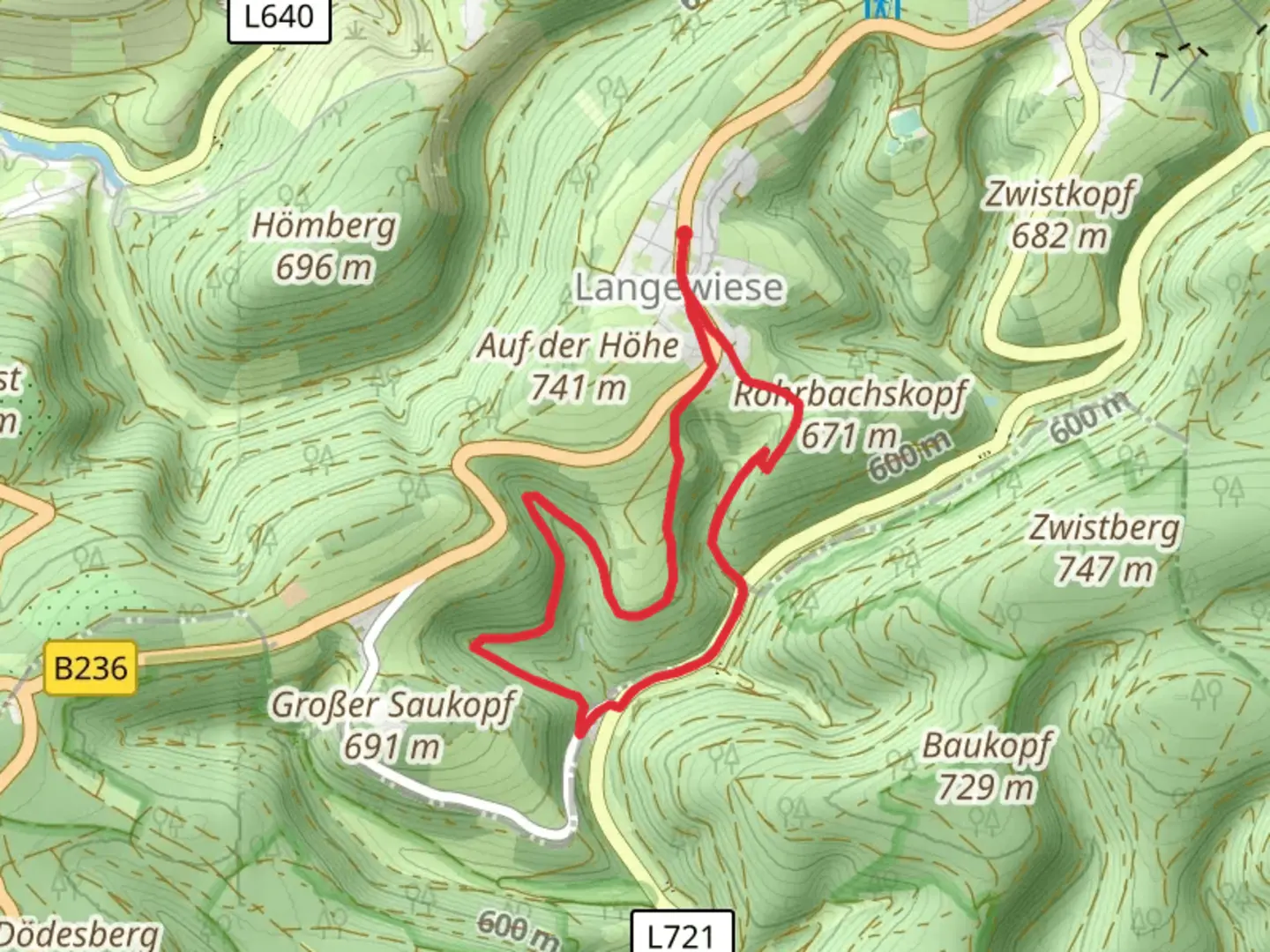
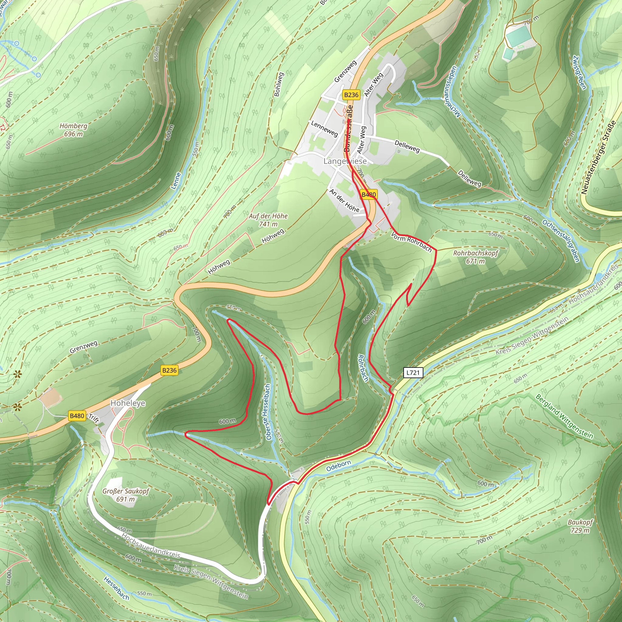
Starting near Hochsauerlandkreis, Germany, the Schmelzhuettenweg is a captivating loop trail that spans approximately 7 km (4.35 miles) with an elevation gain of around 200 meters (656 feet). This medium-difficulty trail offers a blend of natural beauty, historical significance, and a moderate challenge suitable for most hikers.
Getting There To reach the trailhead, you can drive or use public transport. If driving, set your GPS to Hochsauerlandkreis, Germany, and look for parking near the trailhead. For those using public transport, the nearest significant landmark is the town of Winterberg. From Winterberg, you can take a local bus or taxi to the trailhead.
Trail Navigation For navigation, it's highly recommended to use the HiiKER app, which provides detailed maps and real-time updates to ensure you stay on the right path.
Trail Highlights
#### Nature and Wildlife The Schmelzhuettenweg takes you through a diverse landscape, including dense forests, open meadows, and serene streams. The trail is particularly beautiful in spring and autumn when the foliage is vibrant. Keep an eye out for local wildlife such as deer, foxes, and a variety of bird species. The trail is also home to numerous wildflowers, making it a delight for nature enthusiasts.
#### Historical Significance One of the most intriguing aspects of this trail is its historical significance. The name "Schmelzhuettenweg" translates to "Smelting Hut Way," hinting at the area's past in metalworking. Along the trail, you'll find remnants of old smelting huts and informational plaques detailing the region's industrial history. These historical markers provide a fascinating glimpse into the lives of the people who once worked in these now-quiet woods.
Key Landmarks
#### The Old Smelting Huts Approximately 3 km (1.86 miles) into the hike, you'll come across the remains of the old smelting huts. These structures are a testament to the area's rich industrial past. Take a moment to read the informational plaques and imagine the bustling activity that once took place here.
#### Scenic Overlook Around the 5 km (3.1 miles) mark, the trail ascends to a scenic overlook offering panoramic views of the surrounding landscape. This is an excellent spot for a break and some photography. The elevation gain to this point is about 150 meters (492 feet), making it a moderate climb but well worth the effort.
Trail Conditions and Safety The trail is well-marked and maintained, but it's always wise to be prepared for varying conditions. Wear sturdy hiking boots, especially after rain, as some sections can become muddy and slippery. Carry enough water and snacks, and consider bringing a small first-aid kit.
Final Stretch The last 2 km (1.24 miles) of the trail loop back towards the starting point, descending gently through a mixed forest. This section is relatively easy, allowing you to cool down and reflect on the hike.
Accessibility The trail is accessible year-round, but the best times to hike are late spring through early autumn. Winter hikes are possible but require additional gear and preparation due to snow and ice.
By following these guidelines and using the HiiKER app for navigation, you'll be well-prepared to enjoy the Schmelzhuettenweg trail.
Comments and Reviews
User comments, reviews and discussions about the Schmelzhuettenweg, Germany.
average rating out of 5
0 rating(s)
