Download
Preview
Add to list
More
11.8 km
~3 hrs 12 min
505 m
Loop
“Embark on a stunning 12 km journey through Germany's Sauerland, rich in history and natural beauty.”
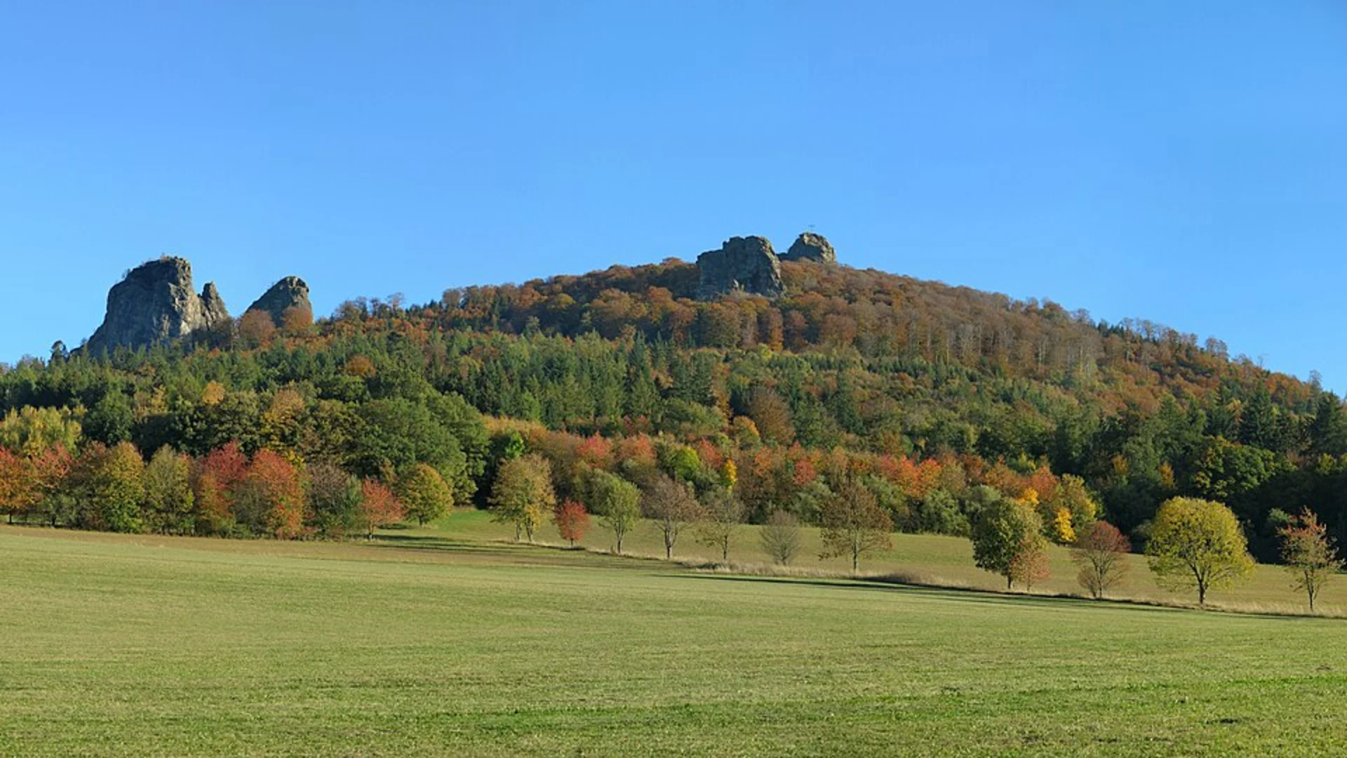
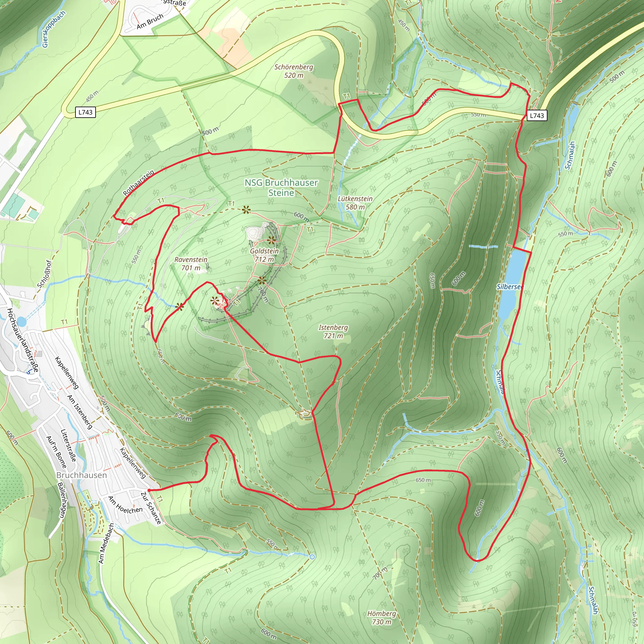
Starting your hike near Hochsauerlandkreis, Germany, the Istenberg, Bruchhauser Steine, and Silbersee Loop offers a captivating journey through a region rich in natural beauty and historical significance. This 12 km (7.5 miles) loop trail with an elevation gain of approximately 500 meters (1,640 feet) is rated as medium difficulty, making it suitable for moderately experienced hikers.### Getting There To reach the trailhead, you can either drive or use public transport. If driving, set your GPS to Bruchhausen, a small village in the Hochsauerlandkreis district. There is ample parking available near the trailhead. For those using public transport, take a train to Olsberg station, which is the nearest major station. From Olsberg, you can catch a local bus to Bruchhausen. The bus stop is conveniently located near the start of the trail.### Trail Highlights#### Istenberg The trail begins with a gradual ascent towards Istenberg. As you climb, you'll be treated to panoramic views of the surrounding Sauerland region. The initial 3 km (1.9 miles) of the trail will take you through dense forests, where you might spot local wildlife such as deer and various bird species. The elevation gain here is about 200 meters (656 feet), so pace yourself and enjoy the serene environment.#### Bruchhauser Steine At around the 4 km (2.5 miles) mark, you'll reach the Bruchhauser Steine, a group of four prominent rock formations that are over 380 million years old. These rocks are not only geological marvels but also hold historical significance. They were considered sacred by ancient Germanic tribes and have been a site of archaeological interest. Take some time to explore the area and perhaps climb one of the rocks for a better view. The elevation gain here is minimal, making it a perfect spot for a short break.#### Silbersee Continuing on, the trail descends slightly towards Silbersee, a picturesque lake located about 7 km (4.3 miles) into the hike. The lake is surrounded by lush greenery and offers a tranquil setting for a picnic or a quick rest. The descent is gentle, with an elevation loss of around 100 meters (328 feet). Keep an eye out for waterfowl and other aquatic life that inhabit the lake.### Flora and Fauna The trail is a haven for nature enthusiasts. The forests are predominantly composed of beech and oak trees, providing ample shade during the summer months. In spring and early summer, the forest floor is carpeted with wildflowers, adding a splash of color to your hike. Wildlife is abundant, and you may encounter foxes, badgers, and a variety of bird species, including woodpeckers and owls.### Navigation and Safety Given the moderate difficulty of the trail, it's advisable to use a reliable navigation tool like HiiKER to keep track of your progress and ensure you stay on the right path. The trail is well-marked, but having a digital map can be reassuring, especially in the denser forest sections.### Final Stretch The last 3 km (1.9 miles) of the loop will take you back towards Bruchhausen. This section is relatively flat, allowing you to cool down and reflect on the diverse landscapes you've traversed. The total elevation gain for this part is minimal, making it a relaxing end to your hike.This trail offers a perfect blend of natural beauty, historical intrigue, and moderate physical challenge, making it a rewarding experience for any hiker.
What to expect?
Activity types
Comments and Reviews
User comments, reviews and discussions about the Istenberg, Bruchhauser Steine and Silbersee Loop, Germany.
4.75
average rating out of 5
4 rating(s)

