Download
Preview
Add to list
More
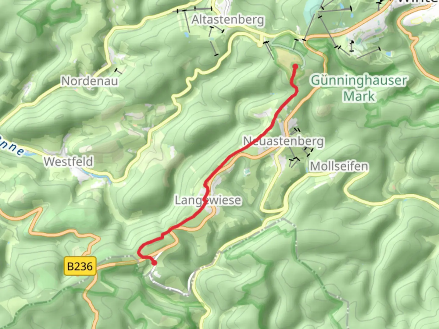
6.5 km
~1 hrs 42 min
237 m
Point-to-Point
“Experience the enchanting Rothaar Mountains' challenging trail with breathtaking views and rich historical intrigue.”
Nestled in the picturesque region of Hochsauerlandkreis, Germany, this trail offers a challenging yet rewarding journey through the heart of the Rothaar Mountains. Spanning approximately 7 kilometers (about 4.3 miles) with an elevation gain of around 200 meters (approximately 656 feet), this point-to-point trail is estimated to be difficult, making it suitable for experienced hikers seeking an invigorating adventure.
Getting There
To reach the trailhead near Hoheleye, travelers can opt for public transport or drive. If using public transport, the nearest major town is Winterberg, which is well-connected by train. From Winterberg, local buses can take you closer to Hoheleye. For those driving, the trailhead is accessible via the B480 road, with parking available nearby.
Trail Highlights
Rothaarsteig Pathway
The trail is part of the renowned Rothaarsteig, often referred to as the "Path of the Senses." This section of the Rothaarsteig is known for its dense forests, rolling hills, and panoramic views. As you embark on this journey, you'll be enveloped by the serene beauty of the Sauerland region, with its lush greenery and diverse flora.
Kahler Asten
One of the most significant landmarks along this trail is the Kahler Asten, one of the highest peaks in North Rhine-Westphalia. Standing at 841 meters (2,759 feet), it offers breathtaking views of the surrounding landscape. The summit is home to a weather station and a tower, both of which are accessible to visitors. The area is also rich in biodiversity, with a variety of bird species and unique alpine plants.
Historical Significance
The Rothaar Mountains have a rich history, with evidence of human settlement dating back to prehistoric times. The region was historically significant for its iron ore mining, which played a crucial role in the local economy. As you hike, you may come across remnants of old mining operations, offering a glimpse into the area's industrial past.
Navigation and Safety
Given the trail's difficulty, it's essential to be well-prepared. The path is well-marked, but using a reliable navigation tool like HiiKER is recommended to ensure you stay on course. Weather conditions can change rapidly, especially at higher elevations, so check forecasts and dress appropriately. Carry sufficient water, snacks, and a first-aid kit, and be mindful of the trail's elevation changes, which can be strenuous.
Flora and Fauna
The trail traverses through diverse ecosystems, from dense coniferous forests to open meadows. Keep an eye out for wildlife such as deer, foxes, and a variety of bird species. The flora is equally captivating, with vibrant wildflowers in the spring and summer months, and a stunning display of autumn foliage later in the year.
This trail offers a perfect blend of natural beauty, historical intrigue, and physical challenge, making it a must-experience for avid hikers.

Comments and Reviews
User comments, reviews and discussions about the Hoheleye to Kahler Asten via Rothaarsteig, Germany.
4.67
average rating out of 5
3 rating(s)