Download
Preview
Add to list
More
13.5 km
~3 hrs 15 min
333 m
Loop
“Experience a captivating 14 km loop in Hochsauerlandkreis, Germany, blending natural beauty, moderate challenge, and history.”
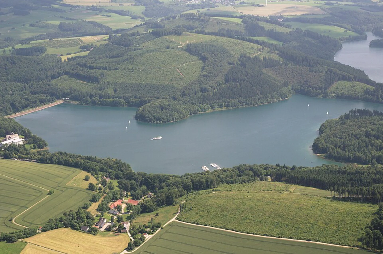
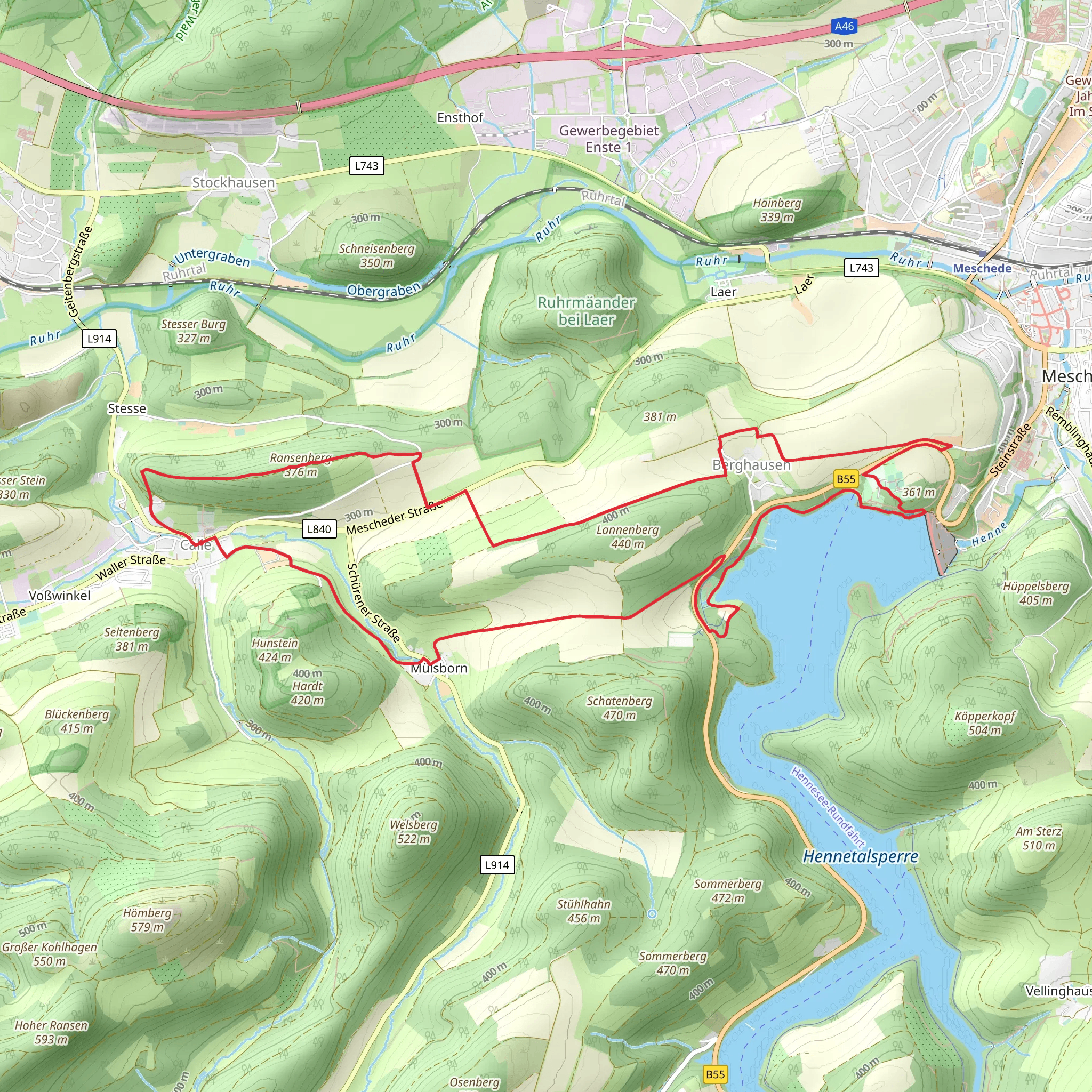
Starting your adventure near Hochsauerlandkreis, Germany, the Hennetalsperre, Langenberg, and Ransenberg Loop is a captivating 14 km (approximately 8.7 miles) trail with an elevation gain of around 300 meters (about 984 feet). This loop trail is rated medium in difficulty, making it suitable for moderately experienced hikers.### Getting There To reach the trailhead, you can drive or use public transport. If driving, set your GPS to Hochsauerlandkreis, Germany. For those using public transport, take a train to Meschede station, which is the nearest major station. From there, local buses or a short taxi ride will get you to the trailhead.### Trail Overview The trail begins near the Hennetalsperre, a picturesque reservoir that serves as a perfect starting point. As you set off, you'll be greeted by serene water views and lush greenery. The first few kilometers are relatively flat, allowing you to ease into the hike.### Hennetalsperre Reservoir Approximately 2 km (1.2 miles) into the hike, you'll encounter the Hennetalsperre Reservoir. This man-made lake is not only a beautiful sight but also historically significant, having been constructed in the early 20th century to manage water supply and flood control in the region. Take a moment to enjoy the panoramic views and perhaps snap a few photos.### Ascending Langenberg As you continue, the trail begins to ascend towards Langenberg, the highest peak in North Rhine-Westphalia. The climb is gradual but steady, with an elevation gain of about 150 meters (492 feet) over the next 4 km (2.5 miles). The path is well-marked, but it's advisable to use HiiKER for navigation to ensure you stay on track.### Flora and Fauna The trail meanders through dense forests, home to a variety of wildlife including deer, foxes, and numerous bird species. Keep an eye out for the European beech and oak trees that dominate the landscape. During spring and summer, the forest floor is carpeted with wildflowers, adding a splash of color to your hike.### Reaching Ransenberg Around the 8 km (5 miles) mark, you'll start your ascent to Ransenberg. This section is a bit steeper, with an elevation gain of about 100 meters (328 feet) over 2 km (1.2 miles). The effort is well worth it, as the summit offers breathtaking views of the surrounding valleys and hills.### Historical Significance The region around Ransenberg has a rich history, with remnants of ancient settlements and medieval trade routes. As you hike, you'll come across old stone markers and possibly even ruins that hint at the area's past. These landmarks offer a fascinating glimpse into the lives of those who once traversed these paths.### Descending Back The final leg of the loop takes you downhill, easing back into the forested areas. The descent is gentle, allowing you to enjoy the tranquil surroundings as you make your way back to the starting point. This section is about 4 km (2.5 miles) and brings you full circle to the Hennetalsperre Reservoir.### Practical Tips - Navigation: Use HiiKER for real-time navigation and trail updates. - Weather: Check the weather forecast before you set out, as conditions can change rapidly in this region. - Gear: Wear sturdy hiking boots and bring a rain jacket, especially if hiking in spring or autumn. - Water and Snacks: Carry enough water and snacks to keep your energy levels up, as there are limited facilities along the trail.This loop trail offers a perfect blend of natural beauty, moderate challenge, and historical intrigue, making it a rewarding experience for any hiker.
What to expect?
Activity types
Comments and Reviews
User comments, reviews and discussions about the Hennetalsperre, Langenberg and Ransenberg Loop, Germany.
4.5
average rating out of 5
2 rating(s)

