Download
Preview
Add to list
More
11.6 km
~2 hrs 58 min
395 m
Loop
“Explore the diverse beauty and history of the 12-km Calle Rundweg Hoemberg trail in Hochsauerlandkreis.”
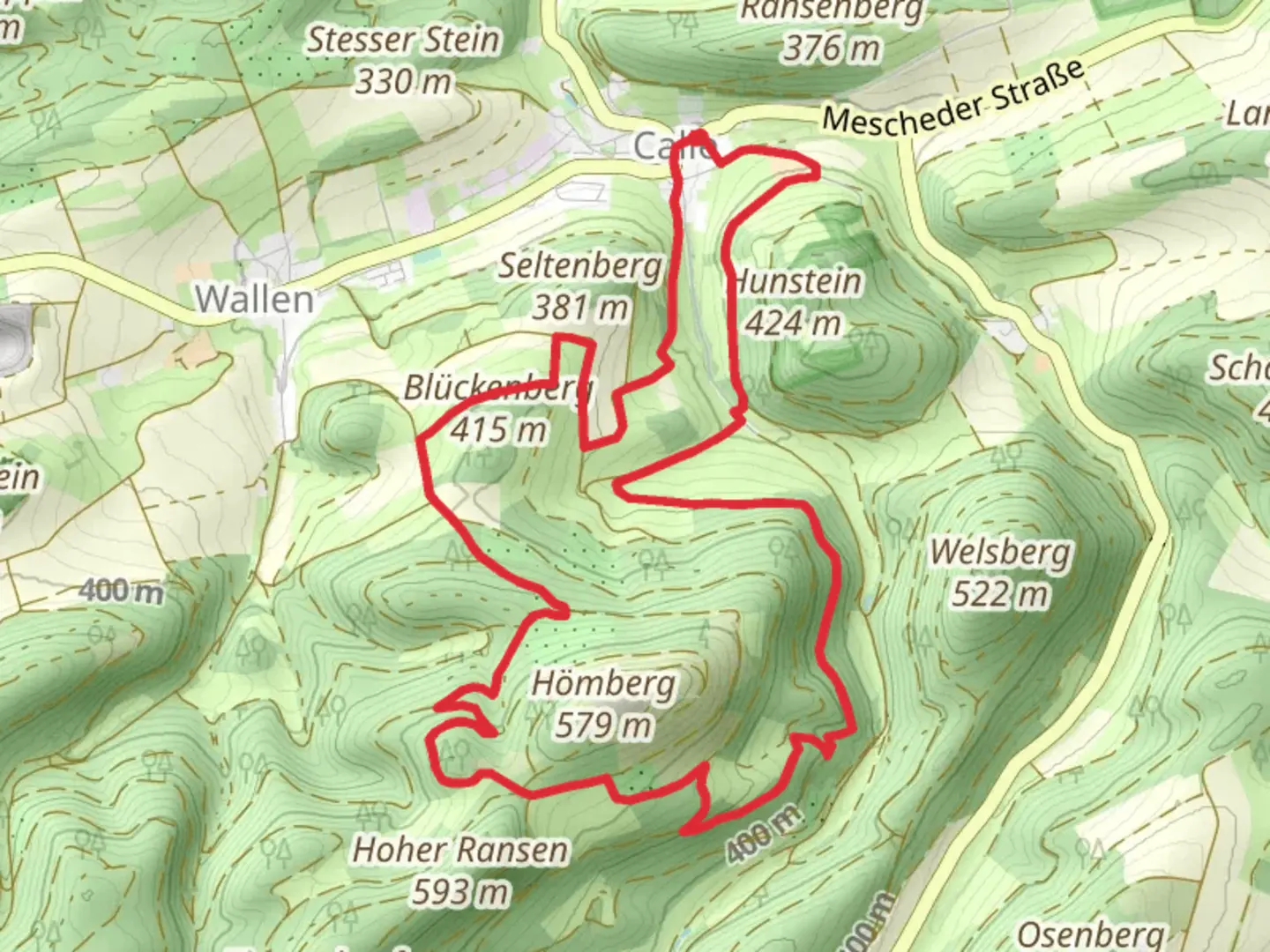
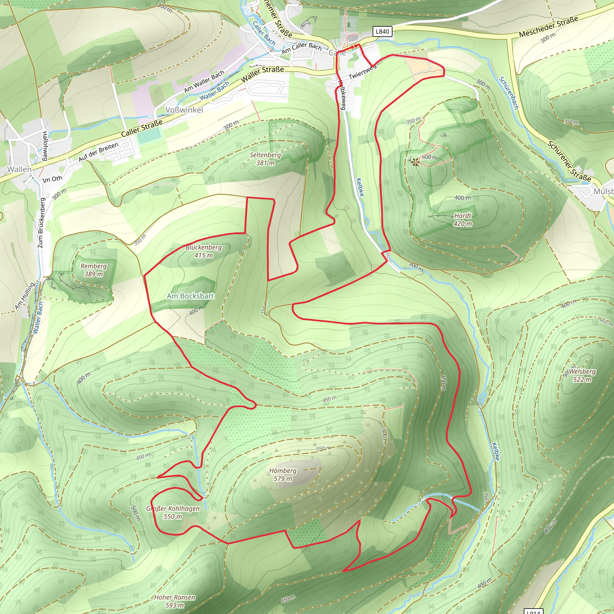
Starting near Hochsauerlandkreis, Germany, the Calle Rundweg Hoemberg is a picturesque loop trail that spans approximately 12 kilometers (7.5 miles) with an elevation gain of around 300 meters (984 feet). This medium-difficulty trail offers a blend of natural beauty, historical landmarks, and diverse wildlife, making it a rewarding experience for hikers.
Getting There To reach the trailhead, you can drive or use public transport. If driving, set your GPS to Hochsauerlandkreis, Germany, and look for parking near the village of Calle. For those using public transport, take a train to Meschede, the nearest major town, and then a local bus to Calle. The trailhead is conveniently located near the village center, making it easily accessible.
Trail Navigation For navigation, it's highly recommended to use the HiiKER app, which provides detailed maps and real-time updates. The trail is well-marked, but having a reliable navigation tool ensures you stay on track.
Trail Highlights
#### Scenic Views and Natural Beauty The trail begins with a gentle ascent through lush forests, offering a serene start to your hike. As you climb, you'll encounter panoramic views of the surrounding Hochsauerland region. The first significant viewpoint is about 3 kilometers (1.9 miles) in, where you can take a break and enjoy the expansive vistas.
#### Flora and Fauna The trail is rich in biodiversity. Keep an eye out for native wildlife such as deer, foxes, and a variety of bird species. The forested sections are home to ancient oak and beech trees, providing ample shade and a cool, refreshing atmosphere.
#### Historical Landmarks Around the 6-kilometer (3.7-mile) mark, you'll come across the remnants of an old watchtower, a relic from the medieval period when the region was a strategic point for local rulers. This site offers a glimpse into the area's historical significance and provides a great spot for a rest and some photos.
Mid-Trail Challenges The trail's midpoint features a more challenging section with steeper inclines and rocky terrain. This part of the hike requires careful footing, especially after rain when the path can become slippery. The elevation gain here is about 150 meters (492 feet) over a 2-kilometer (1.2-mile) stretch, making it the most strenuous part of the hike.
Final Stretch As you descend back towards Calle, the trail levels out, passing through open meadows and farmland. This section is relatively easy and allows for a leisurely end to your hike. The final 3 kilometers (1.9 miles) are mostly flat, making it a pleasant cooldown period before you reach the trailhead.
Practical Tips - **Footwear:** Sturdy hiking boots are recommended due to the varied terrain. - **Weather:** Check the weather forecast before you go, as conditions can change rapidly in the Hochsauerland region. - **Supplies:** Bring enough water and snacks, as there are no facilities along the trail. - **Wildlife:** Be respectful of the local wildlife and maintain a safe distance.
Historical Context The Hochsauerlandkreis region has a rich history dating back to medieval times. The area was once a strategic location for local rulers, evidenced by the old watchtower along the trail. This historical context adds an enriching layer to your hiking experience, connecting you with the past as you traverse the scenic landscape.
By following these guidelines and using the HiiKER app for navigation, you'll be well-prepared to enjoy the diverse and beautiful Calle Rundweg Hoemberg trail.
Comments and Reviews
User comments, reviews and discussions about the Calle Rundweg Hoemberg, Germany.
4.67
average rating out of 5
3 rating(s)
