Download
Preview
Add to list
More
3.6 km
~57 min
143 m
Loop
“Explore Hildesheim's history and natural beauty on the scenic, moderately challenging Sothenberg Loop trail.”
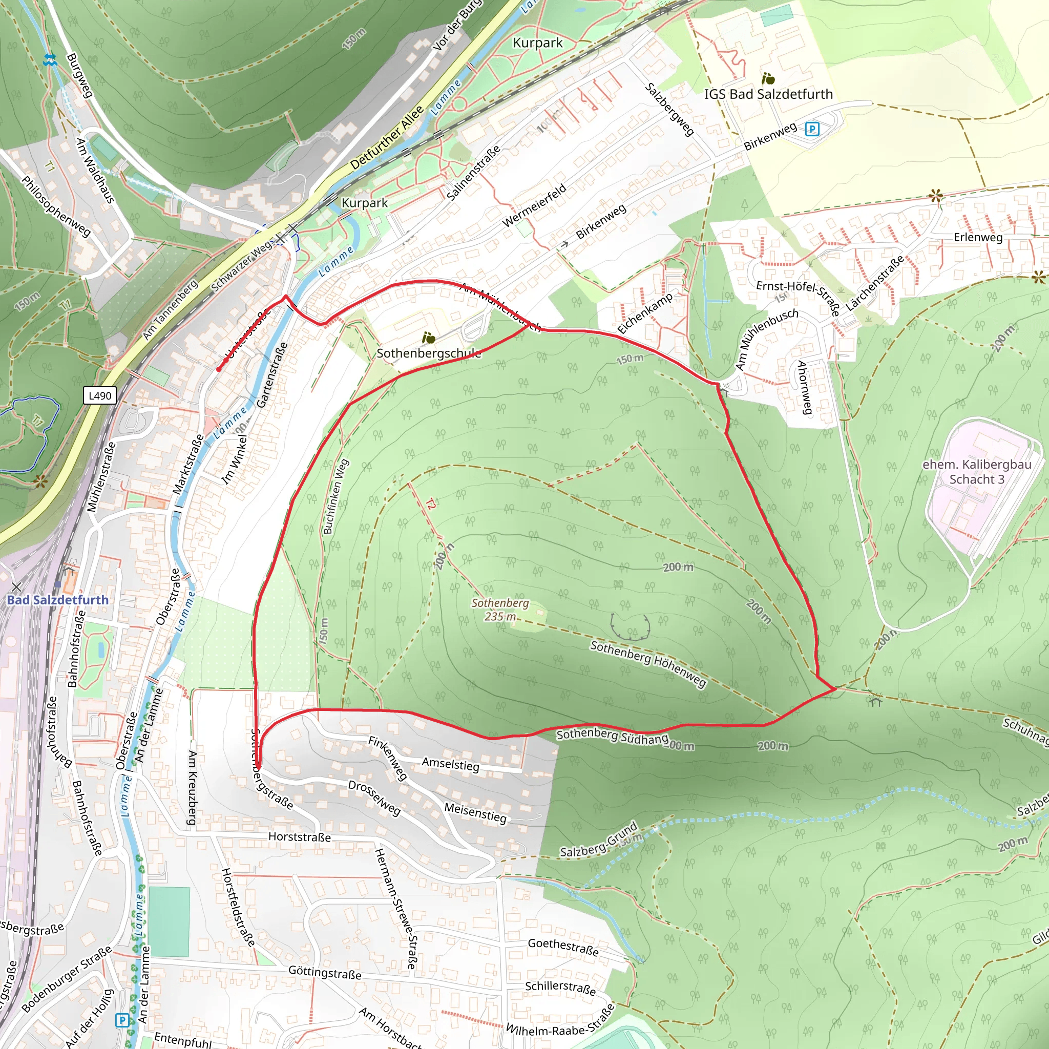
Starting near the charming town of Hildesheim, Germany, the Sothenberg Loop is a delightful 4 km (2.5 miles) trail with an elevation gain of approximately 100 meters (328 feet). This loop trail offers a medium difficulty rating, making it suitable for moderately experienced hikers looking for a rewarding day hike.### Getting There To reach the trailhead, you can either drive or use public transport. If driving, set your GPS to Hildesheim and follow the signs to the trailhead near the outskirts of the town. For those using public transport, take a train to Hildesheim Hauptbahnhof (Hildesheim Central Station). From there, you can catch a local bus or taxi to the trailhead, which is conveniently located just a short distance from the town center.### Trail Overview The Sothenberg Loop begins with a gentle ascent through a mixed forest of beech and oak trees. The initial 1 km (0.6 miles) offers a steady climb, gaining about 50 meters (164 feet) in elevation. As you hike, keep an eye out for the diverse flora and fauna that inhabit this region. Deer, foxes, and a variety of bird species are commonly spotted along this section.### Historical Significance Hildesheim is a town rich in history, and the Sothenberg Loop is no exception. As you progress along the trail, you will come across several historical landmarks. Approximately 2 km (1.2 miles) into the hike, you will encounter the remnants of an old watchtower, dating back to the medieval period. This tower once served as a lookout point to protect the town from invaders. Take a moment to explore the area and imagine the historical significance of this structure.### Scenic Views and Landmarks Around the 3 km (1.9 miles) mark, the trail opens up to a stunning viewpoint overlooking the Leine Valley. This is a perfect spot to take a break, enjoy a snack, and soak in the panoramic views of the surrounding countryside. On a clear day, you can see for miles, making it a popular spot for photographers and nature enthusiasts alike.### Navigation and Safety The trail is well-marked with signs and blazes, but it's always a good idea to have a reliable navigation tool. HiiKER is an excellent app for this purpose, providing detailed maps and real-time tracking to ensure you stay on course. The trail can be muddy and slippery after rain, so sturdy hiking boots with good traction are recommended.### Final Stretch The last kilometer (0.6 miles) of the Sothenberg Loop is a gentle descent back to the trailhead. This section winds through a picturesque meadow, offering a different landscape compared to the forested beginning. Wildflowers bloom in abundance during the spring and summer months, adding a splash of color to your hike.The Sothenberg Loop is a well-rounded trail that offers a bit of everything: historical landmarks, scenic views, and diverse wildlife. Whether you're a local or a visitor, this hike provides a wonderful opportunity to explore the natural beauty and rich history of the Hildesheim region.
What to expect?
Activity types
Comments and Reviews
User comments, reviews and discussions about the Sothenberg Loop, Germany.
average rating out of 5
0 rating(s)

