9.5 km
~2 hrs 29 min
351 m
“This 10 km Heidelberg loop trail blends historic charm, scenic views, and moderate hiking challenges.”
Starting near the picturesque town of Heidelberg, Germany, this 10 km (6.2 miles) loop trail offers a delightful blend of urban exploration and natural beauty. With an elevation gain of approximately 300 meters (984 feet), it is rated as a medium difficulty hike, suitable for moderately experienced hikers.### Getting There
To reach the trailhead, you can either drive or use public transport. If driving, head towards Heidelberg and look for parking near the Altstadt (Old Town) area. For those using public transport, Heidelberg is well-connected by train. From the Heidelberg Hauptbahnhof (main train station), you can take a tram or bus to the Altstadt. The trailhead is conveniently located near the Heidelberg Castle, a significant landmark that is hard to miss.### Trail Overview
The trail begins with a gentle ascent through the historic streets of Heidelberg's Altstadt. As you walk, you'll be surrounded by beautifully preserved medieval architecture, including the Heidelberg Castle and the Church of the Holy Spirit. The cobblestone streets and charming shops add to the quaint atmosphere.### Historical Significance
Heidelberg is steeped in history, with its university being one of the oldest in Germany, founded in 1386. The Heidelberg Castle, perched on a hill overlooking the town, has witnessed centuries of history and offers panoramic views of the Neckar River and the surrounding valley. Make sure to take some time to explore the castle grounds and learn about its storied past.### Nature and Wildlife
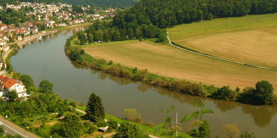
As you leave the urban area and head towards the Neckar River, the trail transitions into a more natural setting. The path meanders along the riverbank, offering serene views of the water and the lush greenery. Keep an eye out for local wildlife, including various bird species and small mammals that inhabit the area.### Key Landmarks
- Heidelberg Castle: Approximately 1 km (0.6 miles) from the trailhead, this iconic landmark is a must-see.
- Philosophenweg (Philosopher's Walk): Around 3 km (1.9 miles) into the hike, this scenic path offers stunning views of Heidelberg and the Neckar River.
- Neckarwiese (Neckar Meadow): About 5 km (3.1 miles) into the hike, this is a perfect spot for a picnic or a rest.### Elevation and Terrain
The trail features a mix of urban streets, forest paths, and riverside trails. The initial ascent through the Altstadt is gradual, but the climb up to the Philosophenweg can be a bit steep. The total elevation gain is around 300 meters (984 feet), so be prepared for some uphill sections. Good hiking shoes are recommended, especially for the forested parts of the trail.### Navigation
To ensure you stay on track, consider using the HiiKER app, which provides detailed maps and real-time navigation. This can be particularly useful in the forested sections where the path may not be as clearly marked.### Final Stretch
The trail loops back towards the Altstadt, passing through the scenic Neckarwiese before returning to the starting point near Heidelberg Castle. This final stretch is relatively flat and offers a relaxing end to your hike.This trail offers a perfect blend of history, culture, and natural beauty, making it a rewarding experience for any hiker.
Reviews
User comments, reviews and discussions about the Neckar via Stadttour Altstadt and Camino Incluso, Germany.
4.0
average rating out of 5
9 rating(s)
Loading reviews...


