Download
Preview
Add to list
More
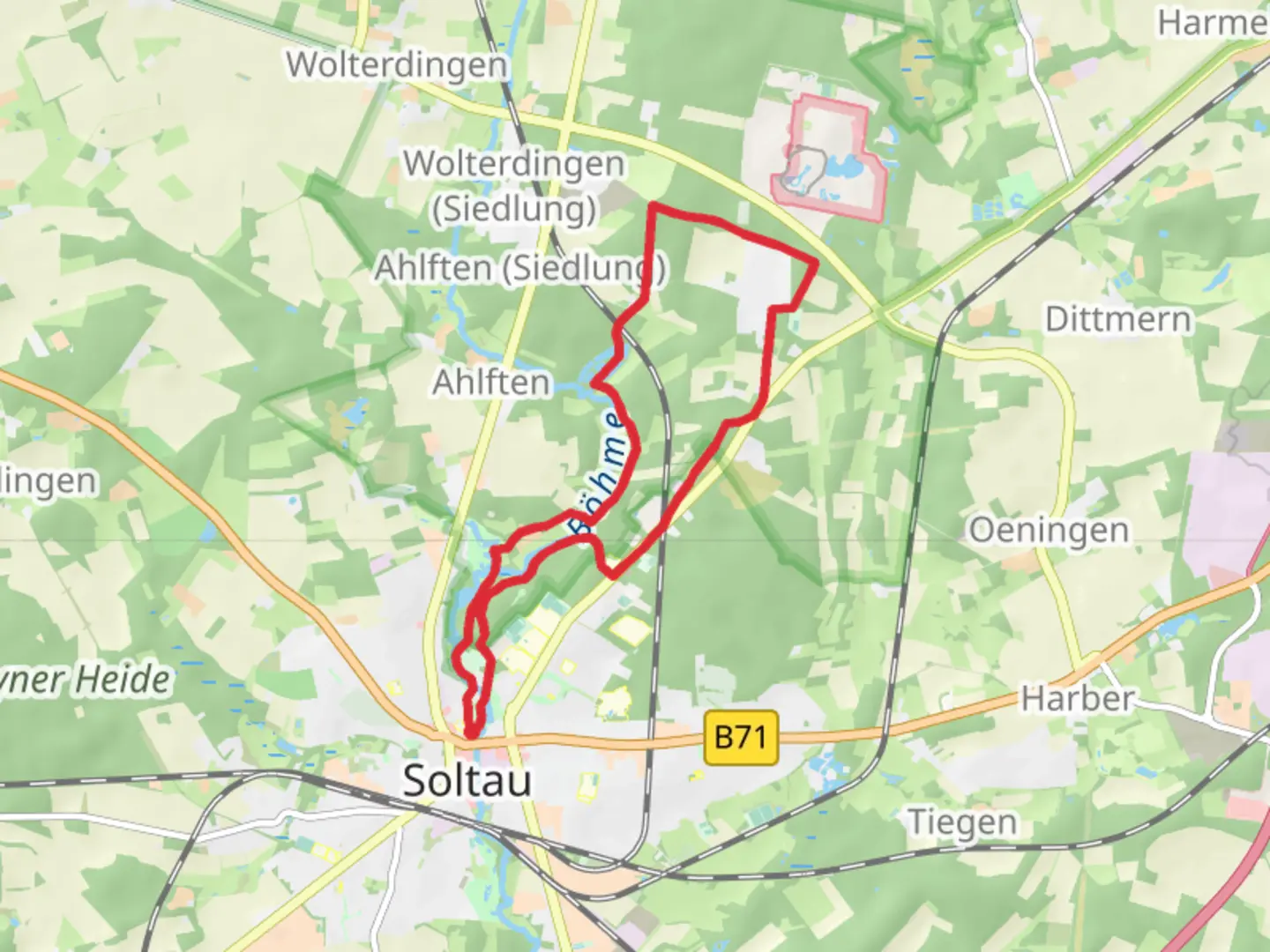
12.0 km
~2 hrs 30 min
63 m
Loop
“Discover the serene, historical 12 km Stoehr Kreuz loop near Heidekreis, offering accessible, picturesque hiking.”
Starting your hike near Heidekreis, Germany, the Stoehr Kreuz via Einfrielinger Weg and Hauptstraße trail offers a delightful 12 km (approximately 7.5 miles) loop with no significant elevation gain, making it accessible for a wide range of hikers. The trailhead is conveniently located near the Heidekreis region, which can be reached by car or public transport. If you're driving, you can park near the Heidekreis area. For those using public transport, the nearest significant landmark is the Heidekreis train station, from where you can take a local bus or taxi to the trailhead.
Trail Navigation and Terrain The trail is well-marked and can be navigated easily using the HiiKER app. The terrain is relatively flat, with an elevation gain of around 0 meters, making it a comfortable hike for those who prefer less strenuous trails. The path meanders through a mix of forested areas and open fields, providing a variety of landscapes to enjoy.
Key Landmarks and Points of Interest As you embark on the trail, you'll first encounter the Einfrielinger Weg, a charming path that winds through dense woodlands. Approximately 3 km (1.9 miles) into the hike, you'll come across a picturesque clearing that offers a perfect spot for a short break. Here, you can enjoy the serene surroundings and perhaps spot some local wildlife, such as deer or various bird species.
Continuing along the trail, you'll reach the Hauptstraße section around the 6 km (3.7 miles) mark. This part of the trail takes you through a quaint rural area, where you can observe traditional German farmhouses and fields. The Hauptstraße is also known for its historical significance, as it has been a vital route for local communities for centuries.
Historical Significance The region around Heidekreis has a rich history, with roots tracing back to medieval times. The Stoehr Kreuz itself is a historical landmark, believed to be a medieval cross that served as a waypoint for travelers and pilgrims. As you hike, you'll be walking in the footsteps of countless individuals who have traversed these paths over the centuries.
Flora and Fauna The trail is abundant with diverse flora and fauna. In the spring and summer months, the forested areas are lush with greenery and wildflowers, while the open fields are dotted with colorful blooms. Keep an eye out for local wildlife, including deer, foxes, and a variety of bird species. The area is also known for its rich insect life, so you might spot butterflies and other pollinators along the way.
Practical Information The entire loop takes around 3-4 hours to complete, depending on your pace and how often you stop to take in the sights. It's advisable to carry water and some snacks, as there are limited facilities along the trail. Wearing comfortable hiking shoes and weather-appropriate clothing will ensure a pleasant experience.
Using the HiiKER app will help you stay on track and provide additional information about the trail as you hike. Enjoy the blend of natural beauty and historical intrigue that the Stoehr Kreuz via Einfrielinger Weg and Hauptstraße trail has to offer.

What to expect?
Activity types
Comments and Reviews
User comments, reviews and discussions about the Stoehr Kreuz via Einfrielinger Weg and Hauptstraße, Germany.
4.0
average rating out of 5
1 rating(s)