Download
Preview
Add to list
More
5.8 km
~1 hrs 20 min
103 m
Loop
“Explore the serene Thuringian countryside on this 6 km trail near Greiz, featuring lush forests, meadows, and historical landmarks.”
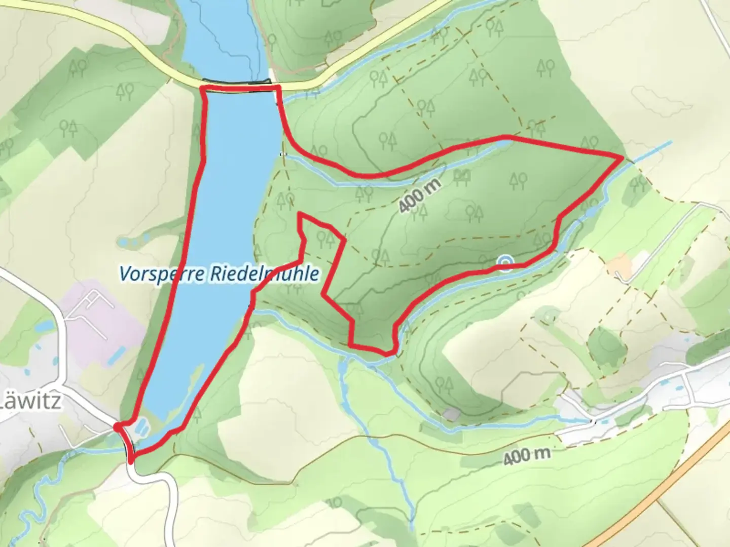
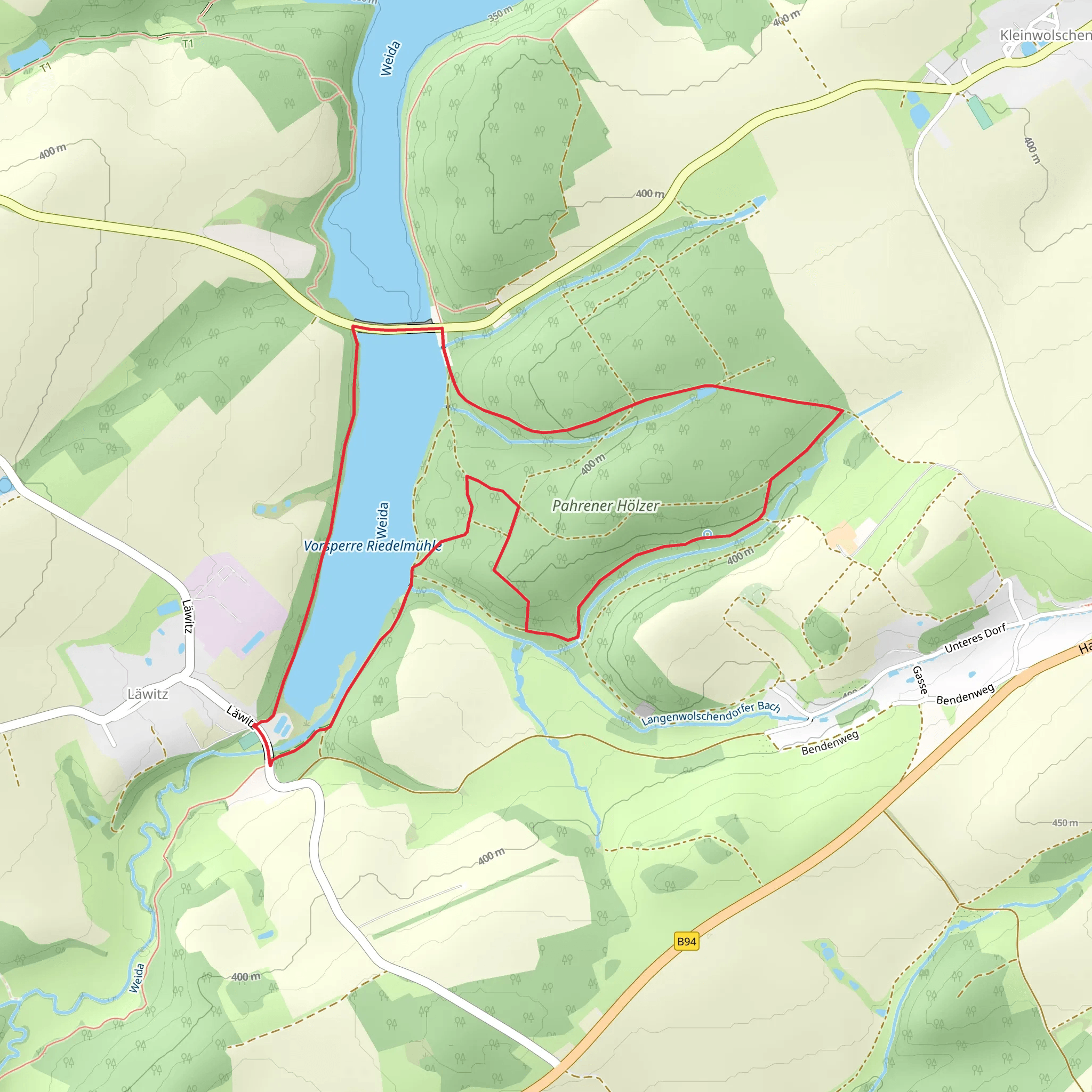
Starting near the picturesque town of Greiz in Germany, the Vorsperre Riedelmühle via Weidatalweg and Quellenrundweg trail offers a delightful 6 km (approximately 3.7 miles) loop with an elevation gain of around 100 meters (328 feet). This medium-difficulty trail is perfect for those looking to immerse themselves in the serene beauty of the Thuringian countryside.
Getting There To reach the trailhead, you can either drive or use public transport. If driving, set your GPS to Greiz, a charming town known for its historical architecture and scenic landscapes. There are several parking options available near the trailhead. For those using public transport, Greiz is well-connected by train and bus services. The nearest train station is Greiz Bahnhof, from where you can take a local bus or taxi to the trailhead.
Trail Overview The trail begins near the Vorsperre Riedelmühle, a small reservoir that serves as a tranquil starting point. As you set off, you'll follow the Weidatalweg, a path that meanders through lush forests and open meadows. The initial part of the trail is relatively flat, making it an easy warm-up for the more challenging sections ahead.
Significant Landmarks and Nature Around the 2 km (1.2 miles) mark, you'll come across the Weidatalsperre, a picturesque dam that offers stunning views of the surrounding landscape. This is a great spot to take a break and enjoy the natural beauty. The trail then ascends gently, gaining about 50 meters (164 feet) in elevation over the next kilometer. Keep an eye out for local wildlife, including deer and various bird species that inhabit the area.
Historical Significance The region around Greiz has a rich history, with roots dating back to the Middle Ages. The town itself is home to several historical landmarks, including the Greiz Castle and the Upper Castle, both of which offer a glimpse into the area's storied past. As you hike, you'll pass by remnants of old mills and other historical structures that add a layer of intrigue to your journey.
Navigation and Safety The trail is well-marked, but it's always a good idea to have a reliable navigation tool. HiiKER is an excellent app for this purpose, providing detailed maps and real-time updates to ensure you stay on track. The trail can be muddy and slippery after rain, so sturdy hiking boots are recommended. Also, bring plenty of water and snacks, as there are limited facilities along the route.
Final Stretch As you loop back towards the starting point, the trail descends gently, offering a relaxing end to your hike. The final kilometer takes you through a beautiful forested area, where you can enjoy the peaceful ambiance and perhaps spot some more wildlife. The trail concludes back at the Vorsperre Riedelmühle, where you can take a moment to reflect on your journey and perhaps plan your next adventure in this beautiful region.
What to expect?
Activity types
Comments and Reviews
User comments, reviews and discussions about the Vorsperre Riedelmühle via Weidatalweg and Quellenrundweg, Germany.
4.5
average rating out of 5
2 rating(s)
