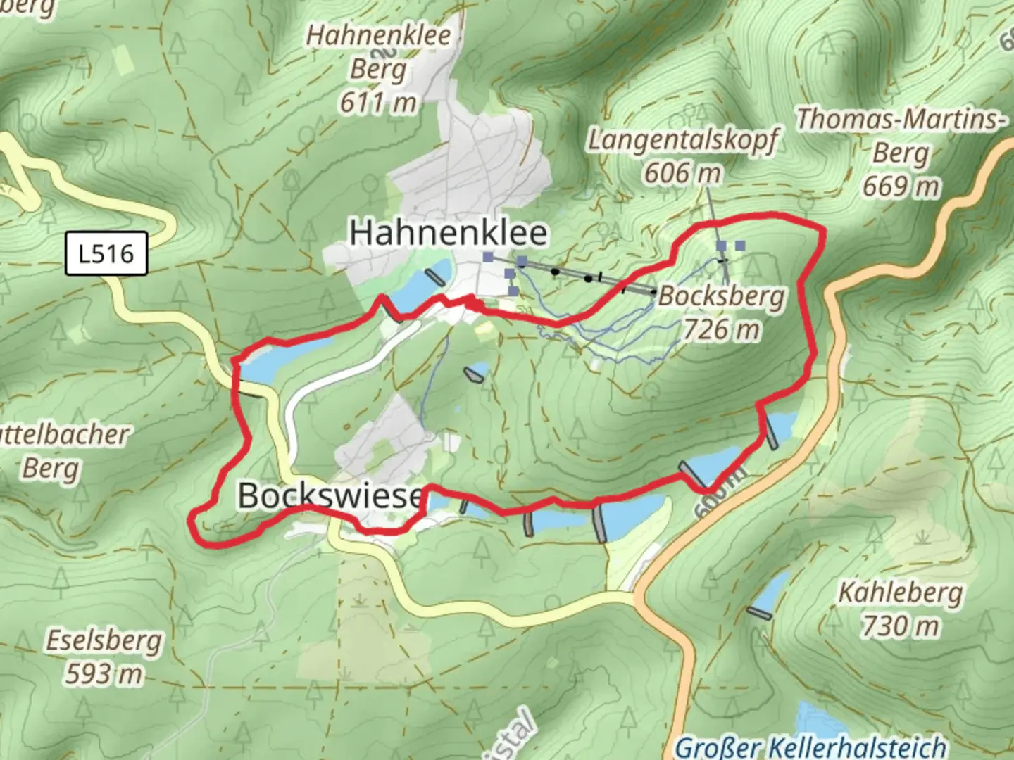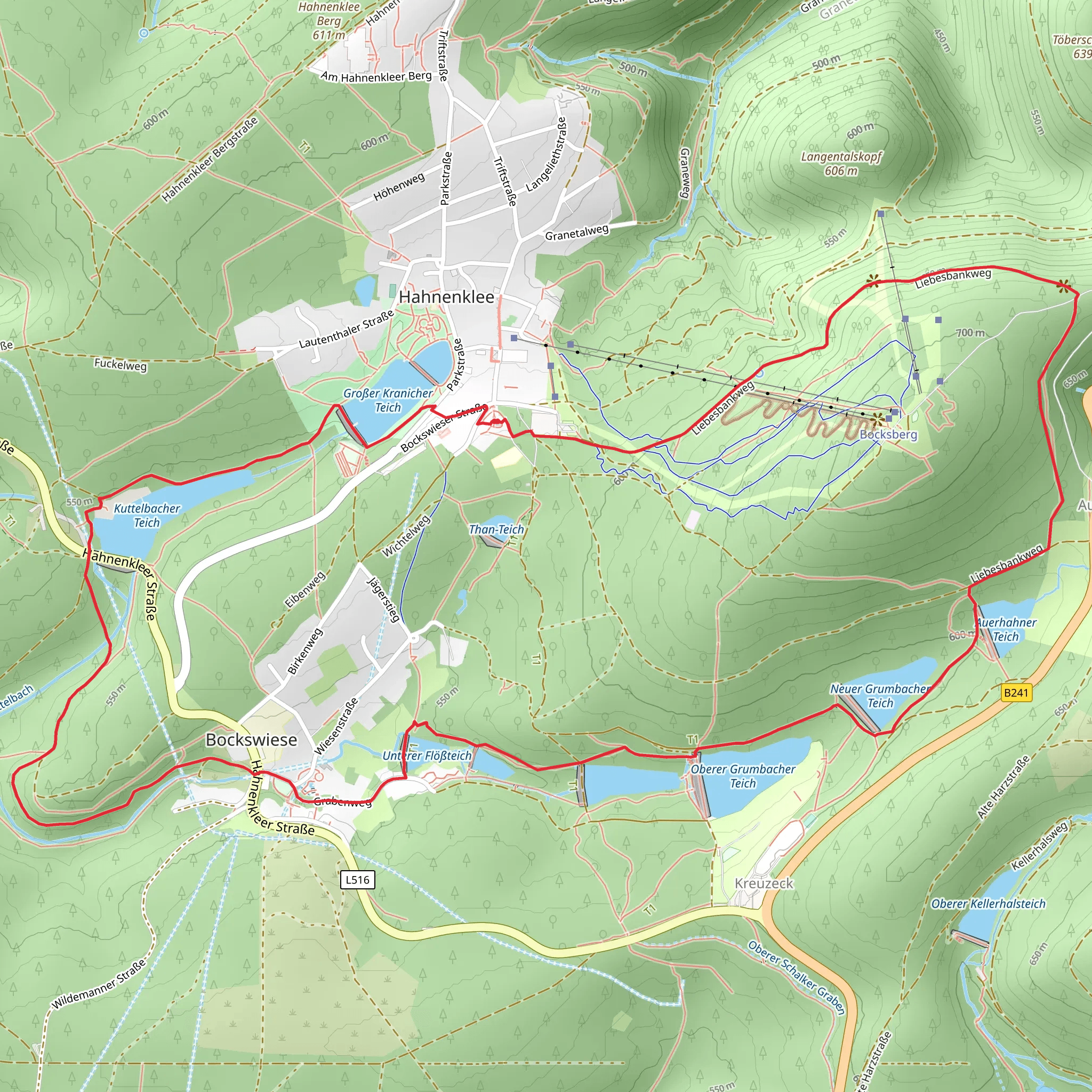
Oberer Grumbacher Teich, Neuer Grumbacher Teich, Großer Kranicher Teich Loop via Liebesbankweg
Download
Preview
Add to list
More
8.7 km
~2 hrs 1 min
172 m
Loop
“Explore serene reservoirs and lush forests on a moderately challenging 9 km hike through the Harz Mountains.”
Starting your hike near the picturesque town of Goslar, Germany, the Oberer Grumbacher Teich, Neuer Grumbacher Teich, Großer Kranicher Teich Loop via Liebesbankweg offers a delightful 9 km (approximately 5.6 miles) journey through the Harz Mountains. With an elevation gain of around 100 meters (328 feet), this loop trail is rated as medium difficulty, making it suitable for moderately experienced hikers.
Getting There To reach the trailhead, you can either drive or use public transport. If driving, head towards Goslar and look for parking near the Liebesbankweg trailhead. For those using public transport, take a train to Goslar Station. From there, local buses or a short taxi ride will get you to the starting point.
Trail Highlights #### Oberer Grumbacher Teich Starting off, you'll encounter the Oberer Grumbacher Teich, a serene reservoir that dates back to the mining era of the Harz region. This area is part of the Upper Harz Water Regale, a UNESCO World Heritage site. The reservoir is surrounded by lush forests and offers a peaceful setting to begin your hike.
#### Neuer Grumbacher Teich Continuing on, you'll reach the Neuer Grumbacher Teich. This reservoir is slightly larger and offers stunning reflections of the surrounding trees on calm days. The trail around this area is well-marked and relatively flat, making it an easy section to navigate.
#### Großer Kranicher Teich Next, the trail leads you to the Großer Kranicher Teich. This is the largest of the three reservoirs you'll encounter on this loop. The area is rich in birdlife, so keep an eye out for various species of waterfowl. The trail here involves a gentle ascent, offering panoramic views of the water and surrounding forest.
Historical Significance The reservoirs you’ll encounter are part of the Upper Harz Water Regale, an intricate system of dams, ditches, and reservoirs built to support mining operations in the region. This system is one of the oldest and most extensive of its kind in the world, dating back to the 16th century. The engineering marvels you see today were crucial for the development of the mining industry in the Harz Mountains.
Navigation and Safety For navigation, it’s highly recommended to use the HiiKER app, which provides detailed maps and real-time updates. The trail is well-marked, but having a reliable navigation tool will ensure you stay on track.
Flora and Fauna The trail meanders through dense forests of spruce and beech, offering a rich tapestry of flora. In spring and summer, the forest floor is carpeted with wildflowers, while autumn brings a spectacular display of foliage. Wildlife is abundant; you might spot deer, foxes, and a variety of bird species.
Final Stretch As you loop back towards the starting point, the trail takes you along the Liebesbankweg, a romantic path adorned with intricately carved wooden benches. This section is relatively flat and offers a relaxing end to your hike. The benches are perfect for a short rest and to take in the beautiful surroundings.
Practical Tips - Wear sturdy hiking boots, as some sections can be muddy, especially after rain. - Bring enough water and snacks, as there are no facilities along the trail. - Check the weather forecast before heading out, as conditions can change rapidly in the mountains.
This loop trail offers a perfect blend of natural beauty, historical significance, and moderate physical challenge, making it a rewarding experience for any hiker.
What to expect?
Activity types
Comments and Reviews
User comments, reviews and discussions about the Oberer Grumbacher Teich, Neuer Grumbacher Teich, Großer Kranicher Teich Loop via Liebesbankweg, Germany.
4.57
average rating out of 5
7 rating(s)
