Download
Preview
Add to list
More
10.8 km
~3 hrs 11 min
626 m
Loop
“This Göppingen loop trail combines serene forests, panoramic views, and historical landmarks for a rewarding hike.”
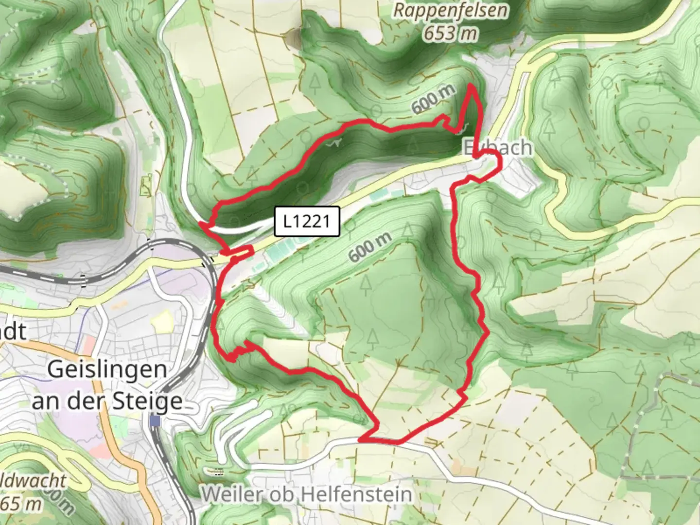
Starting near Göppingen, Germany, this 11 km (approximately 6.8 miles) loop trail offers a moderate challenge with an elevation gain of around 600 meters (about 1,970 feet). The trailhead is easily accessible by car or public transport. If you're driving, you can park near the Göppingen train station, which is a convenient starting point. For those using public transport, take a train to Göppingen and then a local bus to the trailhead.### Initial Ascent and AnwandfelsThe trail begins with a steady ascent through dense forest, providing a serene and shaded environment. After about 2 km (1.2 miles), you'll reach Anwandfels, a prominent rock formation offering panoramic views of the surrounding Swabian Alps. This is a great spot to take a break and enjoy the scenery. The elevation gain to this point is roughly 200 meters (656 feet).### Himmelfels and WildlifeContinuing along the trail, you'll encounter Himmelfels after another 3 km (1.9 miles). This section is known for its diverse flora and fauna. Keep an eye out for local wildlife such as deer and various bird species. The trail here is well-marked but can be rocky, so sturdy hiking boots are recommended. The elevation gain from Anwandfels to Himmelfels is about 150 meters (492 feet).### Bismarckfelsen and Historical SignificanceThe next significant landmark is Bismarckfelsen, located approximately 3 km (1.9 miles) from Himmelfels. Named after the famous German statesman Otto von Bismarck, this rock formation holds historical significance and offers another excellent viewpoint. The elevation gain to Bismarckfelsen is around 150 meters (492 feet). Here, you can find a plaque commemorating Bismarck, adding a touch of history to your hike.### Descent and ReturnThe final leg of the loop involves a descent back towards Göppingen. This section is less strenuous but requires careful footing, especially if the ground is wet. The descent covers about 3 km (1.9 miles) with an elevation loss of approximately 300 meters (984 feet). The trail winds through more forested areas, eventually leading you back to the trailhead.### Navigation and SafetyFor navigation, it's advisable to use HiiKER, which provides detailed maps and real-time updates. The trail is generally well-marked, but having a reliable navigation tool can enhance your hiking experience and ensure you stay on track.### Getting ThereTo reach the trailhead, you can drive to Göppingen and park near the train station. If using public transport, take a train to Göppingen and then a local bus to the starting point. The area is well-connected, making it convenient for both local and international hikers.This loop trail near Göppingen offers a mix of natural beauty, wildlife, and historical landmarks, making it a rewarding hike for those looking to explore the Swabian Alps.
What to expect?
Activity types
Comments and Reviews
User comments, reviews and discussions about the Anwandfels, Himmelfels and Bismarckfelsen Loop, Germany.
4.33
average rating out of 5
6 rating(s)
