11.5 km
~1 day 1 hrs
2556 m
Download
Preview
Add to list
More
“Trek through awe-inspiring alpine landscapes to conquer Germany's highest peak, packed with history and wildlife.”
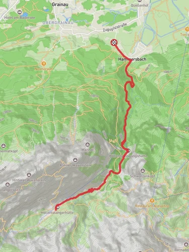
Nestled in the Bavarian Alps, the trail to Zugspitze via Hammersbach is a challenging yet rewarding adventure for seasoned hikers. Starting near the picturesque town of Garmisch-Partenkirchen, Germany, this trail offers a journey through stunning alpine landscapes, rich history, and diverse wildlife.
Getting There
To reach the trailhead, travelers can take advantage of the efficient German public transport system. From Munich, a train ride to Garmisch-Partenkirchen takes approximately 1.5 hours. Once in Garmisch-Partenkirchen, a local bus or a short taxi ride will bring you to the village of Hammersbach, where the trail begins. For those driving, the village is accessible via the A95 motorway from Munich, with parking available near the trailhead.
Trail Overview
The trail spans approximately 12 kilometers (7.5 miles) with a significant elevation gain of around 2,500 meters (8,200 feet), making it an extra difficult trek suitable for experienced hikers. The ascent to Germany's highest peak, Zugspitze, is a test of endurance and skill, requiring careful preparation and planning.
Key Sections and Landmarks
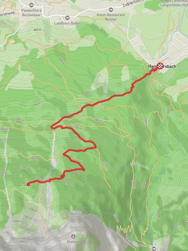
Höllentalklamm Gorge
The journey begins with a trek through the Höllentalklamm Gorge, a dramatic and narrow canyon carved by the Hammersbach River. This section, approximately 2 kilometers (1.2 miles) into the hike, features a series of tunnels and bridges, offering a thrilling start with stunning views of cascading waterfalls and rugged rock formations. The gorge is a testament to the power of natural erosion and provides a cool, shaded respite before the more strenuous sections ahead.
Alpine Meadows and Wildlife
Emerging from the gorge, hikers will traverse lush alpine meadows, home to a variety of flora and fauna. Keep an eye out for edelweiss, a rare and protected flower, and the occasional sighting of chamois or marmots. This section offers a gentle incline, allowing hikers to catch their breath and enjoy the serene beauty of the landscape.
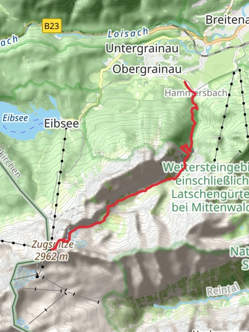
Zugspitzplatt and Glacier
As the trail ascends, it reaches the Zugspitzplatt, a high-altitude plateau at approximately 2,600 meters (8,530 feet). This area is characterized by its rocky terrain and the presence of the Schneeferner Glacier, one of the few remaining glaciers in Germany. The stark beauty of the glacier and the surrounding peaks is a highlight of the hike, offering a glimpse into the region's glacial history.
Historical Significance
The Zugspitze region holds historical significance, with the first recorded ascent dating back to 1820 by Josef Naus, a surveyor for the Bavarian government. The mountain has since become a symbol of Bavarian pride and a popular destination for mountaineers and tourists alike. The trail itself is steeped in history, with remnants of old mining operations and traditional alpine huts dotting the landscape.
Final Ascent
The final push to the summit is the most challenging part of the hike, requiring careful navigation and a steady pace. The path becomes steeper and more rugged, with some sections requiring scrambling over rocks. Hikers are advised to use HiiKER for accurate navigation and to ensure they stay on the correct path. Upon reaching the summit at 2,962 meters (9,718 feet), the panoramic views of the surrounding Alps and the sense of accomplishment make the arduous journey worthwhile.
Preparation and Safety
Given the trail's difficulty, proper preparation is essential. Hikers should be equipped with sturdy footwear, weather-appropriate clothing, and sufficient food and water. Weather conditions can change rapidly in the Alps, so checking forecasts and being prepared for sudden shifts is crucial. Additionally, carrying a map and using HiiKER for real-time navigation will enhance safety and ensure a successful ascent.

Reviews
User comments, reviews and discussions about the Zugspitze via Hammersbach, Germany.
0.0
average rating out of 5
0 rating(s)