Download
Preview
Add to list
More
5.2 km
~2 hrs 10 min
679 m
Out and Back
“Hike the Kofel via Königssteig trail for stunning views, historical intrigue, and a rewarding challenge.”
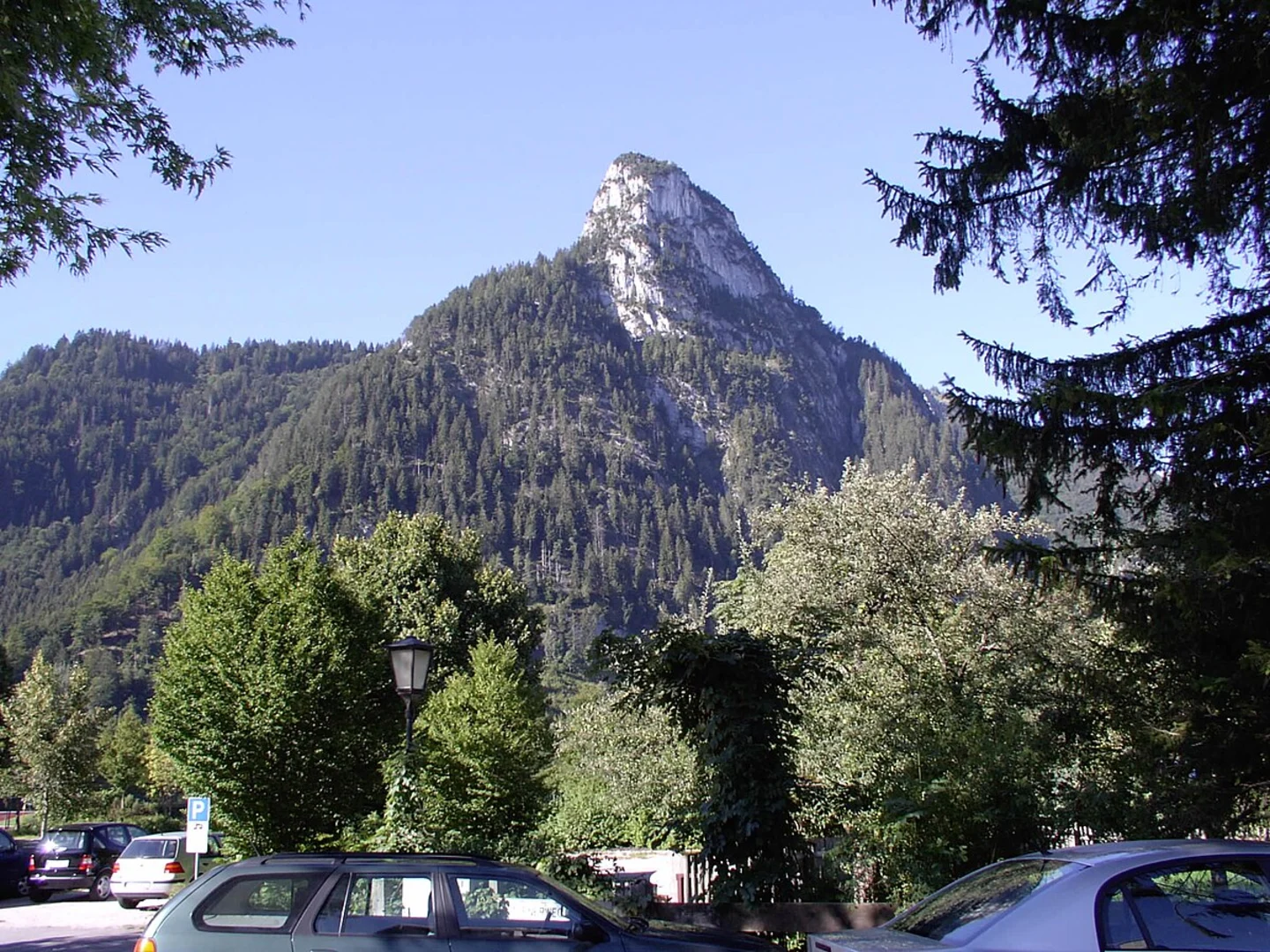
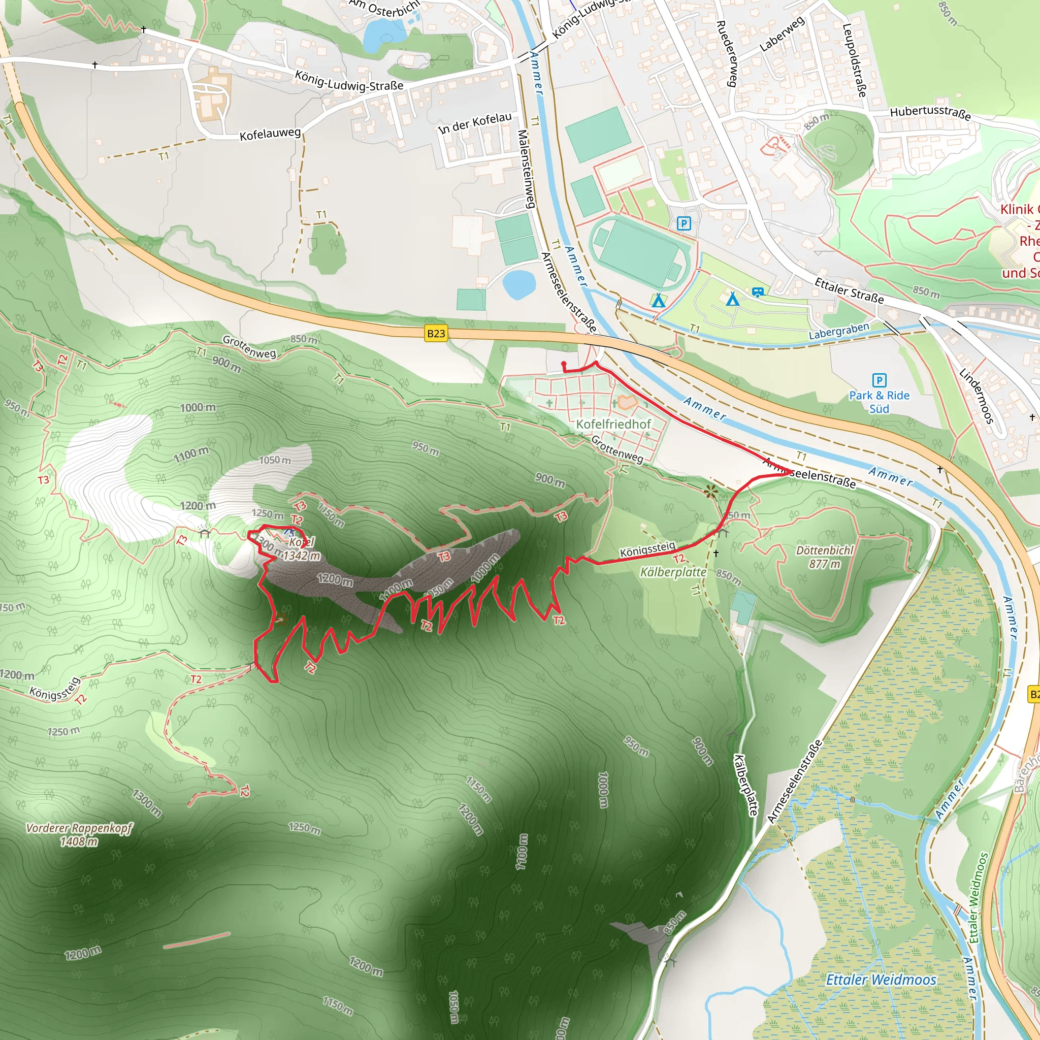
Starting near the picturesque town of Garmisch-Partenkirchen, Germany, the Kofel via Königssteig trail offers a rewarding adventure for hikers. This out-and-back trail spans approximately 5 kilometers (3.1 miles) with an elevation gain of around 600 meters (1,968 feet), making it a moderately challenging hike.### Getting There To reach the trailhead, you can either drive or use public transport. If driving, head towards Garmisch-Partenkirchen and look for parking near the town center or designated trailhead parking areas. For those using public transport, take a train to Garmisch-Partenkirchen station. From there, local buses or a short taxi ride can get you to the trailhead.### Trail Overview The trail begins near the town center, quickly immersing you in the natural beauty of the Bavarian Alps. As you start your ascent, you'll pass through dense forests, which provide a cool and shaded environment, especially pleasant during the warmer months. The initial part of the trail is relatively gentle, allowing you to warm up before the steeper sections.### Key Landmarks and Sections
Forested Ascent
Approximately 1 kilometer (0.6 miles) into the hike, the trail begins to climb more steeply. The forested path is well-marked and maintained, but be prepared for some rocky sections. Keep an eye out for local wildlife such as deer and various bird species that inhabit this area.#### Königssteig Path Around the 2-kilometer (1.2 miles) mark, you'll reach the Königssteig path. This section is historically significant as it was once used by royalty for hunting expeditions. The trail here is narrower and more rugged, offering stunning views of the surrounding mountains and valleys. The elevation gain becomes more noticeable, so take your time and enjoy the scenery.#### Final Ascent to Kofel The last kilometer (0.6 miles) involves a steeper climb with some scrambling required. The path is well-marked, but caution is advised, especially in wet conditions. As you approach the summit, the trees thin out, providing panoramic views of the Bavarian Alps and the town of Garmisch-Partenkirchen below.### Summit Experience Reaching the summit of Kofel, you'll be rewarded with breathtaking 360-degree views. The peak stands at an elevation of approximately 1,342 meters (4,403 feet). On a clear day, you can see the Zugspitze, Germany's highest peak, in the distance. This is a perfect spot to rest, take photos, and enjoy a snack before beginning your descent.### Descent The return journey follows the same path, allowing you to revisit the beautiful landscapes and perhaps notice details you missed on the way up. The descent can be challenging on the steeper sections, so take your time and use trekking poles if you have them.### Navigation and Safety For navigation, the HiiKER app is highly recommended. It provides detailed maps and real-time tracking to ensure you stay on the correct path. Always check the weather forecast before heading out, as conditions in the mountains can change rapidly. Carry sufficient water, snacks, and a first aid kit.### Historical Significance The region around Garmisch-Partenkirchen is steeped in history. The town itself dates back to Roman times and has been a popular destination for royalty and nobility over the centuries. The Königssteig path, in particular, is a reminder of the area's rich cultural heritage, once serving as a route for royal hunting parties.This hike offers a perfect blend of natural beauty, physical challenge, and historical intrigue, making it a must-do for any hiking enthusiast visiting the Bavarian Alps.
What to expect?
Activity types
Comments and Reviews
User comments, reviews and discussions about the Kofel via Königssteig, Germany.
4.0
average rating out of 5
2 rating(s)

