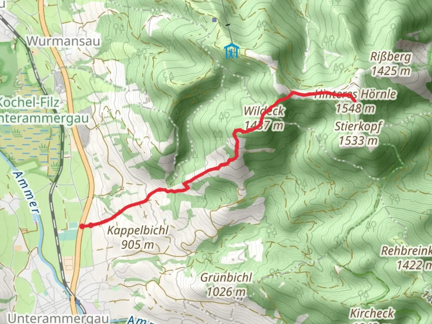
Hinteres Hörnle Peak Walk via Wildeck and Kappel
Download
Preview
Add to list
More
8.8 km
~3 hrs 1 min
756 m
Out and Back
“Embark on a picturesque, moderately challenging 9 km hike in the Bavarian Alps with stunning views and historical charm.”
Starting your hike near the picturesque town of Garmisch-Partenkirchen, Germany, the Hinteres Hörnle Peak Walk via Wildeck and Kappel offers an invigorating journey through the Bavarian Alps. The trailhead is conveniently accessible by both public transport and car. If you're using public transport, take a train to Garmisch-Partenkirchen station and then a local bus to the nearest stop at Wankbahn Talstation. From there, it's a short walk to the trailhead. For those driving, parking is available near the Wankbahn Talstation.Trail OverviewThe trail spans approximately 9 km (5.6 miles) with an elevation gain of around 700 meters (2,300 feet), making it a moderately challenging hike. The route is an out-and-back type, allowing you to enjoy the scenic beauty both on your way up and down.Initial Ascent and WildeckStarting from the trailhead, the initial section of the hike takes you through dense forests, offering a cool and shaded environment. The path is well-marked and gradually ascends, making it manageable for hikers with a moderate level of fitness. After about 2 km (1.2 miles) and an elevation gain of 200 meters (656 feet), you will reach the area known as Wildeck. Here, the forest opens up to reveal stunning views of the surrounding valleys and peaks. It's a great spot to take a short break and hydrate.Kappel and Midway PointContinuing from Wildeck, the trail becomes steeper as you approach Kappel, which is roughly 4 km (2.5 miles) from the start. This section involves a more strenuous climb, gaining an additional 300 meters (984 feet) in elevation. Kappel is a small plateau that offers panoramic views of the Bavarian Alps. The area is rich in alpine flora, and if you're lucky, you might spot some local wildlife such as chamois or marmots. This is an excellent place to rest and enjoy a snack before tackling the final ascent.Final Ascent to Hinteres Hörnle PeakThe last stretch to Hinteres Hörnle Peak is the most challenging part of the hike. Over the next 1.5 km (0.9 miles), you will gain the remaining 200 meters (656 feet) in elevation. The trail here is rocky and can be slippery, especially after rain, so good hiking boots are essential. As you approach the peak, the trees thin out, and you are rewarded with breathtaking 360-degree views of the surrounding mountain ranges and valleys.Historical SignificanceThe region around Garmisch-Partenkirchen has a rich history, dating back to Roman times. The town itself was a significant trading post and has retained much of its historical charm. The trail passes through areas that were once used by local shepherds and farmers, and you might come across old stone walls and huts that tell the story of the region's pastoral past.Descent and ReturnAfter soaking in the views from Hinteres Hörnle Peak, retrace your steps back to the trailhead. The descent offers a different perspective of the landscape and is generally easier on the legs, though still requires caution on the steeper sections.Navigation and SafetyFor navigation, it's highly recommended to use the HiiKER app, which provides detailed maps and real-time updates. Always check the weather forecast before heading out, as conditions in the mountains can change rapidly. Carry sufficient water, snacks, and a basic first-aid kit.This hike offers a perfect blend of natural beauty, moderate challenge, and historical intrigue, making it a must-do for anyone visiting the Bavarian Alps.
What to expect?
Activity types
Comments and Reviews
User comments, reviews and discussions about the Hinteres Hörnle Peak Walk via Wildeck and Kappel, Germany.
4.42
average rating out of 5
12 rating(s)
