Download
Preview
Add to list
More
2.3 km
~38 min
109 m
Loop
“A scenic 2 km loop near Freyung-Grafenau blends natural beauty, moderate challenge, and rich history.”
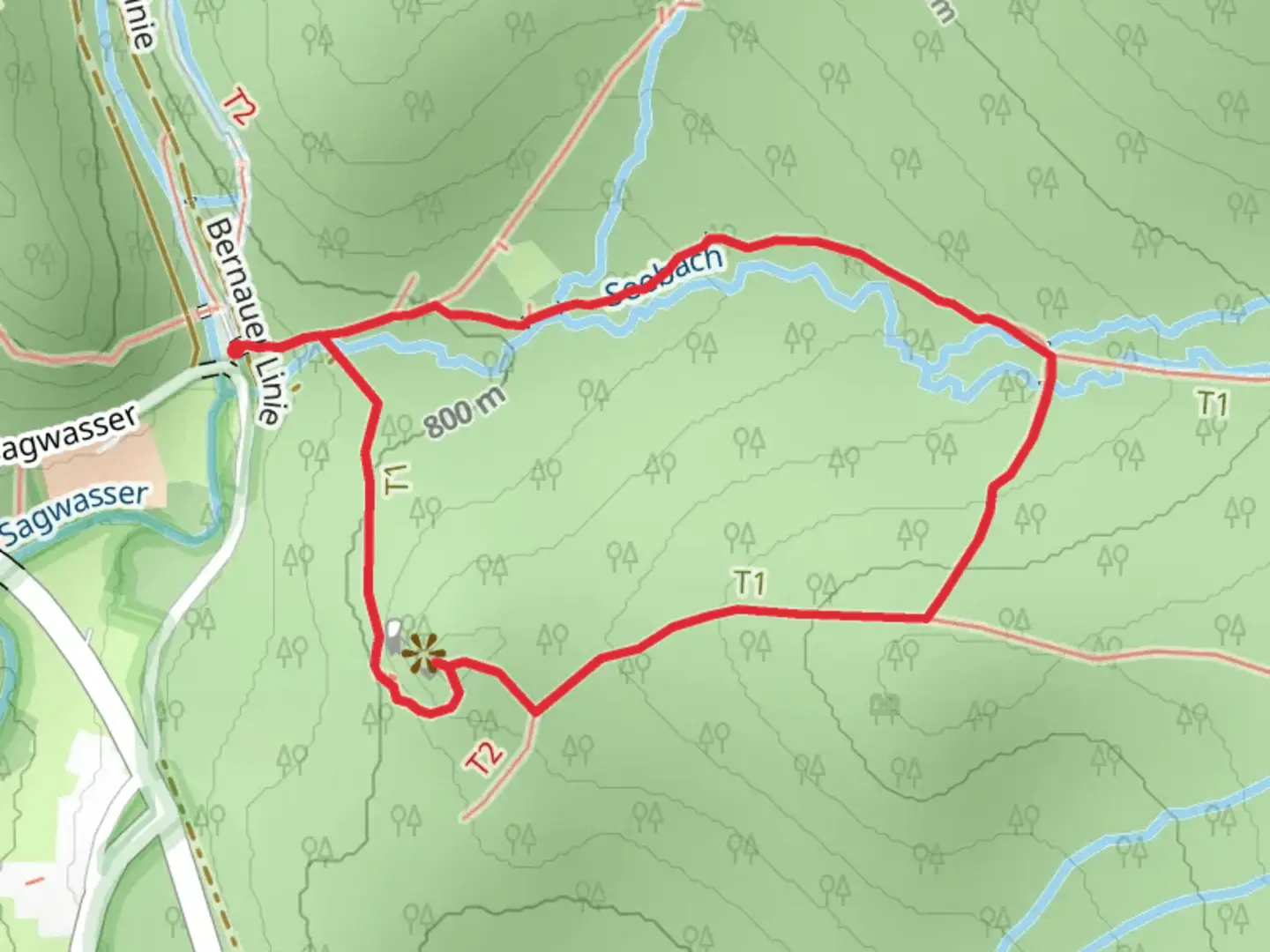
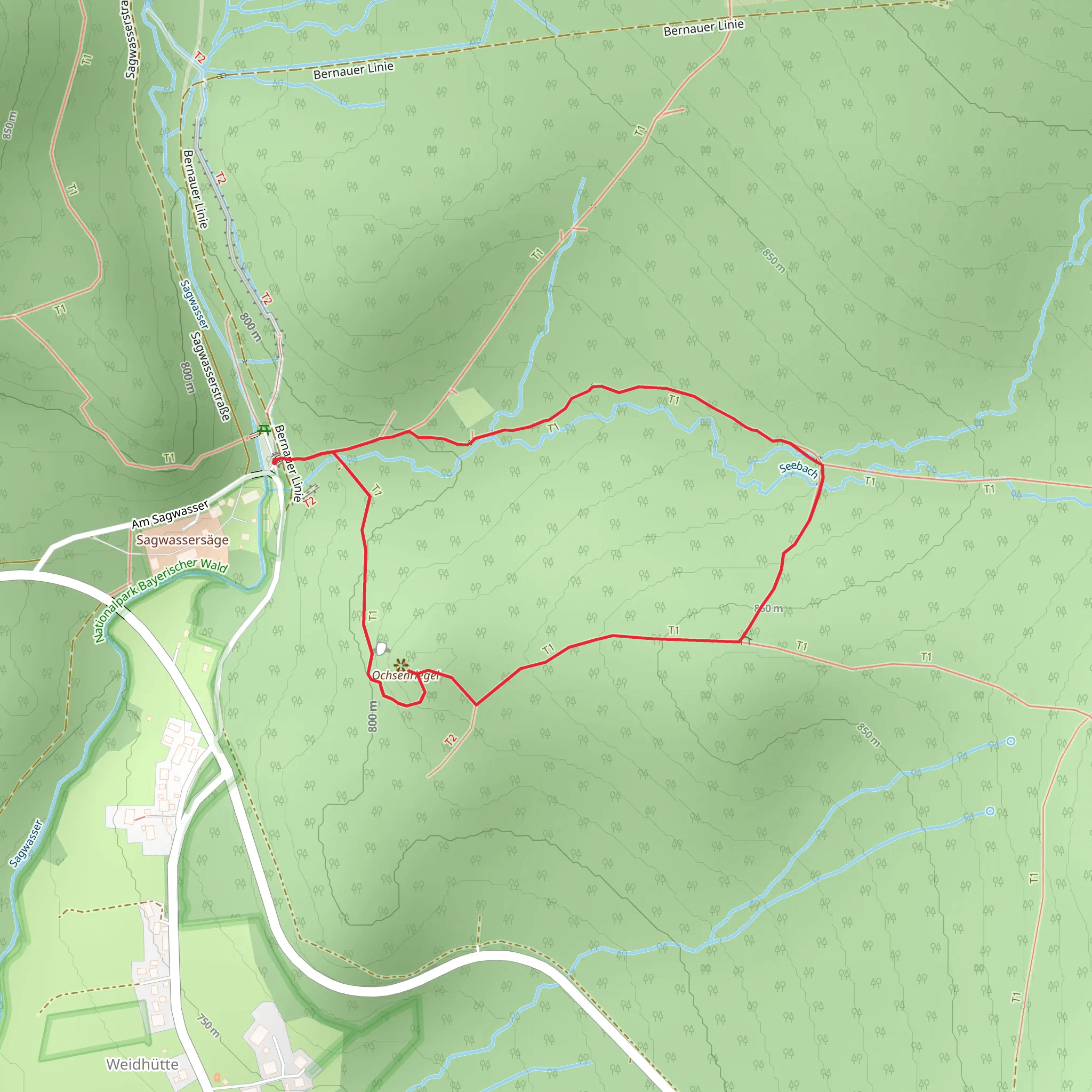
Starting near Freyung-Grafenau in Germany, this 2 km (1.24 miles) loop trail offers a delightful mix of natural beauty and moderate physical challenge. With an elevation gain of approximately 100 meters (328 feet), it is suitable for hikers with a medium level of fitness.
Getting There To reach the trailhead, you can either drive or use public transport. If driving, set your GPS to Freyung-Grafenau, and look for parking options near the town center. For those using public transport, take a train or bus to Freyung-Grafenau station. From there, it's a short walk to the trailhead.
Trail Overview The trail begins with a gentle ascent through a lush forest, where you will be greeted by the soothing sounds of the Flusskrebs stream. The initial section is relatively easy, allowing you to warm up before the more challenging parts of the hike.
Flora and Fauna As you make your way up, keep an eye out for the diverse flora and fauna. The area is home to a variety of bird species, including woodpeckers and songbirds. You might also spot deer and other small mammals. The forest floor is often carpeted with wildflowers in the spring and summer, adding a splash of color to your hike.
Significant Landmarks About 1 km (0.62 miles) into the hike, you will come across a small wooden bridge that crosses the Flusskrebs stream. This is a great spot for a quick rest and some photos. Continuing on, the trail becomes steeper as you approach the Ochsenriegel summit. The final push to the top is the most challenging part of the hike, but the panoramic views from the summit are well worth the effort.
Historical Significance The region around Freyung-Grafenau has a rich history, dating back to medieval times. The trail itself passes near several historical landmarks, including remnants of old stone walls and ancient trees that have stood the test of time. These elements add a layer of historical intrigue to your hike.
Navigation For navigation, it is highly recommended to use the HiiKER app, which provides detailed maps and real-time updates to ensure you stay on the right path. The trail is well-marked, but having a reliable navigation tool can enhance your hiking experience.
Final Stretch After reaching the summit, the trail loops back down through a different section of the forest. This part of the hike is less strenuous, allowing you to enjoy the serene environment as you descend. The loop brings you back to the starting point, completing your 2 km (1.24 miles) adventure.
This trail offers a perfect blend of natural beauty, moderate physical challenge, and historical significance, making it a rewarding experience for any hiker.
What to expect?
Activity types
Comments and Reviews
User comments, reviews and discussions about the Ochsenriegel via Flusskrebs, Germany.
4.33
average rating out of 5
3 rating(s)
