Download
Preview
Add to list
More
13.1 km
~4 hrs 8 min
917 m
Point-to-Point
“Embark on a 13 km Black Forest hike, rich in history, wildlife, and stunning panoramic views.”
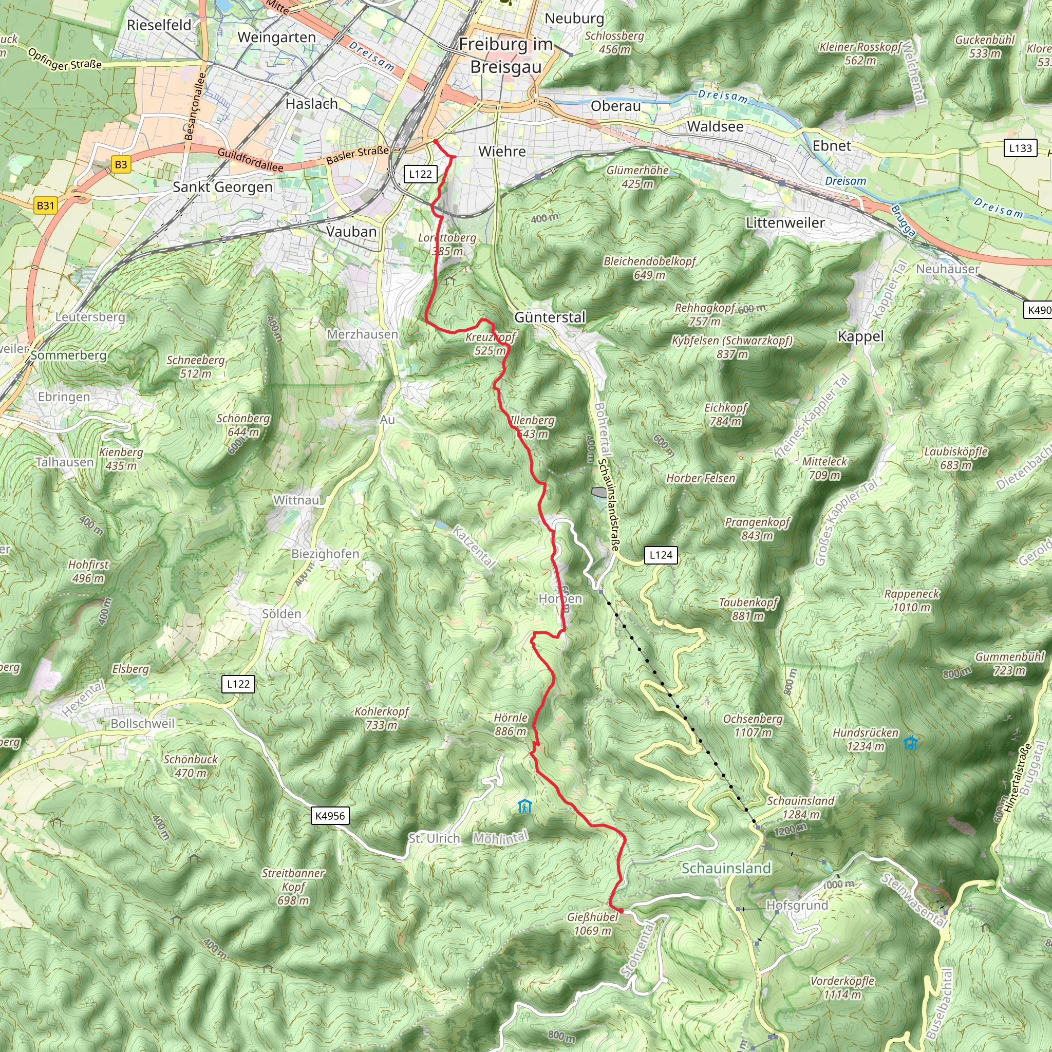
Starting near Freiburg im Breisgau, Germany, this trail stretches approximately 13 km (8 miles) with an elevation gain of around 900 meters (2,950 feet). The trailhead is conveniently located near Heinrich-von-Stephan-Straße, easily accessible by public transport or car. If you're taking public transport, Freiburg's main train station is a short walk away, making it a convenient starting point.
Initial Ascent and Forested Pathways
The trail begins with a moderate ascent, leading you through lush, dense forests typical of the Black Forest region. The initial 3 km (1.9 miles) will see you gaining about 200 meters (656 feet) in elevation. The forest is home to a variety of wildlife, including deer, foxes, and numerous bird species. Keep an eye out for the European Green Woodpecker and the Eurasian Jay, both commonly seen in this area.
Bussweg and Scenic Views
As you continue along Bussweg, the trail opens up to offer stunning panoramic views of the surrounding valleys and hills. Around the 5 km (3.1 miles) mark, you'll reach a viewpoint that provides a perfect spot for a short break and some photography. The elevation gain here is more gradual, adding another 300 meters (984 feet) over the next 4 km (2.5 miles).
Historical Significance
This region is steeped in history, with remnants of ancient Roman roads and medieval trade routes. The trail itself follows parts of these historic paths, offering a unique glimpse into the past. The Black Forest was a significant area for timber and glass production during the Middle Ages, and you might come across old charcoal kilns and glassblowing sites along the way.
Final Stretch to Gießhübel
The last 4 km (2.5 miles) of the trail involve a steeper ascent, gaining the final 400 meters (1,312 feet) in elevation. This section can be challenging, so make sure to pace yourself and stay hydrated. The trail winds through more dense forest before emerging near Gießhübel, where you'll be rewarded with breathtaking views of the surrounding landscape.
Navigation and Safety
For navigation, it's highly recommended to use HiiKER, which provides detailed maps and real-time updates. The trail is well-marked, but having a reliable navigation tool will ensure you stay on track. Be prepared for varying weather conditions, as the Black Forest can be unpredictable. Proper hiking boots, layered clothing, and sufficient water are essential.
Getting to the Trailhead
If you're driving, there are parking facilities near Heinrich-von-Stephan-Straße. For those using public transport, Freiburg's main train station is the nearest significant landmark. From there, it's a short walk to the trailhead, making it accessible for both locals and visitors.
This trail offers a mix of natural beauty, historical intrigue, and physical challenge, making it a rewarding experience for medium-level hikers.
What to expect?
Activity types
Comments and Reviews
User comments, reviews and discussions about the Heinrich-von-Stephan-Straße to Gießhübel via Bussweg, Germany.
4.0
average rating out of 5
1 rating(s)

