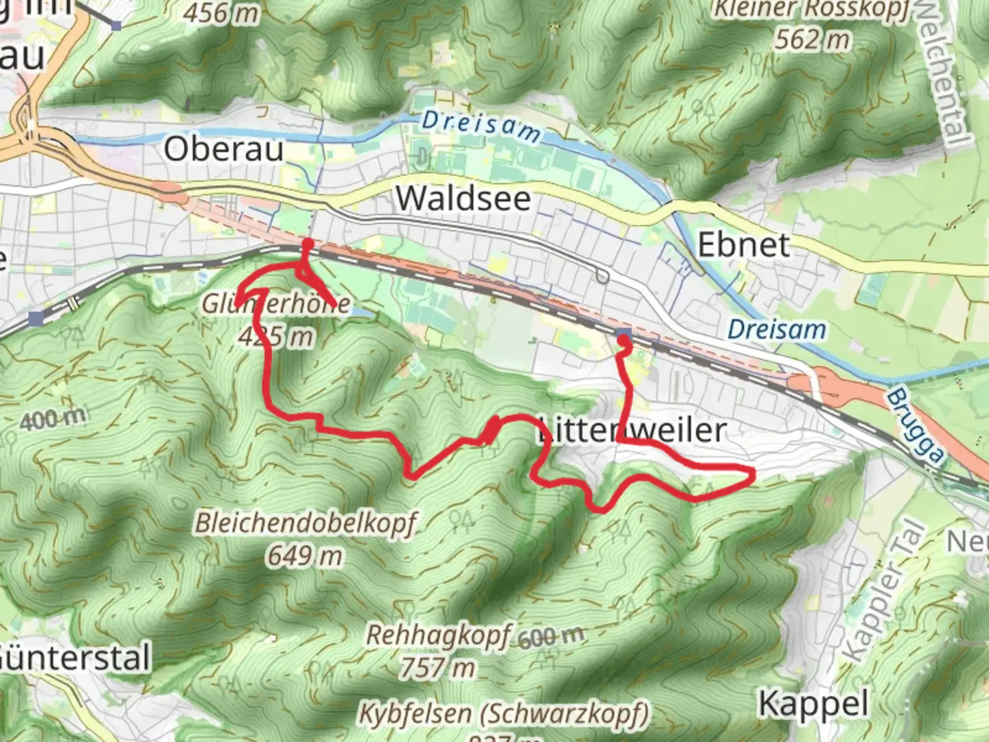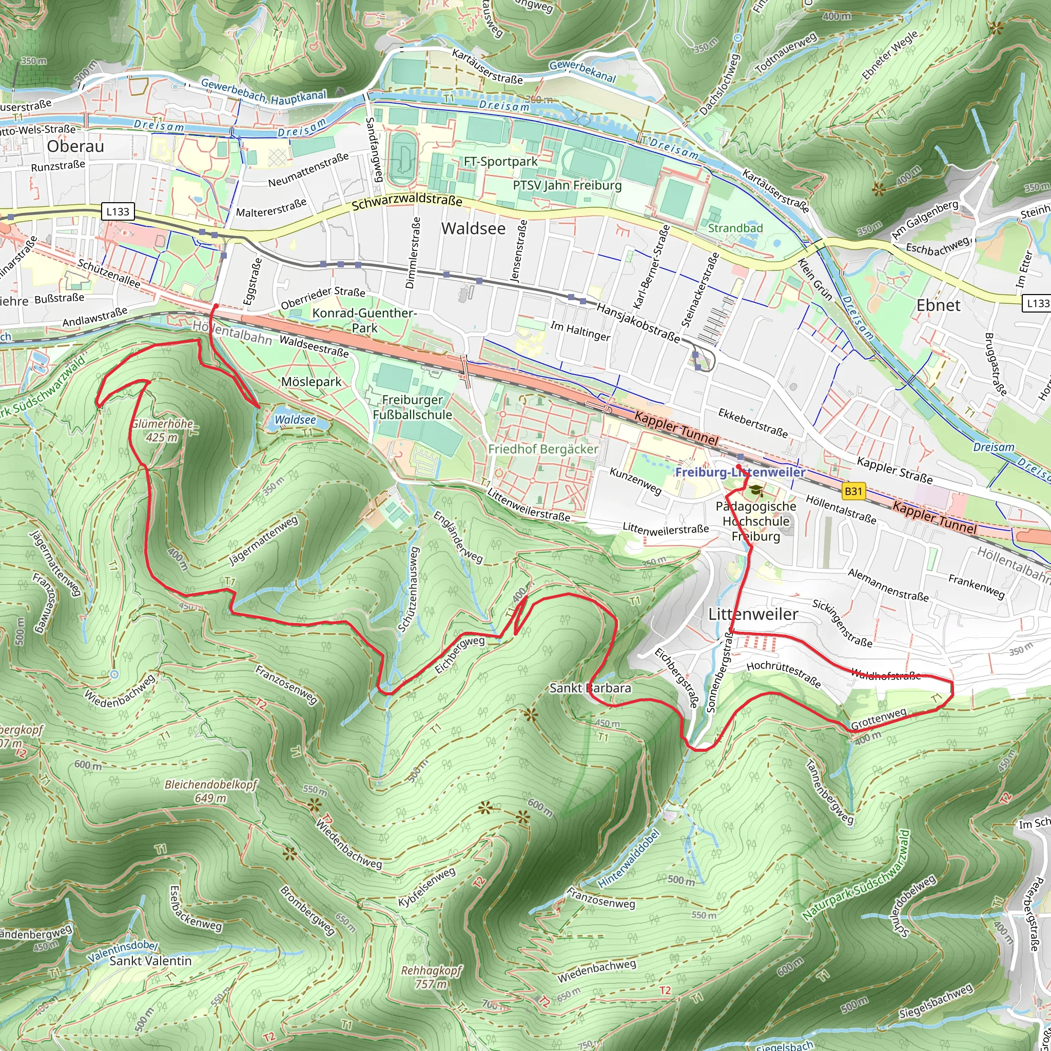
Freiburg Littenweiler to Stadthalle via Sagemaennleweg
Download
Preview
Add to list
More
7.2 km
~2 hrs 3 min
372 m
Point-to-Point
“Experience a scenic, history-rich 7-kilometer hike from Freiburg im Breisgau through lush forests and panoramic views.”
Starting near Freiburg im Breisgau, Germany, this trail stretches approximately 7 kilometers (4.3 miles) and offers an elevation gain of around 300 meters (984 feet). The trailhead is conveniently accessible by public transport or car. If you're using public transport, you can take a tram or bus to the Littenweiler area, specifically near the Freiburg-Littenweiler train station. For those driving, there are parking facilities available near the trailhead.
Initial Ascent and Forest Path
The trail begins with a moderate ascent through a lush forested area. The initial climb is steady but manageable, gaining about 150 meters (492 feet) in the first 2 kilometers (1.2 miles). The path is well-marked and primarily consists of dirt and gravel, making it suitable for most hikers. As you ascend, you'll be surrounded by dense woodland, primarily composed of beech and oak trees. Keep an eye out for local wildlife such as deer and various bird species, which are commonly spotted in this area.
Sagemaennleweg and Scenic Views
Around the 3-kilometer (1.9-mile) mark, you'll reach the Sagemaennleweg section of the trail. This part is particularly scenic, offering panoramic views of the surrounding Black Forest region. The trail here is relatively flat, allowing you to catch your breath and take in the stunning vistas. There are several benches along this stretch where you can rest and enjoy the scenery. The Sagemaennleweg is also known for its historical significance, as it was once a route used by local woodcutters, known as "Sägemännle," hence the name.
Descent Towards Stadthalle
After enjoying the views, the trail begins its descent towards Stadthalle. This section is about 4 kilometers (2.5 miles) long and involves a gradual decline of approximately 150 meters (492 feet). The path here is a mix of forest trails and open meadows, providing a diverse hiking experience. As you approach Stadthalle, you'll pass through several small clearings that offer additional viewpoints of the surrounding landscape.
Historical and Cultural Highlights
The region around Freiburg im Breisgau is rich in history and culture. Freiburg itself is known for its medieval architecture, including the iconic Freiburg Minster, a Gothic cathedral that dates back to the 13th century. The trail also passes near several historical landmarks, including remnants of old farmhouses and traditional Black Forest cottages. These structures offer a glimpse into the rural life of the region's past inhabitants.
Final Stretch and Arrival at Stadthalle
The final stretch of the trail leads you into the urban area of Stadthalle. This part of the hike is relatively easy, with well-maintained paths and clear signage. Stadthalle is a bustling area with various amenities, including cafes, restaurants, and shops, making it a great place to relax and unwind after your hike. If you need to return to Freiburg im Breisgau, public transport options are readily available from Stadthalle.
Navigation and Safety Tips
For navigation, it's highly recommended to use the HiiKER app, which provides detailed maps and real-time updates. Ensure you have adequate water and snacks, as there are limited facilities along the trail. Wear sturdy hiking boots, especially given the mixed terrain and elevation changes. Always check the weather forecast before setting out, as conditions can change rapidly in the Black Forest region.
What to expect?
Activity types
Comments and Reviews
User comments, reviews and discussions about the Freiburg Littenweiler to Stadthalle via Sagemaennleweg, Germany.
4.83
average rating out of 5
6 rating(s)
