Download
Preview
Add to list
More
12.7 km
~2 hrs 59 min
266 m
Point-to-Point
“Embark on a 13 km journey through scenic landscapes and historical markers, perfect for moderate hikers.”
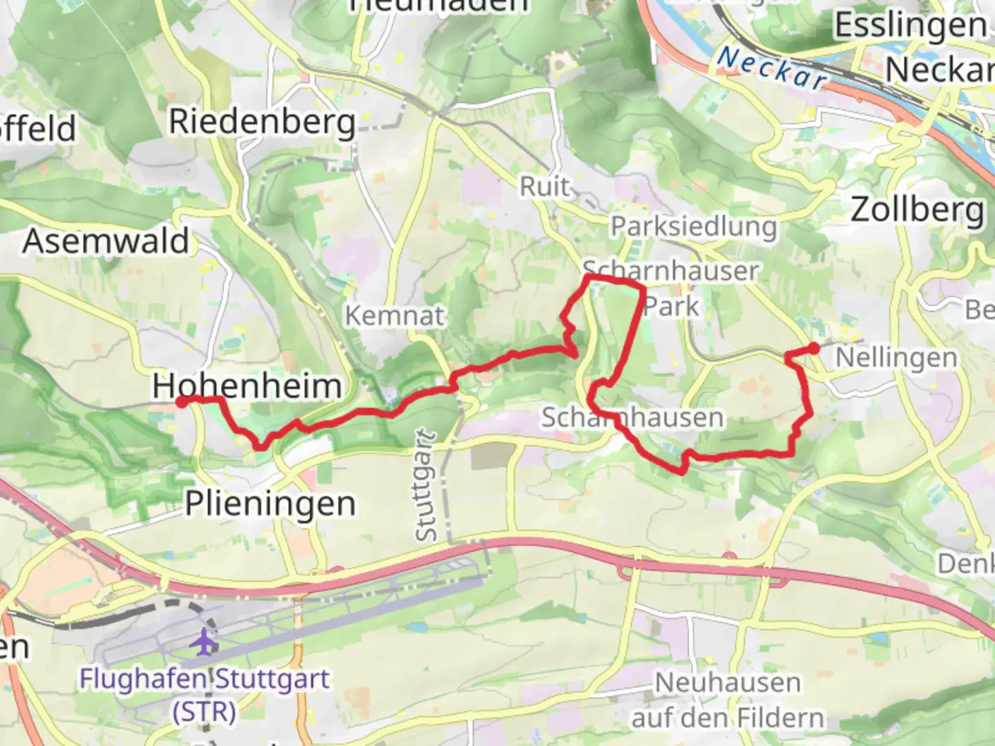
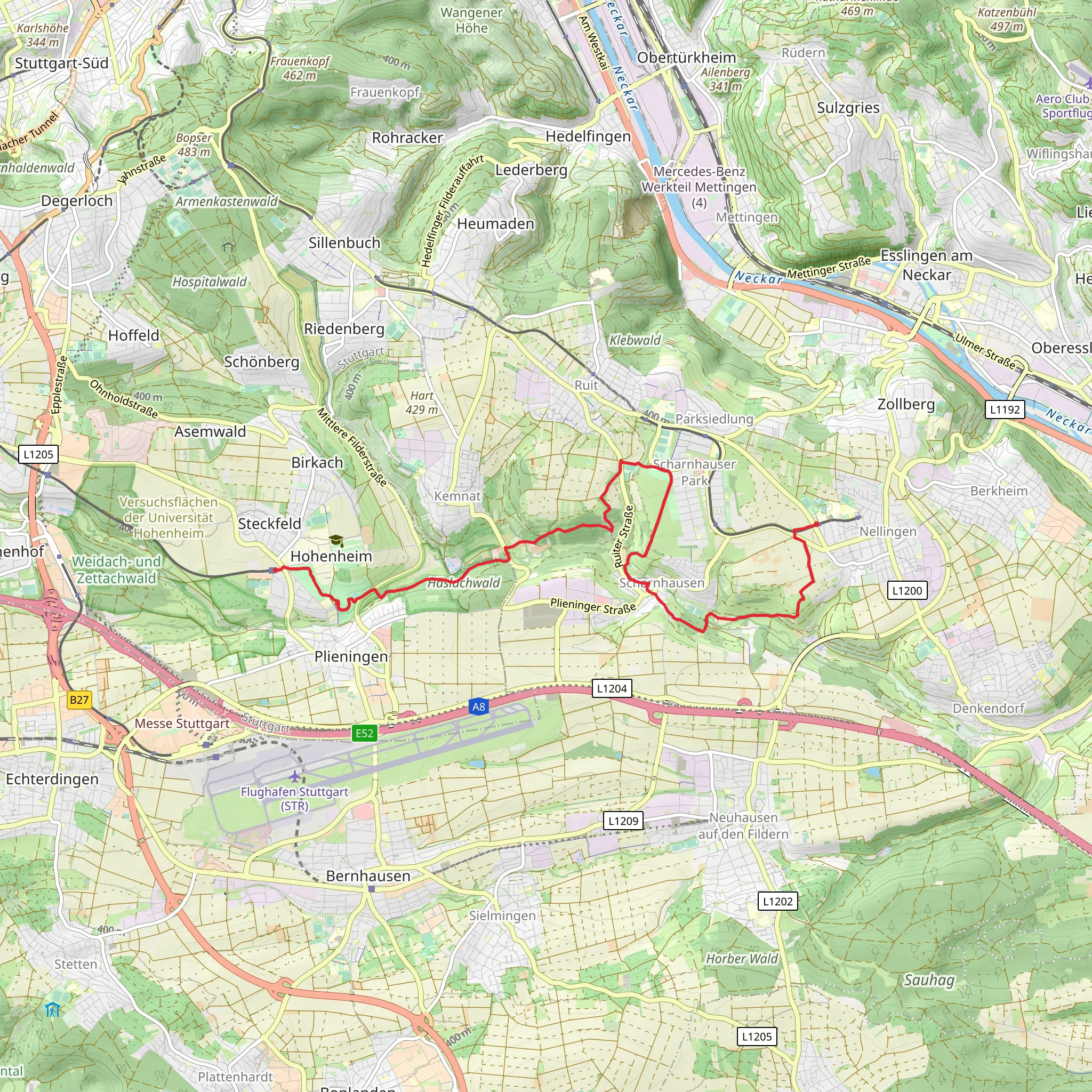
Starting near the Technische Akademie in Nellingen, this 13 km (approximately 8 miles) trail offers a delightful journey through the scenic landscapes of the Esslingen region in Germany. With an elevation gain of around 200 meters (656 feet), the trail is rated as medium difficulty, making it suitable for moderately experienced hikers.
Getting There To reach the trailhead, you can take public transport from Stuttgart to Esslingen. From Esslingen, local buses will take you to Nellingen, where the Technische Akademie is located. If you prefer to drive, there is parking available near the academy.
Trail Overview The trail begins at the Technische Akademie in Nellingen, a significant educational institution in the region. As you start your hike, you'll traverse through a mix of urban and rural landscapes, offering a unique blend of modernity and nature.
Key Landmarks and Sections
#### Nellingen to Koersch The first section of the trail takes you from Nellingen to the small village of Koersch. This part of the hike is relatively flat, with gentle inclines that gradually prepare you for the more challenging sections ahead. Along the way, you'll pass through lush meadows and dense forests, home to a variety of wildlife including deer and numerous bird species. Keep an eye out for the charming half-timbered houses that are characteristic of this region.
#### Koersch to Plieningen From Koersch, the trail begins to ascend more noticeably as you head towards Plieningen. This section offers panoramic views of the surrounding countryside, especially as you reach higher elevations. The trail winds through mixed woodlands, where you might spot wild boar and foxes if you're lucky. The forested areas provide ample shade, making this part of the hike particularly pleasant during warmer months.
Historical Significance The region around Esslingen is steeped in history, dating back to Roman times. As you hike, you'll come across several historical markers and ruins that tell the story of the area's rich past. Esslingen itself is known for its well-preserved medieval architecture, and the influence of this history extends into the surrounding countryside.
Navigation and Safety Given the moderate difficulty of the trail, it's advisable to use a reliable navigation tool like HiiKER to ensure you stay on track. The trail is well-marked, but having a digital map can be very helpful, especially in the more remote sections. Make sure to carry enough water and snacks, as there are limited facilities along the route.
Flora and Fauna The trail offers a diverse range of flora and fauna. In spring and summer, the meadows are awash with wildflowers, while the forests are home to ancient oaks and beeches. Birdwatchers will find plenty to keep them occupied, with species such as the European robin, blackbird, and various types of woodpeckers commonly spotted.
Final Stretch to Plieningen As you approach Plieningen, the trail descends gently, offering a relaxing end to your hike. Plieningen is a picturesque village with several cafes and restaurants where you can rest and refuel. The village is also home to the University of Hohenheim, known for its beautiful botanical gardens, which are worth a visit if you have time.
This trail from Nellingen Technische Akademie to Plieningen via Koersch provides a perfect blend of natural beauty, historical intrigue, and moderate physical challenge, making it a rewarding experience for any hiker.
What to expect?
Activity types
Comments and Reviews
User comments, reviews and discussions about the Nellingen Technische Akademie to Plieningen via Koersch, Germany.
4.67
average rating out of 5
6 rating(s)
