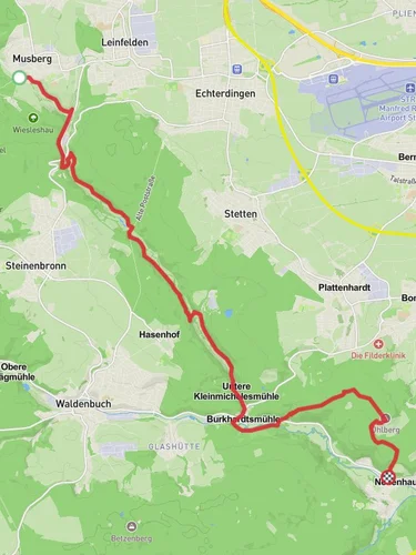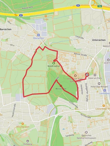
8.0 km
~1 hrs 57 min
210 m
“Explore Esslingen's lush landscapes and rich history on this 8 km medium-difficulty loop trail.”
Starting near Esslingen, Germany, this 8 km (approximately 5 miles) loop trail offers a delightful mix of natural beauty and historical intrigue. With an elevation gain of around 200 meters (656 feet), it is rated as a medium difficulty hike, suitable for those with a moderate level of fitness.
### Getting There To reach the trailhead, you can either drive or use public transport. If driving, set your GPS to Freibadstraße, Esslingen. For those using public transport, take a train to Esslingen am Neckar station. From there, local buses can take you closer to the trailhead, with the nearest stop being at Freibadstraße.
### Trail Overview The trail begins near Freibadstraße and quickly immerses you in the lush greenery of the region. As you start, you'll notice the well-marked path that guides you through a mix of forested areas and open fields. The initial part of the trail is relatively flat, making it a good warm-up for the more challenging sections ahead.
### Significant Landmarks and Nature About 2 km (1.2 miles) into the hike, you'll come across the Sindelfinger Spitzweg, a notable landmark that offers panoramic views of the surrounding countryside. This is a great spot to take a break and enjoy the scenery. The trail then continues through a dense forest, where you might spot local wildlife such as deer, foxes, and a variety of bird species.
### Historical Significance The region around Esslingen is steeped in history, dating back to Roman times. As you hike, you'll pass by several historical markers and ruins that tell the story of the area's rich past. One such site is the remnants of an old Roman road, located approximately 4 km (2.5 miles) into the hike. This ancient pathway once connected various settlements and is a fascinating glimpse into the region's historical significance.
### Elevation and Terrain The trail features a gradual ascent, with the most significant elevation gain occurring between the 3 km (1.9 miles) and 5 km (3.1 miles) marks. Here, the path becomes steeper and more rugged, requiring careful footing. However, the effort is well worth it as you reach the highest point of the trail, offering stunning views of the Swabian Alps in the distance.
### Navigation and Safety To ensure you stay on track, it's advisable to use the HiiKER app, which provides detailed maps and real-time navigation. The trail is well-marked, but having a reliable navigation tool can enhance your hiking experience and provide peace of mind.
### Final Stretch The descent begins around the 6 km (3.7 miles) mark, leading you back through a series of meadows and small streams. This section is less strenuous and allows for a leisurely walk back to the starting point. Keep an eye out for wildflowers and other flora that are abundant in this part of the trail.
### Wildlife and Flora Throughout the hike, you'll encounter a diverse range of plant life, from towering oak and beech trees to vibrant wildflowers. The area is also home to various wildlife species, so be sure to tread lightly and respect their natural habitat.
This trail offers a perfect blend of natural beauty, historical landmarks, and moderate physical challenge, making it an ideal choice for a day hike near Esslingen.
Reviews
User comments, reviews and discussions about the Freibadstraße via Sindelfinger Spitzweg, Germany.
5.0
average rating out of 5
4 rating(s)


