Download
Preview
Add to list
More
13.4 km
~2 hrs 59 min
184 m
Loop
“Explore 13 km of lush trails, historical landmarks, and stunning vistas near Essen, Germany.”
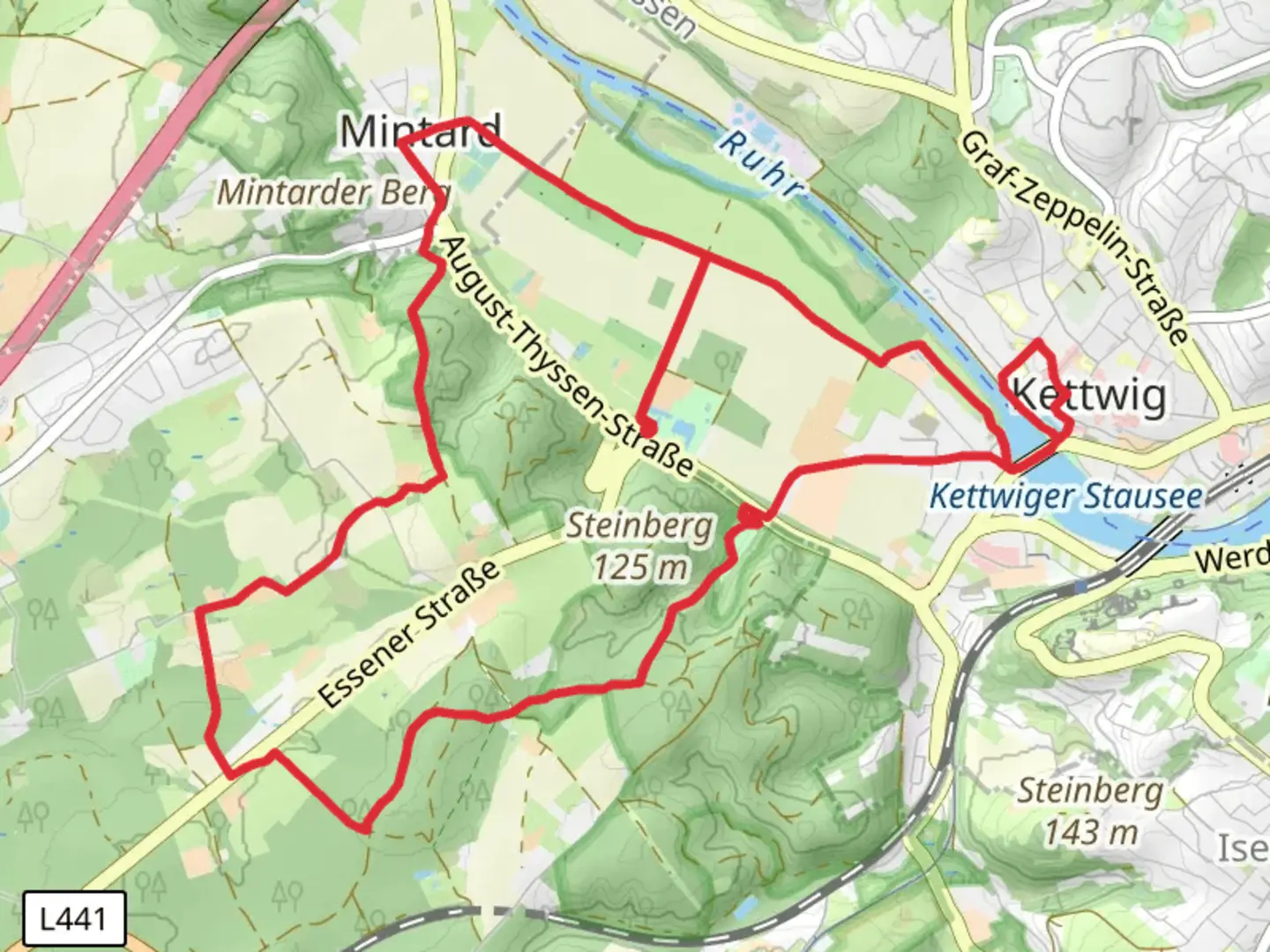
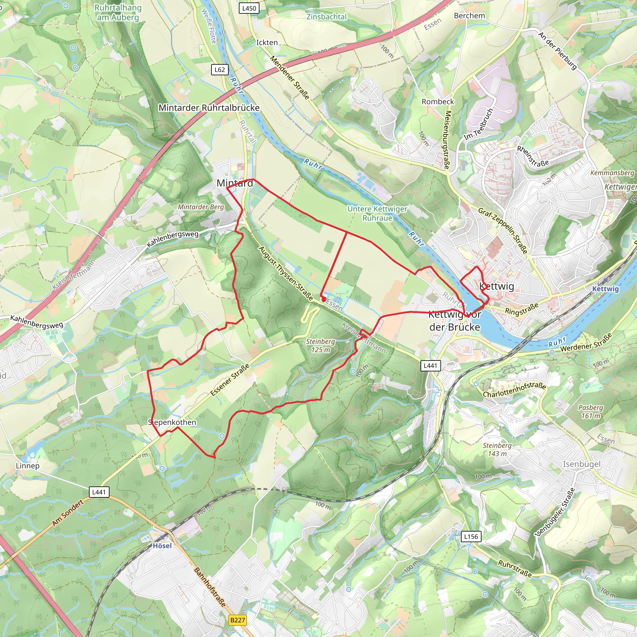
Starting near Essen, Germany, the Mintarder Weg, Ruhrhöhenweg, and Mintarder Weg loop trail spans approximately 13 kilometers (8 miles) with an elevation gain of around 100 meters (328 feet). This medium-difficulty trail offers a rich blend of natural beauty, historical landmarks, and diverse wildlife, making it a rewarding experience for hikers.
Getting There To reach the trailhead, you can either drive or use public transport. If driving, set your GPS to the nearest significant landmark, which is the Essen-Werden train station. From there, it's a short drive to the trailhead. For those using public transport, take a train to Essen-Werden station and then a local bus or taxi to the starting point.
Trail Overview The loop trail begins near Essen and takes you through a variety of landscapes, including dense forests, open meadows, and scenic riverbanks. The trail is well-marked, but it's advisable to use HiiKER for navigation to ensure you stay on the correct path.
Key Sections and Landmarks
#### Mintarder Weg Starting from the trailhead, the first section of the trail, Mintarder Weg, takes you through lush forests and along the banks of the Ruhr River. This part of the trail is relatively flat, making it a good warm-up for the more challenging sections ahead. Keep an eye out for local wildlife such as deer and various bird species. After approximately 4 kilometers (2.5 miles), you'll reach the historic Mintarder Brücke, a bridge that dates back to the early 20th century.
#### Ruhrhöhenweg As you transition to the Ruhrhöhenweg section, the trail begins to ascend, offering panoramic views of the Ruhr Valley. This section is about 5 kilometers (3.1 miles) long and includes the majority of the elevation gain. The climb is gradual but steady, so take your time and enjoy the vistas. Along the way, you'll pass by the ruins of an old castle, Burg Altendorf, which offers a glimpse into the region's medieval past.
#### Return via Mintarder Weg The final section of the loop brings you back via a different part of Mintarder Weg. This 4-kilometer (2.5-mile) stretch is mostly downhill, making for a pleasant and easy return to the trailhead. You'll pass through open meadows and small villages, where you can stop for a rest or a snack. The trail eventually loops back to where you started, completing the 13-kilometer (8-mile) journey.
Historical Significance The region around Essen has a rich history, particularly related to the industrial revolution. The Ruhr Valley was once the heart of Germany's coal and steel industries. While much of the heavy industry has disappeared, the area retains numerous historical landmarks, including old factories and worker settlements, which you can spot along the trail.
Wildlife and Nature The trail offers a diverse range of flora and fauna. In the forested sections, you'll find oak, beech, and pine trees, while the meadows are home to wildflowers and grasses. Wildlife is abundant, with deer, foxes, and a variety of bird species commonly seen. The Ruhr River also supports a healthy fish population, making it a popular spot for local anglers.
Preparation Tips Given the moderate difficulty of the trail, it's advisable to wear sturdy hiking boots and bring plenty of water. The trail is well-marked, but using HiiKER for navigation will help you stay on track. Weather can be unpredictable, so pack a rain jacket and check the forecast before heading out. There are a few spots along the trail where you can stop for a picnic, so consider bringing some snacks or a packed lunch.
This trail offers a perfect blend of natural beauty, historical intrigue, and moderate physical challenge, making it an excellent choice for a day hike near Essen.
What to expect?
Activity types
Comments and Reviews
User comments, reviews and discussions about the Mintarder Weg, Ruhrhöhenweg and Mintarder Weg, Germany.
5.0
average rating out of 5
3 rating(s)
