14.6 km
~3 hrs 27 min
322 m
“Explore Erzgebirgskreis's scenic trails and rich history, perfect for moderately experienced nature enthusiasts.”
Nestled in the picturesque Erzgebirgskreis region of Germany, this 15 km (approximately 9.3 miles) loop trail offers a delightful blend of natural beauty and historical intrigue. With an elevation gain of around 300 meters (approximately 984 feet), the trail is rated as medium difficulty, making it suitable for moderately experienced hikers seeking a rewarding day out in nature.
### Getting There
The trailhead is conveniently located near the town of Erzgebirgskreis. For those traveling by car, ample parking is available near the starting point. If you prefer public transport, the nearest major town is Chemnitz, from where you can take a regional train to the town of Annaberg-Buchholz. From Annaberg-Buchholz, local buses or a short taxi ride will bring you to the trailhead.
### Trail Highlights
#### Lehmergrund Valley
As you embark on the trail, you'll first encounter the serene Lehmergrund Valley. This area is characterized by its lush greenery and the gentle babbling of streams that accompany you along the path. The valley is a haven for birdwatchers, with species such as the European robin and the Eurasian blue tit frequently spotted flitting among the trees.
#### Butterweg Path
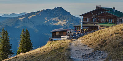
Continuing along the loop, you'll transition onto the Butterweg Path. This section of the trail is known for its rolling hills and expansive views of the surrounding Erzgebirge Mountains. The landscape here is dotted with wildflowers in the warmer months, providing a vibrant tapestry of colors. Keep an eye out for the occasional deer or fox, which are known to inhabit the area.
### Historical Significance
The Erzgebirge region, also known as the Ore Mountains, has a rich mining history dating back to the 12th century. As you hike, you'll pass remnants of old mining operations, including abandoned shafts and equipment, which serve as a testament to the area's industrious past. The trail itself follows some of the old paths used by miners, offering a tangible connection to the region's heritage.
### Navigation and Safety
To ensure a smooth hiking experience, it's advisable to use the HiiKER app for navigation. The trail is well-marked, but having a digital map can provide additional reassurance. Be prepared for some uneven terrain, particularly in the more forested sections of the trail. It's also wise to carry sufficient water and snacks, as there are limited facilities along the route.
### Flora and Fauna
The trail is a botanical delight, with a variety of plant species thriving in the diverse microclimates of the region. In spring and summer, the meadows burst into bloom with daisies, buttercups, and orchids. The forested areas are home to towering beech and spruce trees, providing ample shade and a cool respite on warmer days.
### Final Stretch
As you near the end of the loop, the trail descends gently back towards the starting point, offering panoramic views of the Erzgebirgskreis landscape. This final stretch is a perfect opportunity to reflect on the day's journey and soak in the tranquil beauty of the region.
Reviews
User comments, reviews and discussions about the Lehmergrund and Butterweg Loop, Germany.
0.0
average rating out of 5
0 rating(s)


