Download
Preview
Add to list
More
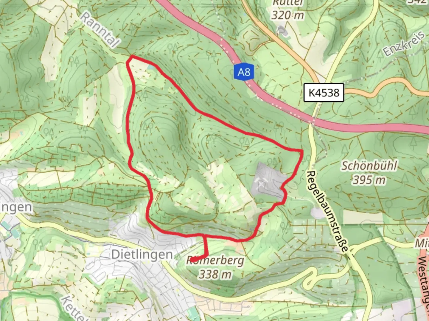
7.9 km
~2 hrs 1 min
266 m
Loop
“Explore the Steinbruch and Hagenreut Loop: an 8 km trail with stunning scenery, history, and moderate challenges.”
Starting near Enzkreis, Germany, the Steinbruch and Hagenreut Loop is an 8 km (approximately 5 miles) trail with an elevation gain of around 200 meters (656 feet). This loop trail is rated as medium difficulty, making it suitable for hikers with some experience.
Getting There
To reach the trailhead, you can drive or use public transportation. If driving, set your GPS to Enzkreis, Germany, and look for parking near the trailhead. For those using public transport, the nearest significant landmark is the Enzkreis train station. From there, you can take a local bus or taxi to the trailhead.
Trail Navigation
For navigation, it is highly recommended to use the HiiKER app, which provides detailed maps and real-time updates. This will help you stay on track and make the most of your hike.
Trail Highlights
The trail begins with a gentle ascent through a mixed forest, offering a serene environment filled with the sounds of birds and rustling leaves. After about 1 km (0.6 miles), you will come across the first significant landmark, an old quarry known as Steinbruch. This area is rich in geological history, showcasing layers of sedimentary rock that tell the story of the region's ancient past.
Flora and Fauna
As you continue, the trail meanders through diverse landscapes, including dense woodlands and open meadows. Keep an eye out for local wildlife such as deer, foxes, and a variety of bird species. The flora is equally diverse, with wildflowers blooming in the spring and summer months, adding a splash of color to your hike.
Historical Significance
Around the 4 km (2.5 miles) mark, you will reach Hagenreut, an area steeped in history. This section of the trail passes by remnants of old settlements and agricultural terraces, offering a glimpse into the lives of those who inhabited the region centuries ago. Informational plaques along the way provide context and enrich your understanding of the area's historical significance.
Elevation and Terrain
The trail features a mix of terrains, including dirt paths, rocky sections, and occasional steep inclines. The total elevation gain is around 200 meters (656 feet), with the most challenging sections occurring between the 3 km (1.8 miles) and 5 km (3.1 miles) marks. These inclines offer rewarding views of the surrounding landscape, making the effort well worth it.
Final Stretch
As you approach the final 2 km (1.2 miles) of the loop, the trail descends gradually, leading you back through lush forests and past small streams. This section is relatively easy, allowing you to cool down and reflect on the hike as you make your way back to the trailhead.
Practical Tips
- Wear sturdy hiking boots, as some sections can be rocky and uneven.
- Bring plenty of water and snacks, especially if you plan to take breaks and enjoy the scenery.
- Check the weather forecast before heading out, as conditions can change rapidly.
- Use the HiiKER app for real-time navigation and updates.
This trail offers a balanced mix of natural beauty, historical intrigue, and moderate physical challenge, making it a rewarding experience for those who venture out to explore it.

What to expect?
Activity types
Comments and Reviews
User comments, reviews and discussions about the Steinbruch and Hagenreut Loop, Germany.
4.5
average rating out of 5
2 rating(s)