Download
Preview
Add to list
More
5.2 km
~1 hrs 34 min
323 m
Loop
“The Die Rinne and Herrnweg Loop offers a scenic 5 km hike with historical landmarks and diverse wildlife.”
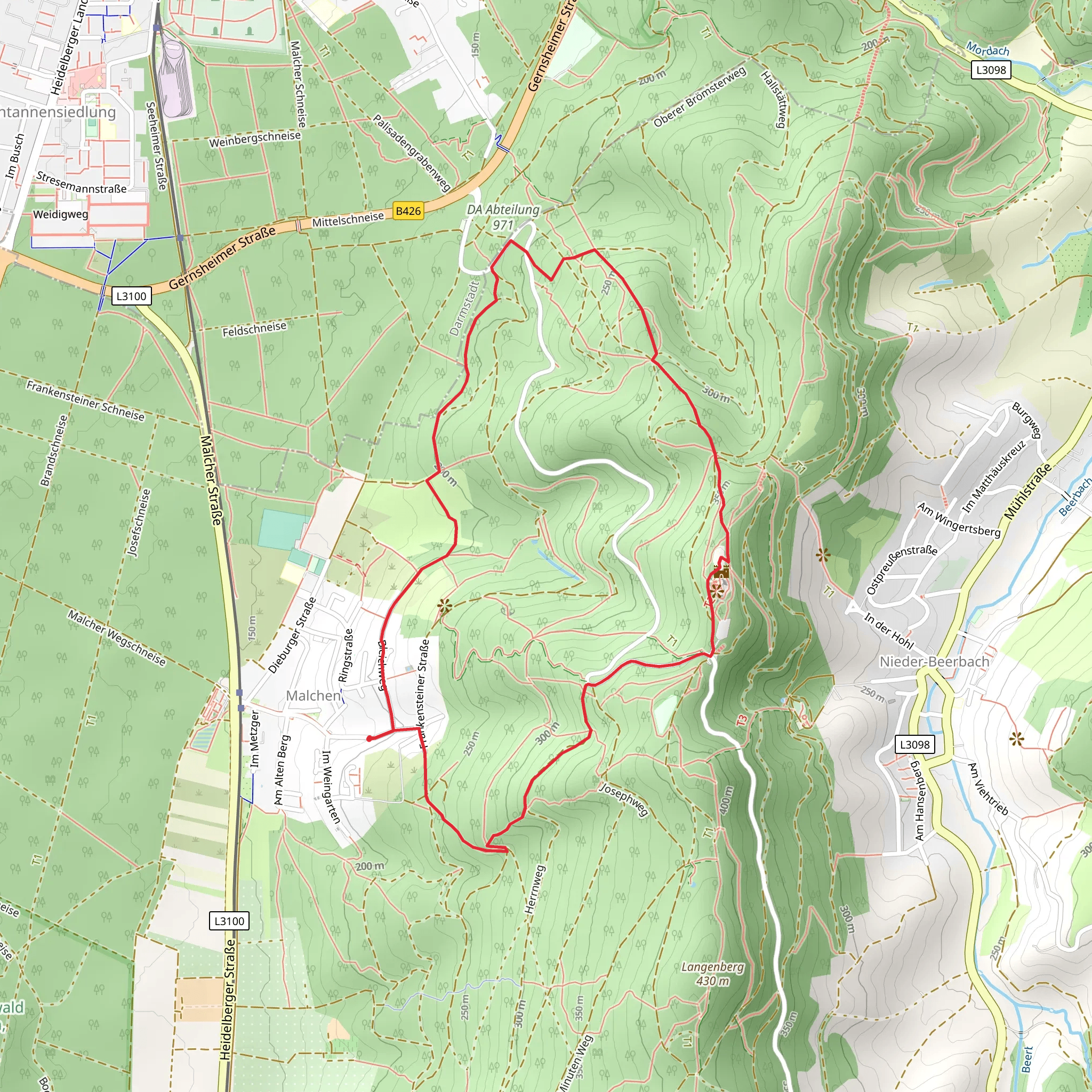
Starting near Darmstadt-Dieburg, Germany, the Die Rinne and Herrnweg Loop is a delightful 5 km (3.1 miles) trail with an elevation gain of approximately 300 meters (984 feet). This loop trail is rated as medium difficulty, making it suitable for moderately experienced hikers.
Getting There To reach the trailhead, you can either drive or use public transport. If driving, set your GPS to the vicinity of Darmstadt-Dieburg. For those using public transport, take a train to Darmstadt Hauptbahnhof and then a local bus towards Dieburg. The nearest significant landmark to the trailhead is the Darmstadt-Dieburg district, which is well-connected by both road and rail.
Trail Overview The trail begins with a gentle ascent through a mixed forest, offering a serene start to your hike. As you progress, the path becomes steeper, leading you through dense woodland areas rich with oak and beech trees. The first significant landmark you'll encounter is an old stone bridge, approximately 1 km (0.6 miles) into the hike. This bridge dates back to the 19th century and offers a picturesque spot for a brief rest.
Flora and Fauna The trail is abundant with local flora and fauna. Keep an eye out for wildflowers such as wood anemones and bluebells in the spring. Birdwatchers will be delighted by the presence of species like the European robin and the great spotted woodpecker. Small mammals such as red squirrels and hedgehogs are also commonly seen along the trail.
Midway Point: Die Rinne Around the 2.5 km (1.55 miles) mark, you'll reach Die Rinne, a narrow ravine that gives the trail its name. This section is particularly scenic, with moss-covered rocks and a small stream running through it. The elevation gain here is about 150 meters (492 feet), making it the steepest part of the hike. Use caution as the path can be slippery, especially after rain.
Herrnweg Section After navigating through Die Rinne, the trail levels out as you enter the Herrnweg section. This part of the trail is more open, with fewer trees and more expansive views of the surrounding countryside. Historical markers along this section indicate the route of an old trade path used during medieval times. These markers provide a fascinating glimpse into the region's history and are worth a moment's pause.
Final Stretch The last 1 km (0.6 miles) of the trail descends gradually back towards the trailhead. This section is less challenging, allowing you to enjoy the final moments of your hike at a leisurely pace. As you near the end, you'll pass by a small pond, a perfect spot for a final rest and reflection on your journey.
Navigation For navigation, it's highly recommended to use the HiiKER app, which provides detailed maps and real-time updates to ensure you stay on track. The trail is well-marked, but having a reliable navigation tool can enhance your hiking experience.
This loop trail offers a balanced mix of natural beauty, historical significance, and moderate physical challenge, making it a rewarding hike for those looking to explore the scenic landscapes near Darmstadt-Dieburg.
What to expect?
Activity types
Comments and Reviews
User comments, reviews and discussions about the Die Rinne and Herrnweg Loop, Germany.
4.8
average rating out of 5
5 rating(s)

