Download
Preview
Add to list
More
9.2 km
~2 hrs 35 min
454 m
Loop
“Explore diverse landscapes and historical landmarks on this scenic 9 km hike near Cochem-Zell, Germany.”
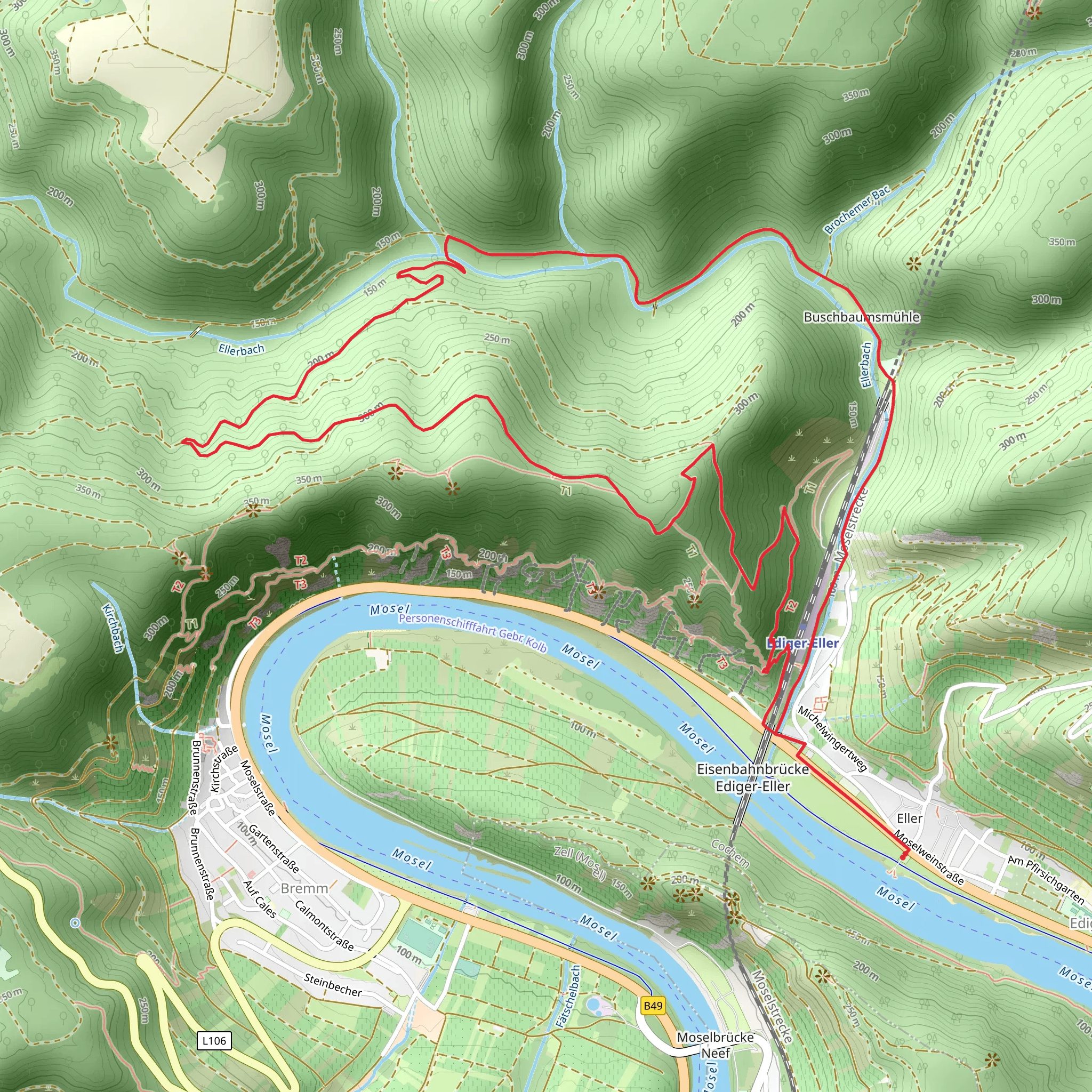
Starting near the picturesque town of Cochem-Zell in Germany, this 9 km (5.6 miles) loop trail offers a moderately challenging hike with an elevation gain of approximately 400 meters (1,312 feet). The trailhead is conveniently accessible by both car and public transport. If you're driving, you can park near the Ediger-Eller train station, which is also the nearest significant landmark for those arriving by train.
Getting There For those using public transport, take a train to Ediger-Eller station. From there, it's a short walk to the trailhead. If you're driving, follow the signs to Ediger-Eller and park near the train station. The trailhead is well-marked and easy to find.
Trail Overview The loop trail takes you through a variety of landscapes, including dense forests, open meadows, and steep vineyards. The first section of the trail ascends gradually, offering stunning views of the Moselle River and the surrounding valley. As you climb, you'll pass through the Calmont region, known for its steep vineyards, which are among the steepest in Europe.
Key Landmarks and Points of Interest - **Calmont Klettersteig**: Around 2 km (1.2 miles) into the hike, you'll encounter the Calmont Klettersteig, a via ferrata section that offers an exhilarating experience for those who are up for the challenge. This section is optional and can be bypassed if you're not comfortable with heights. - **Cochem Castle**: Approximately 4 km (2.5 miles) into the hike, you'll have a clear view of the iconic Cochem Castle perched on a hilltop. This medieval castle dates back to the 11th century and is a significant historical landmark in the region. - **Ellerwald Forest**: As you continue, you'll enter the Ellerwald Forest, a dense woodland area that provides a cool, shaded respite. This section is particularly beautiful in the autumn when the leaves change color. - **Kunderkopf Summit**: The highest point of the trail is the Kunderkopf summit, located around 6 km (3.7 miles) into the hike. From here, you'll have panoramic views of the Moselle Valley and the surrounding hills.
Flora and Fauna The trail is rich in biodiversity. In the spring and summer, you'll see a variety of wildflowers, including orchids and lilies. The forested sections are home to deer, foxes, and a variety of bird species. Keep an eye out for the rare black stork, which nests in the area.
Trail Conditions and Safety The trail is well-marked, but it's advisable to use a reliable navigation tool like HiiKER to ensure you stay on track. The terrain can be rocky and uneven, so sturdy hiking boots are recommended. During the wetter months, some sections can be slippery, so take extra caution.
Historical Significance The region has a rich history dating back to Roman times. The steep vineyards of Calmont have been cultivated for centuries, and the area is renowned for its Riesling wines. The trail also passes near several historical sites, including remnants of Roman fortifications and medieval castles.
Final Stretch The final section of the trail descends back towards Ediger-Eller, offering more stunning views of the Moselle River. As you approach the end of the loop, you'll pass through charming villages with traditional German architecture, providing a perfect end to your hike.
This trail offers a perfect blend of natural beauty, historical significance, and moderate physical challenge, making it a must-do for any hiking enthusiast visiting the Moselle Valley.
What to expect?
Activity types
Comments and Reviews
User comments, reviews and discussions about the Calmont, Cochem Ellerwald and Kunderkopf Loop - Ediger Eller, Germany.
4.75
average rating out of 5
4 rating(s)

