9.7 km
~3 hrs 11 min
745 m
“A scenic 10 km hike near Cham, Germany, offering moderate challenge, lush forests, and historical intrigue.”
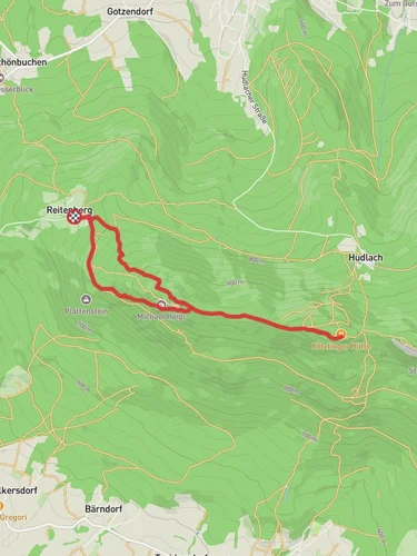
Starting near the charming town of Cham in Germany, this point-to-point hike from Schönbuchen to Eck via Mittagstein spans approximately 10 km (6.2 miles) with an elevation gain of around 700 meters (2,297 feet). The trail is rated as medium difficulty, making it suitable for moderately experienced hikers.
### Getting There To reach the trailhead near Cham, you can either drive or use public transport. If driving, Cham is accessible via the A3 motorway, and there are several parking options in the town. For those using public transport, Cham is well-connected by train, with regular services from major cities like Munich and Regensburg. From Cham, local buses can take you closer to the starting point at Schönbuchen.
### Trail Overview The hike begins in Schönbuchen, a small village that offers a peaceful starting point. As you set off, the initial part of the trail meanders through lush forests and rolling hills, providing a serene atmosphere. The first 2 km (1.2 miles) are relatively gentle, allowing you to ease into the hike.
### Key Landmarks and Elevation Around the 3 km (1.9 miles) mark, you'll start to notice a gradual increase in elevation as you approach the Mittagstein. This section is characterized by steeper inclines and rocky terrain, so be prepared for a more strenuous climb. The Mittagstein itself is a notable landmark, offering panoramic views of the surrounding Bavarian Forest. At an elevation of approximately 1,034 meters (3,392 feet), it's a perfect spot for a short break and some photography.
### Flora and Fauna The trail is rich in biodiversity. As you ascend, you'll pass through mixed forests dominated by beech, oak, and spruce trees. Keep an eye out for local wildlife, including deer, foxes, and a variety of bird species. The area is also known for its vibrant wildflowers during the spring and summer months.
### Historical Significance The region around Cham has a rich history dating back to medieval times. The town itself was an important trading post and has several historical buildings worth exploring if you have time before or after your hike. The trail also passes near ancient boundary stones that once marked territorial limits, adding a touch of historical intrigue to your journey.
### Final Stretch to Eck The final 3 km (1.9 miles) from Mittagstein to Eck are a mix of descending paths and gentle slopes. This section is less challenging but equally scenic, offering views of the distant valleys and the occasional glimpse of local villages. As you approach Eck, the trail levels out, making for a pleasant end to your hike.
### Navigation and Safety For navigation, it's highly recommended to use the HiiKER app, which provides detailed maps and real-time updates. Ensure you have adequate water, snacks, and appropriate clothing, as weather conditions can change rapidly in the Bavarian Forest.
This hike offers a blend of natural beauty, moderate physical challenge, and a touch of historical significance, making it a rewarding experience for those who undertake it.
Reviews
User comments, reviews and discussions about the Schönbuchen to Eck Walk via Mittagstein, Germany.
0.0
average rating out of 5
0 rating(s)


