Download
Preview
Add to list
More
175.7 km
~9 days
3334 m
Multi-Day
“Hike the historic Pandurensteig trail, a Bavarian journey of heritage, diverse landscapes, and rewarding elevation.”
Embarking on the Pandurensteig trail, hikers will traverse a scenic route of approximately 176 kilometers (around 109 miles) with an elevation gain of about 3300 meters (roughly 10,827 feet). This point-to-point trail, nestled in the Upper Palatinate region of Bavaria, Germany, begins near the town of Cham and stretches through the Bavarian Forest, concluding in the historic town of Eslarn.
Getting to the Trailhead
To reach the starting point near Cham, hikers can utilize public transportation by taking a train to the Cham railway station. From there, local buses or taxis can bridge the gap to the trailhead. For those driving, parking is available in the vicinity of Cham, allowing for a convenient start to the journey.
Navigating the Trail
As you set out from the trailhead, the path will lead you through a mosaic of dense forests, rolling hills, and pastoral landscapes. The trail is well-marked, but carrying a reliable navigation tool like HiiKER is advisable to ensure you stay on course and can anticipate upcoming changes in terrain or elevation.
Historical Significance and Landmarks
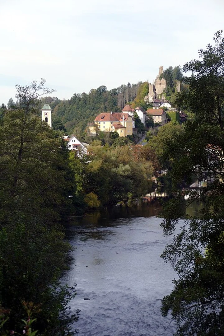
The Pandurensteig is steeped in history, taking its name from the Pandurs, Croatian soldiers who marched through the region in the 18th century during the War of the Austrian Succession. As you hike, you'll encounter landmarks that echo the past, such as the Nepomuk Chapel, the historic town of Waldmünchen, and the ruins of Schwarzenburg Castle. Each of these sites offers a glimpse into the region's rich heritage.
Natural Beauty and Wildlife
The trail meanders through the Bavarian Forest, a haven for diverse flora and fauna. Expect to walk through serene forested areas, home to species such as red deer, wild boar, and various birds of prey. The changing seasons paint the landscape with different hues, from the vibrant greens of spring to the golden tones of autumn.
Elevation and Difficulty
While the Pandurensteig is rated as medium difficulty, it's important to prepare for the cumulative elevation gain. The trail includes several ascents and descents, with the most significant elevation changes occurring in the first half of the hike. Proper conditioning and pacing are key to enjoying the journey.
Accommodation and Resupply Points
Throughout the trail, there are opportunities to rest and resupply in small towns and villages. Hikers can find guesthouses, inns, and shops to replenish provisions. It's recommended to plan overnight stays in advance, especially during peak hiking seasons.
Weather and Preparation
The weather in the Upper Palatinate can be unpredictable, so hikers should be prepared for varying conditions. Layered clothing, waterproof gear, and sturdy hiking boots are essential. Additionally, carrying enough water and snacks to sustain you between resupply points is crucial.
By preparing adequately and respecting the trail's natural and historical significance, hikers can fully immerse themselves in the beauty and challenge of the Pandurensteig.

Comments and Reviews
User comments, reviews and discussions about the Pandurensteig, Germany.
4.83
average rating out of 5
6 rating(s)