Download
Preview
Add to list
More
10.5 km
~2 hrs 57 min
515 m
Loop
“Embark on a scenic 11 km loop through Germany's Black Forest, featuring panoramic peaks and diverse wildlife.”
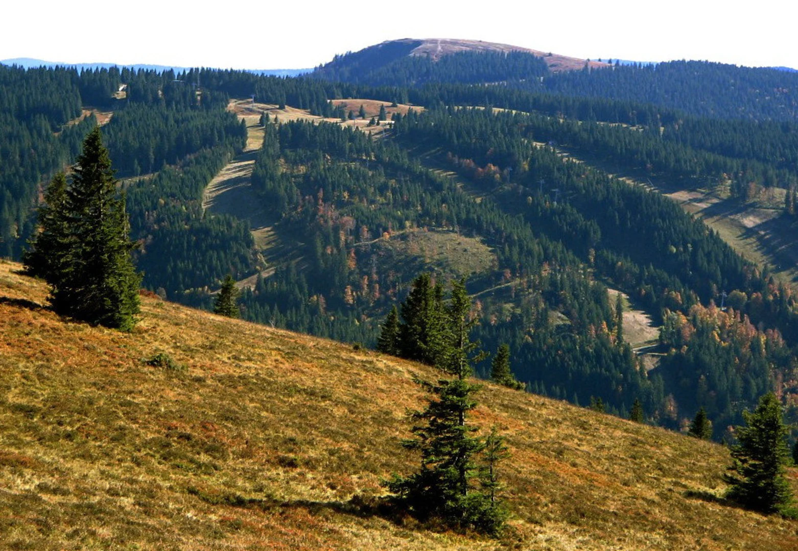
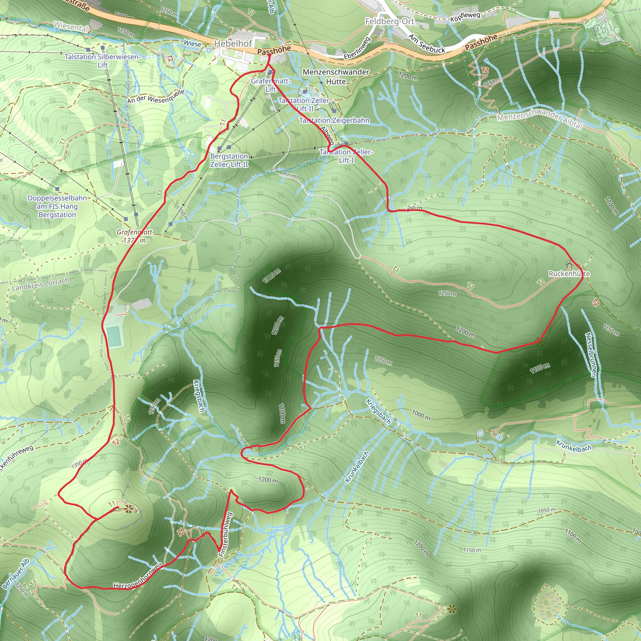
Starting near Breisgau-Hochschwarzwald in Germany, this 11 km (approximately 6.8 miles) loop trail offers a moderate challenge with an elevation gain of around 500 meters (1,640 feet). The trailhead is easily accessible by car or public transport. If you're driving, you can park near the Herzogenhorn Ski Lift, which is a convenient starting point. For those using public transport, take a train to the nearest station in Todtnau and then a bus to the Herzogenhorn Ski Lift area.### Initial Ascent and GlockführeThe trail begins with a gradual ascent through dense forest, providing a serene start to your hike. As you climb, you'll reach the Glockführe, a notable peak offering panoramic views of the surrounding Black Forest. This section is about 3 km (1.9 miles) into the hike and involves an elevation gain of approximately 200 meters (656 feet). The forest here is rich with flora, including towering pines and a variety of ferns, making it a great spot for nature enthusiasts.### HerzogenhornContinuing from Glockführe, the trail leads you to Herzogenhorn, the second highest peak in the Black Forest at 1,415 meters (4,642 feet) above sea level. This section adds another 2 km (1.2 miles) to your journey and an additional 150 meters (492 feet) in elevation gain. Herzogenhorn is renowned for its breathtaking views, especially on clear days when you can see the Swiss Alps in the distance. The area is also historically significant, having been a strategic lookout point during various periods of conflict.### Finsterbuhl and DescentFrom Herzogenhorn, the trail descends towards Finsterbuhl, a less prominent but equally beautiful peak. This part of the trail is about 3 km (1.9 miles) long and involves a descent of around 100 meters (328 feet). The path here is more rugged, with rocky outcrops and occasional streams, so watch your footing. Wildlife is abundant in this area, and you might spot deer, foxes, and a variety of bird species.### Return LoopThe final leg of the hike takes you back to the trailhead, covering the remaining 3 km (1.9 miles) with a gentle descent. This section meanders through open meadows and mixed forests, offering a relaxing end to your hike. The meadows are particularly beautiful in spring and summer, filled with wildflowers and buzzing with pollinators.### Navigation and SafetyFor navigation, it's highly recommended to use the HiiKER app, which provides detailed maps and real-time updates. The trail is well-marked, but having a reliable navigation tool ensures you stay on track. Always carry sufficient water, snacks, and a first-aid kit. Weather in the Black Forest can be unpredictable, so pack layers and be prepared for sudden changes.### Getting ThereTo reach the trailhead, drive to the Herzogenhorn Ski Lift parking area if you're coming by car. For public transport users, take a train to Todtnau and then a bus to the ski lift area. The trailhead is well-signposted and easy to find from there.
What to expect?
Activity types
Comments and Reviews
User comments, reviews and discussions about the Glockführe, Herzogenhorn and Finsterbuhl Loop, Germany.
4.5
average rating out of 5
6 rating(s)

