Download
Preview
Add to list
More
14.4 km
~3 hrs 8 min
152 m
Loop
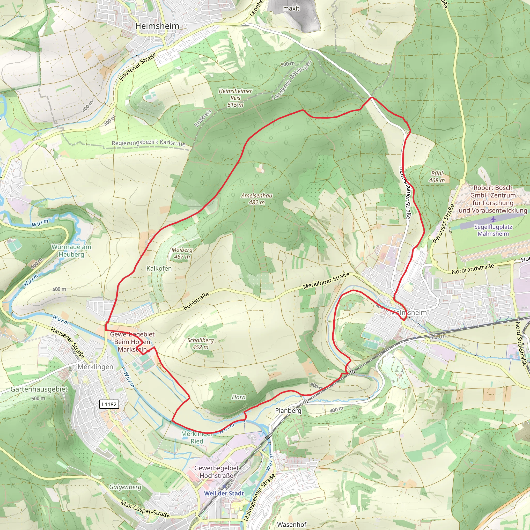
“Explore the scenic Merklingen and Großer Wald Loop, a 14 km trail featuring historical landmarks and diverse wildlife.”
Starting near Böblingen, Germany, the Merklingen and Großer Wald Loop is a delightful 14 km (approximately 8.7 miles) trail with an elevation gain of around 100 meters (328 feet). This loop trail is rated as medium difficulty, making it suitable for moderately experienced hikers.### Getting ThereTo reach the trailhead, you can either drive or use public transport. If driving, head towards Böblingen and follow signs to Merklingen. There is ample parking available near the trailhead. For those using public transport, take a train to Böblingen station. From there, you can catch a local bus to Merklingen, which is a short ride away. The nearest significant landmark to the trailhead is the Merklingen town center.### Trail OverviewThe trail begins in the charming town of Merklingen, where you can stock up on supplies or grab a quick bite before you start. As you set off, the initial part of the trail is relatively flat, winding through picturesque farmlands and meadows. This section is perfect for warming up your legs and taking in the serene rural landscape.### Into the ForestAround the 3 km (1.9 miles) mark, you'll enter the Großer Wald, a dense forest that offers a refreshing change of scenery. The forest is home to a variety of wildlife, including deer, foxes, and numerous bird species. Keep your eyes peeled and your camera ready, as you might spot some of these creatures along the way.### Historical SignificanceAs you continue through the forest, you'll come across several historical landmarks. One notable site is an old Roman road that dates back to ancient times. This road was once a crucial route for trade and military movements. The remnants of this road are a fascinating glimpse into the region's rich history.### Midpoint and Elevation GainAround the 7 km (4.3 miles) mark, you'll reach the midpoint of the trail. Here, the elevation begins to increase gradually. The ascent is steady but manageable, offering stunning views of the surrounding landscape as you climb. The highest point of the trail is approximately 100 meters (328 feet) above the starting elevation, providing a rewarding vantage point.### Scenic Views and Rest StopsAs you descend from the highest point, the trail opens up to several scenic viewpoints. These spots are perfect for taking a break, enjoying a snack, and soaking in the panoramic views. One particularly beautiful viewpoint overlooks the entire Großer Wald and the distant town of Böblingen.### Return to MerklingenThe final stretch of the trail leads you back through a mix of forest and open fields, eventually bringing you full circle to Merklingen. This section is relatively easy, allowing you to cool down and reflect on the hike.### NavigationFor navigation, it's highly recommended to use the HiiKER app, which provides detailed maps and real-time updates. This will ensure you stay on track and can easily find your way back to the trailhead.### Flora and FaunaThroughout the hike, you'll encounter a diverse range of flora, including oak, beech, and pine trees. In the spring and summer months, the trail is adorned with wildflowers, adding a splash of color to the verdant landscape. The forest floor is often carpeted with moss and ferns, creating a lush, green environment.### Final TipsMake sure to wear sturdy hiking boots, as some sections of the trail can be uneven and rocky. Bring plenty of water and snacks, especially if you plan to take your time and enjoy the various viewpoints and historical sites. The trail is well-marked, but having a navigation tool like HiiKER will enhance your hiking experience and provide peace of mind.
What to expect?
Activity types
Comments and Reviews
User comments, reviews and discussions about the Merklingen and Großer Wald Loop, Germany.
5.0
average rating out of 5
1 rating(s)

