Download
Preview
Add to list
More
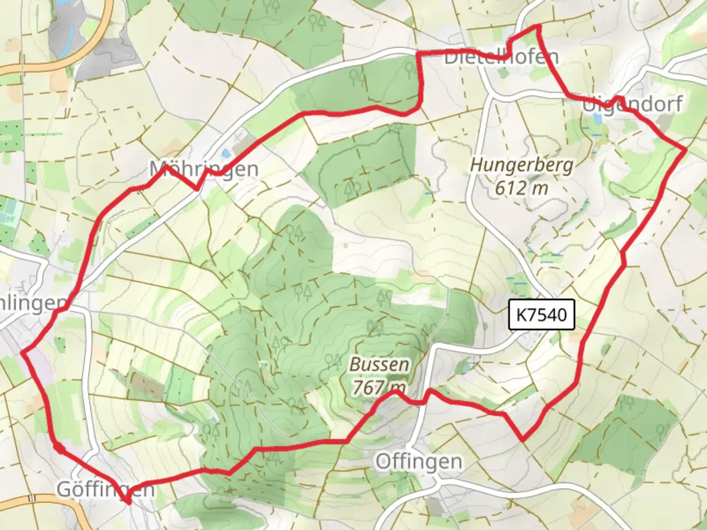
14.4 km
~3 hrs 18 min
255 m
Loop
“Explore the serene landscapes and rich history of the 14 km Wanderweg um den Bussen loop trail.”
Starting near Biberach, Germany, the Wanderweg um den Bussen is a picturesque loop trail that spans approximately 14 km (8.7 miles) with an elevation gain of around 200 meters (656 feet). This trail offers a moderate challenge, making it suitable for hikers with some experience.
Getting There
To reach the trailhead, you can drive or use public transport. If driving, set your GPS to Biberach, Germany, and follow local signs to the trailhead. For those using public transport, take a train to Biberach an der Riß station. From there, local buses or a short taxi ride will get you to the starting point.
Trail Overview
The trail begins near the town of Biberach and quickly immerses you in the serene landscapes of the Swabian Alps. The path is well-marked, but it's advisable to use the HiiKER app for navigation to ensure you stay on track.
Key Landmarks and Points of Interest
Bussen Hill: Known as the "Holy Mountain of Upper Swabia," Bussen Hill is the highest point on the trail. At approximately 4 km (2.5 miles) into the hike, you'll start the ascent. The climb is gradual but steady, gaining about 150 meters (492 feet) in elevation. The summit offers panoramic views of the surrounding countryside and is home to the Bussen Church, a pilgrimage site with historical significance dating back to the 13th century.
Bussen Church: Located at the summit of Bussen Hill, this church is a significant landmark. It has been a pilgrimage destination for centuries and offers a peaceful spot to rest and take in the views. The church's architecture and history are worth exploring, so plan to spend some time here.
Forests and Meadows: As you descend from Bussen Hill, the trail meanders through lush forests and open meadows. This section, around 7 km (4.3 miles) into the hike, is relatively flat and offers a chance to spot local wildlife such as deer, foxes, and various bird species. The flora is diverse, with wildflowers blooming in the spring and summer months.
Trail Conditions and Safety
The trail is well-maintained but can be muddy after rain, so waterproof hiking boots are recommended. There are a few steep sections, particularly around Bussen Hill, where trekking poles can be helpful. Always check the weather forecast before heading out and carry sufficient water and snacks.
Historical Significance
The region around Bussen Hill has a rich history. The hill itself has been a site of human activity since prehistoric times. The Bussen Church, built in the 13th century, adds a layer of medieval history to your hike. The area was also significant during various historical periods, including the Roman era and the Middle Ages, making it a fascinating destination for history enthusiasts.
Wildlife and Nature
The trail offers a diverse range of natural habitats. In the forests, you might encounter deer and foxes, while the meadows are home to various bird species. Keep an eye out for wildflowers, especially in the spring and summer, which add vibrant colors to the landscape.
Final Stretch
The last few kilometers of the trail bring you back towards Biberach, passing through more meadows and small wooded areas. This section is relatively flat and offers a relaxing end to your hike. As you approach the trailhead, you'll have a chance to reflect on the diverse landscapes and historical landmarks you've encountered.
Using the HiiKER app will ensure you stay on the correct path and can fully enjoy the beauty and history of the Wanderweg um den Bussen.

Comments and Reviews
User comments, reviews and discussions about the Wanderweg um den Bussen, Germany.
4.5
average rating out of 5
2 rating(s)