Download
Preview
Add to list
More
7.1 km
~1 hrs 27 min
19 m
Loop
“Explore Berlin's Tempelhofer Feld Loop: a 7 km trail blending history, nature, and urban adventure.”
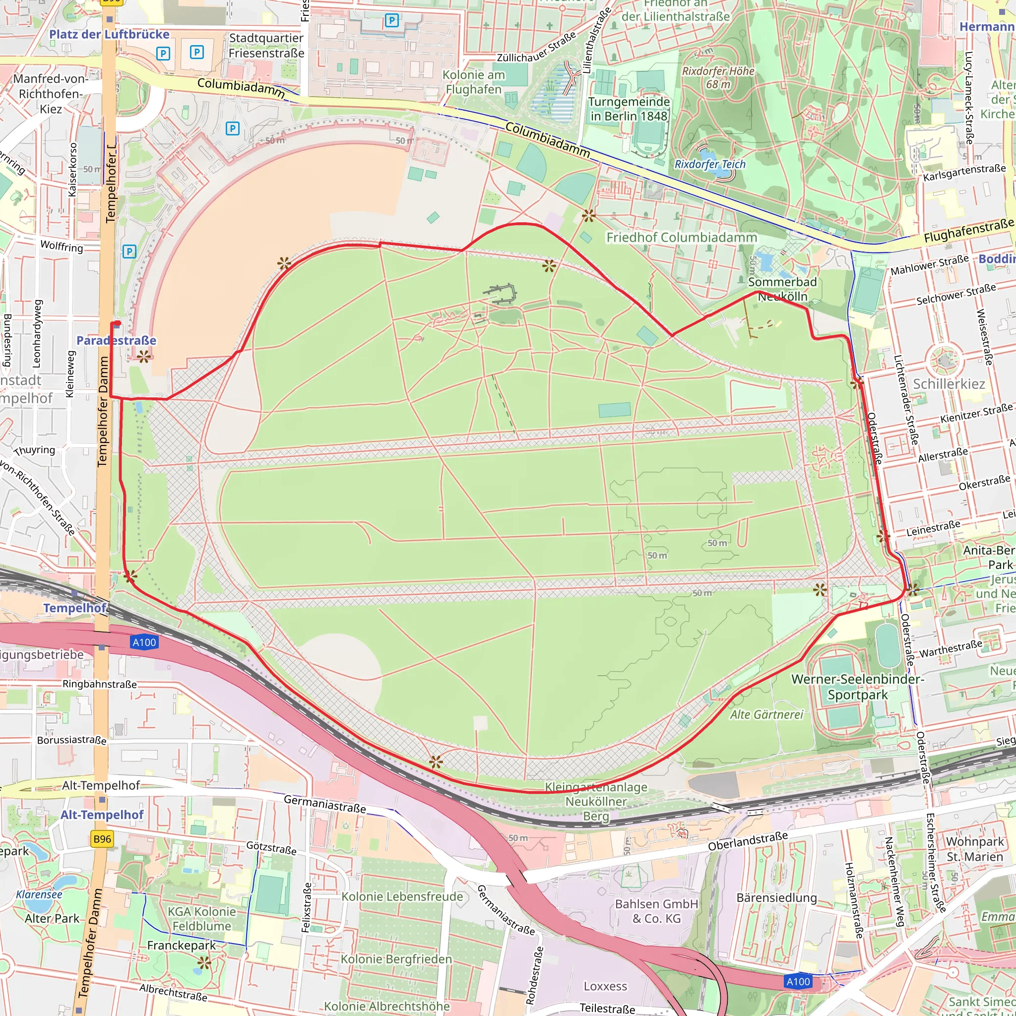
Starting near Berlin, Germany, the Tempelhofer Feld Loop is a unique 7 km (4.35 miles) trail with virtually no elevation gain, making it an accessible hike for many. The trailhead is conveniently located at the entrance of Tempelhofer Feld, a former airport turned public park, easily reachable by public transport or car. If you're using public transport, take the U-Bahn to the Platz der Luftbrücke station, which is just a short walk from the park entrance. For those driving, there is parking available near the entrance at Tempelhofer Damm.Trail OverviewThe Tempelhofer Feld Loop offers a fascinating blend of history, nature, and urban exploration. As you begin your hike, you'll immediately notice the vast open spaces that once served as runways for Tempelhof Airport. This airport played a significant role during the Berlin Airlift in 1948-1949, and remnants of its aviation past are still visible today.Historical SignificanceApproximately 1 km (0.62 miles) into the hike, you'll pass by the iconic Tempelhof Airport building, one of the largest structures in the world. This building is a testament to the architectural ambition of the Nazi era and later became a symbol of freedom during the Cold War. Take a moment to appreciate the historical weight of this landmark before continuing your journey.Nature and WildlifeAs you move further along the loop, around the 3 km (1.86 miles) mark, you'll encounter a variety of natural habitats. The park is home to several species of birds, including skylarks and kestrels, which thrive in the open grasslands. Keep an eye out for these avian residents, especially in the early morning or late afternoon when they are most active.Recreational ActivitiesAt around 5 km (3.1 miles), you'll come across areas designated for various recreational activities. Tempelhofer Feld is a popular spot for kite flying, cycling, and even urban gardening. The community gardens, known as "Allmende-Kontor," are a vibrant example of local sustainability efforts and are worth a quick detour.Navigation and AmenitiesNavigating the Tempelhofer Feld Loop is straightforward, but it's always a good idea to have a reliable navigation tool like HiiKER to ensure you stay on track. The park is well-maintained with clear signage, and there are several restrooms and water fountains scattered throughout the area, particularly near the main entrances.Final StretchAs you approach the final 2 km (1.24 miles) of the loop, you'll find yourself back near the starting point. This section of the trail offers panoramic views of the Berlin skyline, providing a striking contrast between the open fields and the urban landscape beyond. It's a perfect spot to pause and reflect on the diverse experiences this trail offers.Whether you're a history buff, nature enthusiast, or simply looking for a leisurely hike, the Tempelhofer Feld Loop provides a unique and enriching experience right in the heart of Berlin.
What to expect?
Activity types
Comments and Reviews
User comments, reviews and discussions about the Tempelhofer Feld Loop, Germany.
4.5
average rating out of 5
6 rating(s)

